Donate Now to Our Year End Campaign!

Forecast for the Uintas Area Mountains

Craig Gordon
Issued by Craig Gordon on
Sunday morning, December 28, 2025

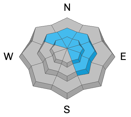
Steep, upper elevation slopes, especially those in the windzone at and above treeline offer MODERATE avalanche danger. Fresh wind drifts will react to our additional weight and human triggered avalanches are POSSIBLE particularly on the leeward side of mid and upper elevation ridges. Note to self... recent drifts form on a slick Christmas Eve raincrust and once initiated, may pack a little more heat than we might expect, especially on sustained, steep slopes.

Becoming more the exception than the rule, human triggered avalanches breaking to old snow near the ground are still POSSIBLE. The usual suspects come to mind... steep, rocky, upper elevation slopes where a hard, dense slab sits above multiple persistent weak layers.

Low
Moderate
Considerable
High
Extreme
Learn how to read the forecast here
Weather and Snow

Nowcast - It made for an absolute gong show on I-80 early yesterday morning, but wow... what a nice burst of snow for the eastern front! Generally 8-10 inches of snow with .60-.75 inches H2O, whilst the North Slope squeezed out a legit, chin tickling, 12 inches of uber-fluff. Under clearing skies, a few rogue snow showers linger over the region, but in general we're clearing out. Temperatures cratered overnight, currently registering in the low single digits °F across the board. Along the ridges winds blowing out of the northwest at 25-35 mph create finger numbing windchill values to -23 °F... ouch.

Forecast - Look for mostly sunny skies with temperatures climbing into the teens and low 20's °F. Winds blowing 20-30 mph from the northwest add a bite to the air. Overnight lows dip to near zero °F.

Futurecast - A drying and warming trend take us out of the deep freeze to kick off the work week. More active weather is slated to ring in the New Year.

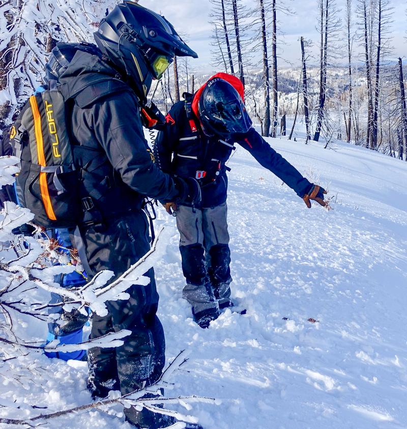
Travel Conditions - A whole lotta tech goin' on in the image above, but the Clif Notes version is... Big Al was in the Trail Lake zone yesterday and reports over-the-hood riding conditions on a go almost anywhere base.

Vehicle access to Mirror Lake Highway (HW150) and Bald mountain Pass is shut down, while SR-35 (Wolf Creek Pass) remains open.

Recent Avalanches

Shallow fresh drifts were the flavor of the day Saturday. Click on the button below for a look into the history of this seasons avalanche events.

Avalanche Problem #1
Wind Drifted Snow
Type
Location
Likelihood
Size
Description

Yesterdays drifts were quite reactive to my additional weight, yet very manageable and predictably breaking out in front of my skis and sled. I think today's drifts might be a little thicker and possibly more stubborn but are every bit as easy to detect by their fat, rounded appearance and easy to avoid, by losing some elevation and steering towards wind sheltered terrain. The wild card is... recent drifts rest on a slick Christmas Eve rain crust that provides a resistance free surface for avalanches to run on, and that means today's avalanches might pack a little more punch than you'd expect, especially on sustained, steep slopes.

Looking into the future... raincrusts in the snowpack can be a problem child once they're buried, so I'm gonna keep my eyes on this setup and see how it plays out knowing that some of the bigger mid and late season train-wrecks we've had in the western Uinta's involve a raincrust/faceted snow/slab trifecta.

Avalanche Problem #2
Persistent Weak Layer
Type
Location
Likelihood
Size
Description

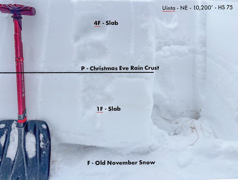
From record warm temperatures to a good shot of Christmas Eve rain followed by rapid cooling, our snowpack has been yanked all over the map this week. Sure, weird weather makes for weird snowpacks, but I'm super encouraged to see the snowpack looking and feeling quite pedestrian... very receptive to ying and yang temperature swings, rebounding nicely in the past 72 hours, and becoming more comfortable in its own skin. In fact, 4 out of 5 basal weak layers surveyed say they're ready to settle down, buy a home in the outskirts of Francis, and concentrate on piecing together the DIY barrel sauna kit they received from the in-laws for Christmas... good news. Of course, reading through the detailed, piece by piece construction diagram might lead to a bit of unexpected and misunderstood friction, much like triggering a slide that breaks deeper and wider than you might expect, especially on steep, rocky slopes facing the north half of the compass.

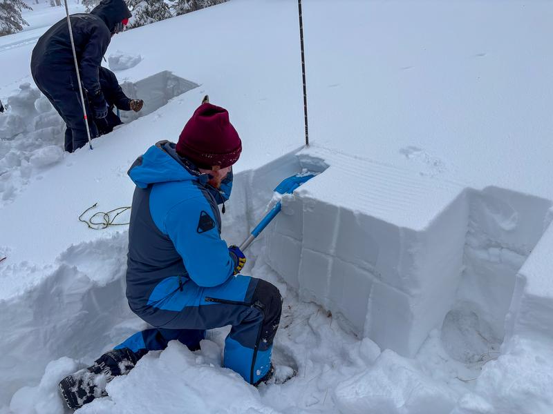
Current North Slope snow structure in northeast facing terrain at 9,410 feet

Additional Information

This fleet can't be beat! Huge thanks to Ski-Doo in partnership with Karl Malone's Plaza Cycle, for arranging our sled, loaner program. This vital state-wide partnership gets sleds into the hands of UAC forecasters, allowing us to see more terrain, gather more snowpack information, and issue more accurate avalanche forecasts. Ultimately, this program helps us save lives!

General Announcements

We have some upcoming classes and events that we would be stoked to see you at -- Please reach out with any questions and check out below for more details!

We are always looking for snow and avalanche observations or just general riding conditions. Reach out to us with questions, concerns, or if you see anything in your travels! Contact us directly through the info below:

This forecast is from the U.S.D.A. Forest Service, which is solely responsible for its content. This forecast describes general avalanche conditions, and local variations always occur. This forecast was issued on Sunday, December 28th at 0400 AM and expires 24 hours after it was issued. We'll update this information by 07:00 AM tomorrow.