Donate to the 2024 Spring Campaign to help rebuild the UAC website.

Forecast for the Skyline Area Mountains

Brett Kobernik
Issued by Brett Kobernik for
Saturday, April 13, 2019
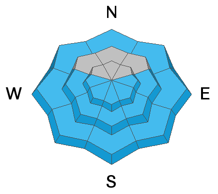
The avalanche danger starts out LOW this morning but will rise to MODERATE with daytime heating. All the new snow may become unstable especially on sunny facing slopes. Pay close attention to what the snow is doing this afternoon during the heat of the day. Once steep slopes get really wet, it's time to start avoiding them.
Low
Moderate
Considerable
High
Extreme
Learn how to read the forecast here
Special Announcements
This is the last week for daily avalanche forecasting. We will continue to put out intermittent forecasts which will revolve around Spring snowstorms through April.
Weather and Snow
A few more inches of snow trickled in on Friday. Most places I was traveling had 18 to 24 inches of new snow since Wednesday.
We'll see mostly clear skies today with ridgetop high temperatures in the low 30s with light to moderate northwest wind. High temperatures on Sunday will get into the low 40s and the west wind will increase in speed.
It looks like another storm is shaping up for early next week that may bring some more snow to the mountains.
Ad
Avalanche Problem #1
Wet Snow
Type
Location
Likelihood
Size
Description
Wet avalanche activity is your main concern today. The new snow became damp on many aspects and elevations on Friday. This is a good thing concerning wet snow avalanches today. The snow will have frozen up again overnight and it will be a bit harder for the sun and warm temperatures to make the new snow wet to the point of becoming unstable. Also, it doesn't look like the temperatures will get all that warm today. However, wet avalanche activity can be tricky to predict and often things start to fall apart quickly when you might not expect it. Move off of steep slopes that become really wet, heavy and sloppy. East faces will heat up first, then south then west.
Additional Information
This forecast is from the U.S. Forest Service, which is solely responsible for its content. This forecast describes general avalanche conditions and local variations always occur.