This is the last week for daily avalanche forecasting. We will continue to put out intermittent forecasts which will revolve around Spring snowstorms through April.
We've picked up 4 to 6 inches of new snow overnight. The northwest wind has not been too outrageous. It's actually been light to moderate in speed. Temperatures dramatically cooled off with most mountain locations in the low 20s. We should see more snow today with possibly 6 to 10 inches more. The storm kind of lingers through Friday and then things clear out for the weekend.
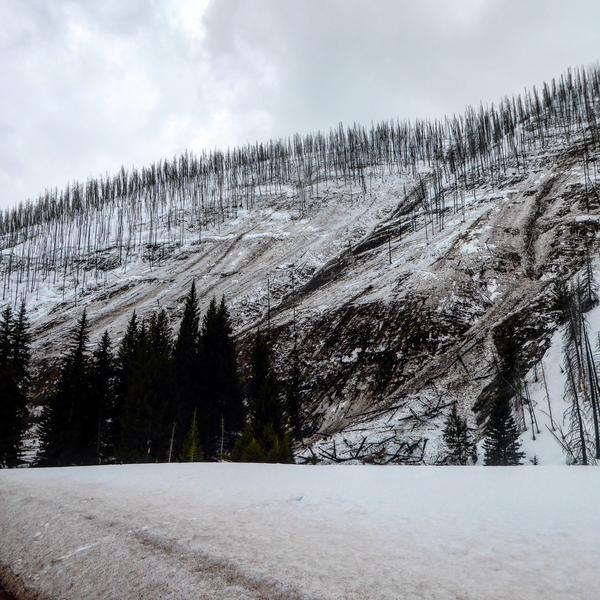
There was a massive wet slab avalanche that released on Tuesday in Huntington Canyon above the Chute Camp Site. It was 1/3 of a mile wide and 4 to 5 feet deep on a northeast aspect starting at about 9000 feet in elevation. It cleared out a large amount of burned trees. This was caused from a known weak snowpack in the canyon coupled with numerous days of above freezing temperatures. In short, it was the first time that the loose sugar snow near the ground was affected by the springtime warm up. Huntington Canyon is not very representative of the majority of the terrain on the Skyline as it generally has a much weaker snowpack compared to where most people recreate.