General Conditions: East facing slopes became damp on Saturday almost the instant that the sun hit them in the morning. South and west facing slopes also became damp as well as all aspects below about 9000 feet. Upper-elevation northerly-facing slopes remain dry and should still hold good powder this morning. Temperatures made it into the low 30s in the higher terrain on Saturday and dropped into the mid 20s overnight. Wind has been generally light from the west.
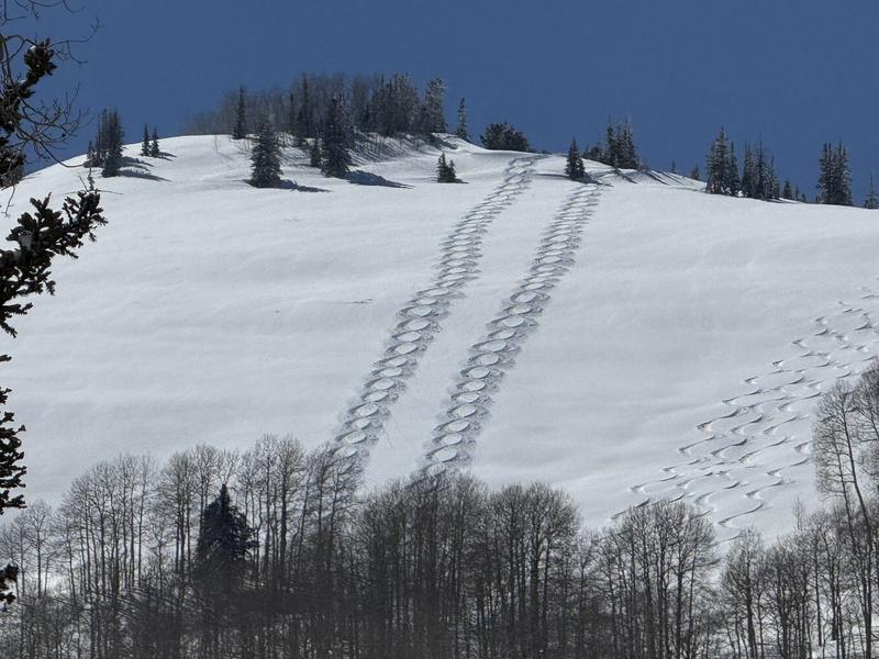
Photo below: Kobernik - Good ski conditions on high elevation northerly facing terrain. Keep in mind that where the riding conditions are the best is also the most likely place to trigger an avalanche.
There are two good backcountry observations you can check out for more details about what people were finding Saturday.
Chris Magerl: Birch Creek
Logan Addis: Electric Lake
Mountain Weather: If you want to get the last of the powder, you probably want to get after it quickly this morning. Temperatures will warm into the 40s in the higher terrain today. This will most likely make the snow damp on all aspects at all elevations. Wind will remain generally light from the west. Temperatures stay warm through the week with no significant storms in sight.