Forecast for the Skyline Area Mountains

Brett Kobernik
Issued by Brett Kobernik for
Saturday, March 30, 2019
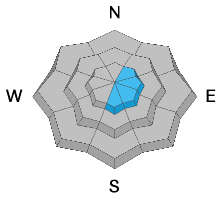
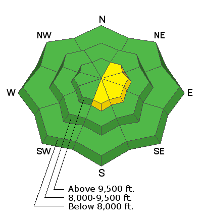
The overall avalanche danger is generally LOW today. There is a MODERATE danger of triggering a fresh wind drift along the upper ridgelines on the more east facing steep terrain. Only put one person on a steep slope at a time and don't regroup at the bottom of steep slopes.
Low
Moderate
Considerable
High
Extreme
Learn how to read the forecast here
Weather and Snow
Storm totals from Friday's little event are 5 to 7 inches of fairly dense snow which included some graupel in it. Northwest wind was a bit blustery stirring up the new snow and forming fresh drifts.
We'll see partly cloudy skies today with the chance for snow later today. No significant accumulations are expected. High temperatures will get into the upper 20s along the ridges. North northeast wind should be fairly light although sometimes it blows harder than anticipated when there is an east component to the direction.
Ad
Avalanche Problem #1
Wind Drifted Snow
Type
Location
Likelihood
Size
Description
The potential for triggering a fresh drift that formed on Friday is your main concern today. I don't expect these to be very large and my guess is that they won't be all that sensitive today since they've had some time to settle already. However, don't let your guard down. You might find some drifts up to 2 feet deep. The most likely places to trigger one are on the upper elevation more east facing slopes. Use little test slopes that have drifts on them to see how sensitive the new snow is before just punching the big lines.
Additional Information
This forecast is from the U.S. Forest Service, which is solely responsible for its content. This forecast describes general avalanche conditions and local variations always occur.