Forecast for the Skyline Area Mountains

Brett Kobernik
Issued by Brett Kobernik for
Sunday, March 10, 2024
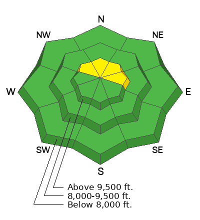
The overall avalanche danger rating for the Skyline is generally LOW.
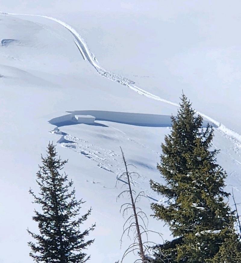
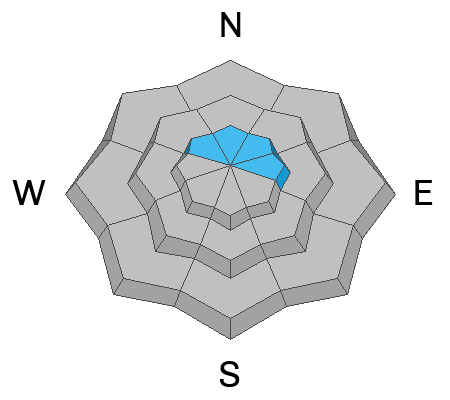
There is a "pockety" MODERATE danger in the upper elevation northwest through east facing slopes.
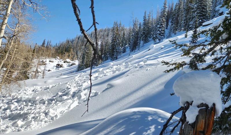
Human triggered avalanches are possible but not very likely.
Places you may trigger something are on very steep slopes that face northwest through east especially right along and below ridgelines where recent deposits of wind drifted snow are present.
Low
Moderate
Considerable
High
Extreme
Learn how to read the forecast here
Weather and Snow
Current Conditions: Most people reported excellent riding conditions still on Saturday. The snow was very user friendly. It gave good traction to machines and you can basically go anywhere. The sunny skies heated up many slopes so you'll find crusts on them this morning. Northerly facing upper elevation terrain still has dry cold snow. Temperatures were into the mid 30s on Saturday and dropped back to around 20˚F overnight. Wind has been generally light from the southwest.
Mountain Weather: Clouds will increase as the day goes on today with high temperatures into the upper 30s. The wind should stay pretty light from the southwest. It might increase slightly during the day. Monday looks cloudy with a minor weather disturbance moving through Monday night. A better looking storm is shaping up for mid week that should bring a decent shot of snow.
Recent Avalanches
There were no avalanches reported from the Skyline on Saturday. However, there were a couple of pockets that were triggered in the Gooseberry zone on Fish Lake. These are similar to what we've been seeing this week on the Skyline. These are wind loaded areas that just haven't completely stabilized yet.
Ad
Avalanche Problem #1
Wind Drifted Snow
Type
Location
Likelihood
Size
Description
There were lots of steep slopes that got climbed by snowmobiles on Saturday without incident, as far as I know. This tells me that most of the wind drifts and slabs that formed earlier in the week are stable now. The avalanche danger trend is decreasing. The avalanches that were triggered this week were very "pockety" in nature and didn't pose all that much threat. That said, continue to be aware of what might happen if you happen to find a pocket that releases on you today. The problem would be getting pushed into trees or rocks or perhaps getting buried in a terrain trap (steep walled gully or ravine).
General Announcements
This forecast is from the U.S.D.A. Forest Service, which is solely responsible for its content. This forecast describes general avalanche conditions and local variations always occur.