Forecast for the Skyline Area Mountains

Brett Kobernik
Issued by Brett Kobernik for
Thursday, February 8, 2024
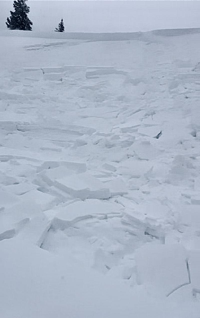
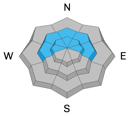
The avalanche danger has reached HIGH on the Skyline.
Natural and human triggered avalanches released on Wednesday.
Human triggered avalanches are almost certain today.
Avoid all avalanche terrain today.
Low
Moderate
Considerable
High
Extreme
Learn how to read the forecast here
Avalanche Warning
What
Strong wind over the past few days along with heavy dense snowfall has created very dangerous avalanche conditions. The avalanche danger is HIGH, and traveling in or under avalanche terrain is NOT recommended.
When
In effect until 6:00 AM MST Friday.
Where
For the Wasatch Range south of I-80, the Western Uinta Mountains, the Wasatch Plateau and Skyline Mountains of central Utah, the Abajo mountains in southeast Utah, and mountain ranges in southwestern Utah including the Tushars and areas near Cedar City.
Impacts
Several days of strong south wind and heavy snowfall are causing large and dangerous avalanches that are running far downhill. Avoid being on or under any steep slope where avalanches run. Dangerous avalanche conditions are expected to last through the weekend.
Warning Times
Thursday, February 8, 2024 - 6:00am to Friday, February 9, 2024 - 6:00am
Weather and Snow
Current Conditions: Storm totals south of Horseshoe Mountain are about 10". North of Horseshoe did better with 18 to 24" since Tuesday. There was some wind on Wednesday that was drifting snow in the higher terrain. It still looks a little breezy from the west. Temperatures are in the upper teens.
Mountain Weather: There are two more storm waves that will move through, one later today, one later Friday. The majority of the energy is to our south. I'm not expecting large amounts of snow from these waves. Perhaps a few inches out of each one. Temperatures today will get up to around 20˚F and the wind will slow to almost calm from the south or southeast late today.
Recent Avalanches
There was one snowmobile triggered avalanche reported in Ephraim Canyon on Wednesday. It was in pretty non-consequential terrain and was on a relatively low angle slope. This demonstrates how sensitive things are. Photo: Kerry and Cole Nielson
Ad
Avalanche Problem #1
New Snow
Type
Location
Likelihood
Size
Description
The new snow was fairly dense when the storm started. Also, the wind has played a roll in drifting snow and forming slabs. Furthermore, there is some weakness in the upper layers of the snowpack.
Here are the bullseye clues I saw yesterday:
  • Recent avalanches
  • Shooting cracks
  • Heavy snowfall
  • Wind drifting snow
More snow fell overnight and the wind was still strong enough to blow snow.
All the pieces of the puzzle are there. It's time to step back.
Avalanche Problem #2
Persistent Weak Layer
Type
Location
Likelihood
Size
Description
I'm still concerned about avalanches breaking deeper into weak sugary snow from December. So far this storm, the avalanches that I've seen are involving only the upper layers of the snowpack. This is a good sign. We should know more about the state of the old weak December snow after this series of storms passes and we can look around. Hopefully we don't find any avalanches that break into the old snow and we can put that to rest. Until then, all bets are still off. You'll want to continue to avoid steep slopes until things stabilize.
General Announcements
This forecast is from the U.S.D.A. Forest Service, which is solely responsible for its content. This forecast describes general avalanche conditions and local variations always occur.