UDOT PLANNED AVALANCHE CLOSURES!!

Forecast for the Skyline Area Mountains

Brett Kobernik
Issued by Brett Kobernik for
Tuesday, February 5, 2019
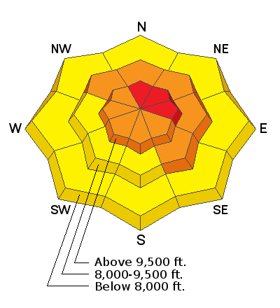
The avalanche danger will increase today during the anticipated storm. The danger is CONSIDERABLE and may reach HIGH if we see the upper end of forecasted snow amounts. Travel in avalanche terrain is not recommended today. Because of the buried Persistent Weak Layers of sugary snow, the danger will remain elevated for a number of days. Continue to use caution after the storm clears.
Low
Moderate
Considerable
High
Extreme
Learn how to read the forecast here
Weather and Snow
A winter storm is approaching and will bring snow to the Skyline today through Wednesday. We'll see fairly strong ridgetop southwest wind today. It will slow tonight and increase a bit again on Wednesday as it veers to the northwest. Mountain temperatures will be in the 20s and decreasing through the day. We'll see temperatures in the teens on Wednesday. I'm expecting 9 to 12 inches of new snow by Thursday morning.
Ad
Additional Information
This forecast is from the U.S. Forest Service, which is solely responsible for its content. This forecast describes general avalanche conditions and local variations always occur.