Forecast for the Skyline Area Mountains

Brett Kobernik
Issued by Brett Kobernik on
Sunday morning, February 23, 2025
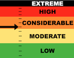
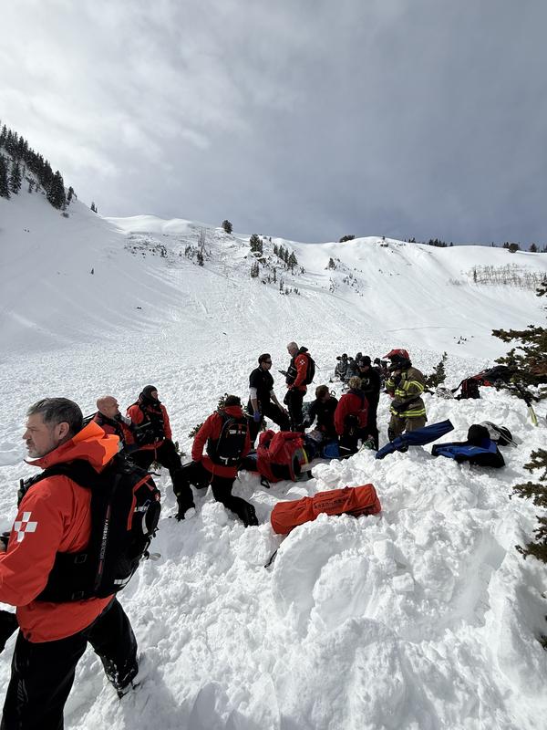
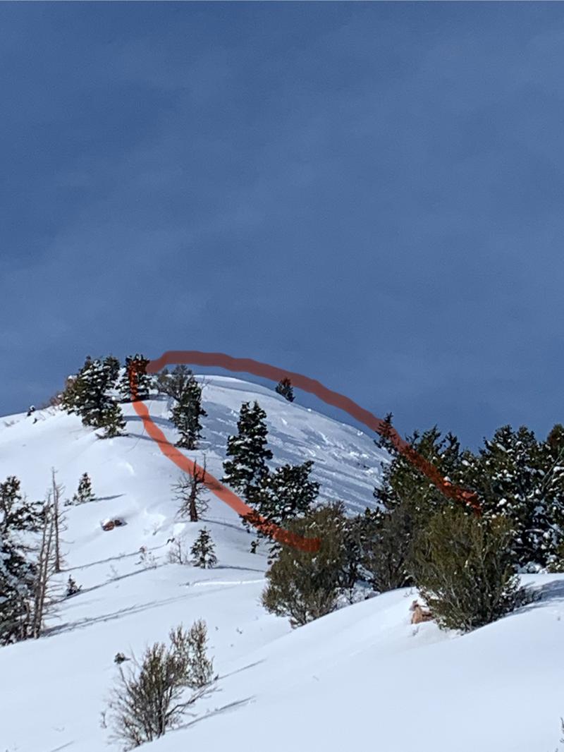
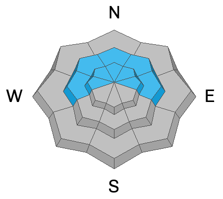
A CONSIDERABLE danger rating exists on upper elevation north through east facing slopes.
Human triggered avalanches are becoming less likely but still are a MAJOR CONCERN TODAY.
The only thing you can do to avoid being caught is avoid steep slopes especially on north through east facing terrain.
Low
Moderate
Considerable
High
Extreme
Learn how to read the forecast here
Special Avalanche Bulletin
We've continued the Special Avalanche Bulletin through today. This is an extra heads up that while the avalanche danger is not HIGH, it remains very dangerous. Nice weather and fresh powder tend to cloud our judgment.
Don't let "powder fever" get the best of you.
Weather and Snow
Current Conditions: Saturday was an absolute glorious day with excellent powder snow, plenty of sun and light wind. Temperatures pushed into the mid 30s and dropped back into the mid 20s overnight.
Mountain Weather: The day starts out beautiful today with clear skies but I think we'll see clouds moving in by mid day. Temperatures are going to get a little warmer than Saturday with highs pushing 40˚F Wind from the west looks like it might increase in speed slightly but should remain generally light to moderate in speed. High pressure continues through next week. The next chance for any snow looks like around March 4th.
Recent Avalanches
There were no avalanches reported from the Skyline on Saturday. However, there were numerous VERY CLOSE CALLS around the state.
Ant Knolls, Provo: Snowmobiler triggered the avalanche mid slope after jumping a cornice, was carried and clobbered a tree sustaining serious injuries and was flown out by helicopter. MORE DETAILS HERE
Boss Canyon, Logan: Snowmobiler triggered a large slide as he climb out of a steep slope. The avalanche ran downhill and caught a rider at the bottom of the slope partially buring him and knocking his front teeth out. MORE DETAILS HERE.
Mt Aire, Salt Lake: Skier was caught and carried into a stand of trees where he suffered minor injuries to his ankle. MORE DETAILS HERE
Ad
Avalanche Problem #1
Persistent Weak Layer
Type
Location
Likelihood
Size
Description
All these avalanches around the state are breaking into weak faceted snow deeper in the snowpack. We have the same weak layers here on the Skyline. The difference is that we haven't received as much snow out of the last two storms as the regions to our north have. We are only seeing scattered avalanche activity with shallower fracture lines. It's still a dangerous situation here and these layers are very slow to stabilize.
The only thing you can do with buried Persistent Weak Layers of loose sugary faceted snow is avoid the steep terrain. You can't accurately predict that one steep slope will stay in place and another won't. All you can do is have patience and wait for things to stabilize or roll the dice.
.
General Announcements
This forecast is from the U.S.D.A. Forest Service, which is solely responsible for its content. This forecast describes general avalanche conditions and local variations always occur.