Forecast for the Skyline Area Mountains

Brett Kobernik
Issued by Brett Kobernik for
Tuesday, February 19, 2019
The danger remains CONSIDERABLE. Human triggered avalanches are likely today. The bottom line is you'll want to avoid slopes steeper than about 30 degrees today at all elevations and all aspects. Avalanches are releasing in mid and lower elevations where we don't always see them.
Low
Moderate
Considerable
High
Extreme
Learn how to read the forecast here
Weather and Snow
Light snowfall on Monday added another few inches of low density snow. Wind has been light from the northwest.
We'll see cloudy skies today with the chance for light snowfall not adding up to much. A more significant storm moves through late Wednesday into Thursday.
Recent Avalanches
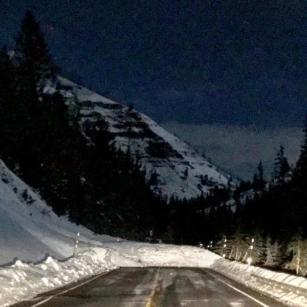
A natural avalanche crossed State Road 31 in Huntington Canyon at about 8pm on Monday night. There was no significant weather to act as a trigger; no heavy snowfall, no wind, no rapid rise in temperature or rain. However, there have been a lot of elk trudging through the starting zones in many of these paths and given the poor snowpack structure in the canyon it is possible that this was triggered by an elk.
Photo: Brett Kobernik
Ad
Additional Information
This forecast is from the U.S. Forest Service, which is solely responsible for its content. This forecast describes general avalanche conditions and local variations always occur.