Sign Up for the Utah Snow and Avalanche Workshop (USAW) on December 7th!

Forecast for the Skyline Area Mountains

Brett Kobernik
Issued by Brett Kobernik on
Sunday morning, February 18, 2024
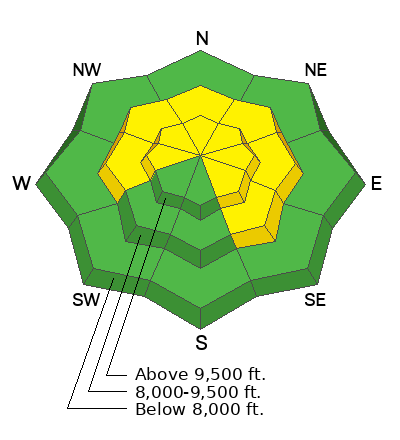
The overall danger rating on the Skyline is rated MODERATE.
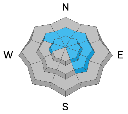
Recent wind has drifted snow and the pillows and slabs that formed may be sensitive to people still today. Keep in mind these are now covered up with new snow and will be hard to spot. Furthermore, we may see fresh drifts form today.
Use caution on steep terrain especially just below high, exposed ridges.
Low
Moderate
Considerable
High
Extreme
Learn how to read the forecast here
Weather and Snow
Current Conditions: Wind was from the east on Saturday and was slightly breezy drifting some snow around. It's switched around and is from the southwest and generally light this morning. Temperatures got into the mid 20s and have pretty much stayed there overnight. Two days of wind has damaged the snow quality in a lot of the open, exposed terrain but there are plenty of locations that are holding very nice riding conditions. We picked up 2 or 3 inches of new snow this morning so this will obviously improve riding conditions.
Mountain Weather: We could see a few more inches of snow this morning. Snowfall might linger into the afternoon before this storm wave moves on. Temperatures should get into the upper 20s. Wind from the southwest and west looks like it might get a little breezy mid day today. Monday looks like a clear day then we have more chances for periods of snow throughout the week. The next best-looking impulse should be late Tuesday.
Ad
Avalanche Problem #1
Wind Drifted Snow
Type
Location
Likelihood
Size
Description
Recent wind from the northwest on Friday then from the east on Saturday has stirred the snow up. There are fresh drifts scattered around but I personally didn't find any that were sensitive on Saturday. I wasn't in the most likely spots to find them either. I suspect that most of these are going to stay in place at this point but with some new snow and perhaps some more wind today, there could be a fresh round that will form. These aren't going to produce huge avalanches but if you trigger one, it might shove you around and that could obviously cause injury.
Avalanche Problem #2
Persistent Weak Layer
Type
Location
Likelihood
Size
Description
On Saturday I was in an area with a total snow depth of about 6 feet. Digging down to the ground, the snowpack looked pretty good to me. You can still easily identify the old facets at the base of the pack but they have gained strength and are not reactive to stability tests. I did not find any other layers of concern throughout the snowpack here. If everywhere looked like this, it would be green light conditions. However, there are places scattered around where the snowpack is shallower and weaker. These places are where a person might find trouble still. I don't think it's very likely at this point but it's still a concern of mine.
General Announcements
This forecast is from the U.S.D.A. Forest Service, which is solely responsible for its content. This forecast describes general avalanche conditions and local variations always occur.