Forecast for the Skyline Area Mountains

Brett Kobernik
Issued by Brett Kobernik for
Saturday, February 17, 2024
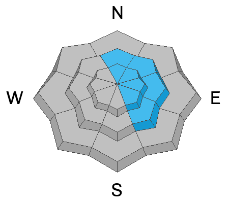
The overall danger rating on the Skyline is rated MODERATE.
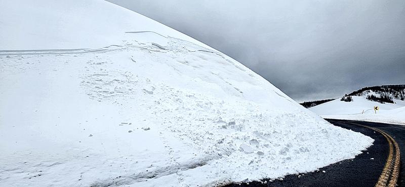
Fresh wind drifts and slabs that formed on Friday may still be sensitive to people today.
Human triggered avalanches are possible especially on steep slopes just below the ridges. High northeast, east and southeast facing slopes are the most suspect.
It is not "green light" conditions.
Low
Moderate
Considerable
High
Extreme
Learn how to read the forecast here
Weather and Snow
Current Conditions: Wind leads the headlines. The wind was drifting a lot more snow on Friday than I anticipated. It was getting down into canyon bottoms. You'll find crusts and areas with stiff slabs scattered about today. The wind was from the west. It has slowed down to almost calm this morning. There is a trace to an inch of new snow. Temperatures cooled into the teens overnight. Skies are mostly clear.
Mountain Weather: We'll enjoy a sunny day today with temperatures getting into the mid 20s and light wind shifting around and coming from the east. There will be a series of storms moving through over the next week that will bring small shots of snow to the Skyline. The next one will move through on Sunday bringing a trace to a couple of inches of new snow.
Recent Avalanches
There was some minor avalanche activity on Friday caused by the wind drifted snow. This was a small pocket that released naturally above State Road 264 near Electric Lake. Photo: Brian Seeley
Ad
Avalanche Problem #1
Wind Drifted Snow
Type
Location
Likelihood
Size
Description
The wind was actively drifting snow on Friday. These drifts will have stabilized somewhat by today but there is certainly a chance that a person could trigger one. These will be most pronounced on the more east facing slopes just below the ridgelines. Avoid steep slopes that have obvious cornices, pillows or fresh slabs of snow on them.
Avalanche Problem #2
Persistent Weak Layer
Type
Location
Likelihood
Size
Description
The old weak snow from December at the bottom of the snowpack can still easily be found. However, it seems very stubborn and not reactive in most snowpit stability tests. There is another layer within the snowpack that I've been keeping an eye on. It formed during the big warm up at the end of January. This one produced some scattered avalanches last week. It still fails in tests but is stubborn.
The take home is that these weak layers are not all that active. However, Friday's strong wind formed drifts and slabs which will enhance the chance of one of these layers failing. The tricky thing is this issue is very scattered. It's difficult to identify slopes that might fail. It is not all that likely for a person to trigger something breaking into one of these layers but it is certainly something to keep in mind.
General Announcements
This forecast is from the U.S.D.A. Forest Service, which is solely responsible for its content. This forecast describes general avalanche conditions and local variations always occur.