Forecast for the Skyline Area Mountains

Brett Kobernik
Issued by Brett Kobernik for
Thursday, February 14, 2019
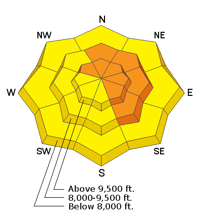
The avalanche danger is increasing as snow stacks up and wind drifts it. The danger is CONSIDERABLE today especially on the more east facing steep terrain where the wind is depositing snow into deep drifts. Human triggered avalanches are likely today.
Low
Moderate
Considerable
High
Extreme
Learn how to read the forecast here
Weather and Snow
The Skyline picked up 4 to 6 inches of dense new snow over the last 24 hours. Southwest wind was strong but has slowed over the last few hours. Temperatures are relatively warm. I'm seeing readings near 30 in most upper elevation locations. We should see periods of snow through today and tonight. I'm anticipating another 5 to 10 inches of snow by Friday morning. We'll have a break on Friday and then a cold front moves through Friday night which should bring another 6 to 8 inches of snow.
Ad
Additional Information
This forecast is from the U.S. Forest Service, which is solely responsible for its content. This forecast describes general avalanche conditions and local variations always occur.