Check Out Our Holiday Auction!

Forecast for the Skyline Area Mountains

Brett Kobernik
Issued by Brett Kobernik on
Tuesday morning, December 13, 2016

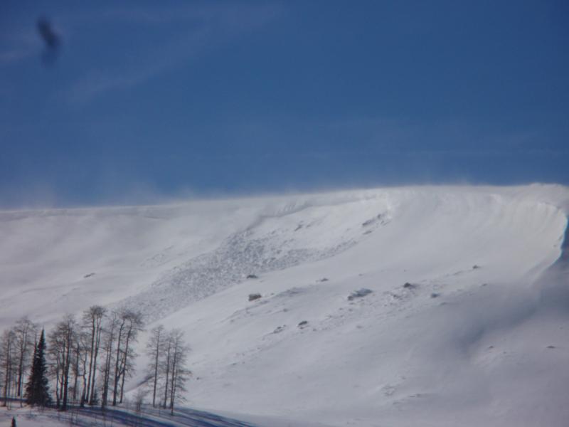
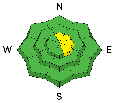
There remains a MODERATE avalanche danger along the highest ridges and peaks where a snow drift formed by the recent winds may still release with the weight of a person. Avoid steep slopes in the high terrain facing north through southeast that have a rippled, "pillowy", or textured look to them. Out of the wind affected snow, the danger is generally LOW.
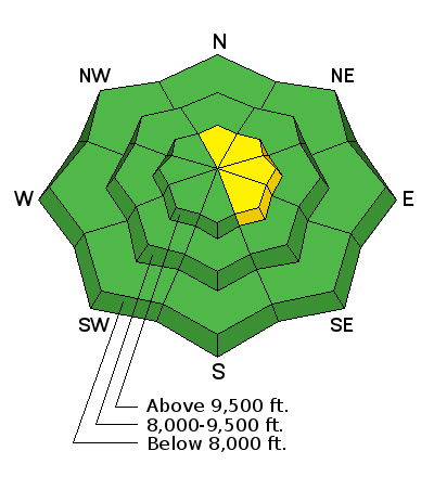
Low
Moderate
Considerable
High
Extreme
Learn how to read the forecast here
Special Announcements

Please join us at Big Pine Sports for an avalanche presentation on Thursday, Dec 15th at 6:30pm. I will be talking about the current conditions and sharing tips on how to stay out of avalanches. I'll cover anything else avalanche related the audience is interested in.

CLICK HERE FOR DETAILS

Weather and Snow

Steve Cote sent in a backcountry observation from Monday. Check it out HERE

Recent Avalanches

There was at least one natural avalanche that released during the day on Monday during the strong westerly wind. This is pretty typical of what to anticipate out there right now.

Skyline 12/12/2016 Avalanche: Wedding Ring Ridge Steve Cote Details

Avalanche Problem #1
Wind Drifted Snow
Type
Location
Likelihood
Size
Description

Triggering a fresh wind slab on the more east facing steep terrain is the biggest avalanche concern out there right now. These will be a bit more stubborn today than yesterday.

Additional Information

General Announcements

We will publish full detailed advisories Saturday and Sunday mornings by 7am. We will also be publishing basic avalanche danger ratings & info during the week.

If you are getting out into the mountains, we love to hear from you! You can SUBMIT OBSERVATIONS ONLINE or EMAIL US

If you would like to have avalanche advisories emailed to you, SIGN UP HERE

We can provide basic avalanche awareness presentations for your school, group or club. To enquire, CLICK HERE