Forecast for the Skyline Area Mountains

Brett Kobernik
Issued by Brett Kobernik for
Tuesday, November 27, 2018
The majority of the terrain along the Skyline has a LOW avalanche danger. There is a MODERATE avalanche danger on steep slopes above 9500' that face northwest, north and northeast. Small human triggered avalanches breaking into old snow near the ground are possible.
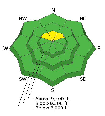
Low
Moderate
Considerable
High
Extreme
Learn how to read the forecast here
Weather and Snow
There is no doubt some weak old snow near the ground from October and early November. It is in the upper elevation northerly facing terrain. There was some minor natural avalanche activity breaking into this layer during the storm on Saturday, November 24th. It appears to be currently dormant. It is the main concern for the upcoming storms later this week.
MORE DETAILS ON THE CURRENT SNOWPACK HERE
Weather Outlook: We'll have a series of storm move through later this week. One Thursday, one Friday and one more Sunday. The first two are in a southerly flow and combined, they should bring a good amount of snow.
Ad
Additional Information