Join us at our 2nd Annual Blizzard Ball

Forecast for the Skyline Area Mountains

Brett Kobernik
Issued by Brett Kobernik on
Sunday morning, January 19, 2025
.
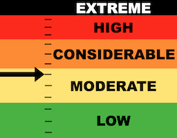
Recent wind drifted snow has increased the avalanche danger slightly.
Human triggered avalanches are possible on steep slopes that have recent deposits of wind drifted snow.
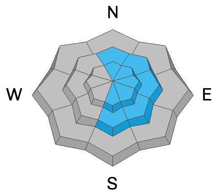
Steep slopes just below ridges especially on the more easterly facing terrain are the most suspect.
A more dangerous situation but with a lower probability is the chance for triggering an avalanche that breaks deeper into early season sugary facets. Recent wind drifting has enhanced the chances of this.
Low
Moderate
Considerable
High
Extreme
Learn how to read the forecast here
Weather and Snow
Current Conditions: Light snowfall on Saturday added up to 1 to 2 inches. It was hard to measure due to the wind drifting it all over. The wind from the west wasn't all that strong but just the right speed to really move snow. Down in the canyons it has really slowed. It is still in the moderate speed category along the higher ridges and peaks. Temperatures are as cold as they've been all winter with most locations right around zero, give or take.
Mountain Weather: We have some scattered clouds this morning and we'll probably see more throughout the day. Temperatures should get up into at least the low teens. It'll still feel slightly breezy along the more exposed terrain. I don't think the wind will be much of a factor down in the canyons and drainages. Wind will be from the west in the moderate speed category. Monday looks colder with clouds that should clear in the afternoon. We'll see sunny skies move in with warmer termperatures for the last part of the work week.
Recent Avalanches
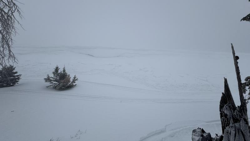
There was a report of a shallow but wide snowmobile triggered avalanche on Saturday near the Meadows in Ephraim Canyon. It was on an east facing steep slope just below a ridge. No one was caught.
Photo: Aaron Case
Ad
Avalanche Problem #1
Wind Drifted Snow
Type
Location
Likelihood
Size
Description
Wind Drifted Snow avalanches are the most likely type of slide you might encounter today. Some of these have gotten large enough that they could be potentially dangerous on bigger slopes. They will probably be a little less sensitive today compared to the last two days. Simply avoid steep slopes that have obvious drifts, pillows, or slabs to stay out of trouble. The more east facing steep slopes just below ridges are the most likely places to trigger something. .
Avalanche Problem #2
Persistent Weak Layer
Type
Location
Likelihood
Size
Description
A less likely but more dangerous problem is the chance of triggering an avalanche that breaks deeper into underlying Persistent Weak Layers. The weak faceted snow formed earlier in the season. It was quite unstable during the Christmas holidays but has slowly been stabilizing. I haven't heard of any recent avalanches breaking deep. However, the recent wind loading adds stress on top of the old weak snow and this enhances the chance for triggering a deeper avalanche. Again, the key is avoidance. Don't monkey around with steep terrain where the wind has been depositing snow.
General Announcements
This forecast is from the U.S.D.A. Forest Service, which is solely responsible for its content. This forecast describes general avalanche conditions and local variations always occur.