Check Out Our Holiday Auction!

Forecast for the Skyline Area Mountains

Brett Kobernik
Issued by Brett Kobernik on
Friday morning, December 5, 2025

As of today, there is very little threat of avalanches. With an expected storm moving though this weekend, we may see a slight increase in the avalanche danger. Be sure to check the daily forecast before heading out this weekend.

Low
Moderate
Considerable
High
Extreme
Learn how to read the forecast here
Weather and Snow
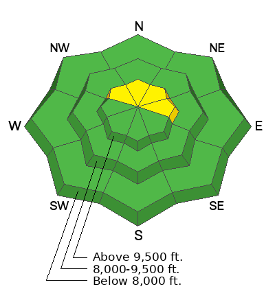
Current Conditions: During fieldwork on Thursday, I found that the higher terrain is holding a little more snow than I thought. Depths along the Skyline Drive from Spring City Canyon to Pleasant creek were averaging about 12 to 15 inches deep. Oddly enough, the very first slope that I touched this season cracked out on weak facets. So, there is a little weak snow up there but currently, it's not much and is only found in the highest more northerly facing terrain.
PHOTO: north facing slope that cracked out when I approached it from below. 10,600'
Overnight temperatures were in the upper teens. Wind has been generally light from the southwest but it has increased in speed slightly along the most exposed peaks.
Mountain Weather: The first few flakes of snow from the next storm are starting to fall. Today will be cloudy with periods of light snow that I don't think will add up to much. Temperatures will be in the low to mid 20s. Wind speeds should start to increase. The main part of the storm that will impact our area is on Saturday. Temperatures will remain in the low to mid 20s. Wind speeds from the northwest could get pretty strong. We should see heavier and more steady snowfall with totals in the 6 to 8 inch range. Some weather models are indicating more.
General Announcements
This forecast is from the U.S.D.A. Forest Service, which is solely responsible for its content. This forecast describes general avalanche conditions and local variations always occur.