I hate forecasting for wet avalanches because they are so unpredictable. When faced with uncertainty, most avalanche experts choose conservative terrain, which is what I urge everyone to do through the weekend.
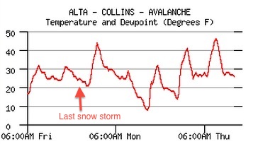
This is the first extended warm up after several snowy weeks. Snow does not like rapid change, and on many slopes, over 2 feet of settled, dry snow is getting wet for the first time. I'm hoping that the warming will come slowly enough and combined with expected refreezes each night, that it will keep wet activity to a reasonable level. But then again, wet avalanches are very unpredictable. Anyone venturing into the Uinta Mountains should be especially cautious because--as usual--the Uintas still have buried layer of persistently weak, faceted snow that can produce deep, large avalanches. Also notice, the yellow (Moderate) on the danger rose has expanded to include most aspects and elevations with the exception of the high elevation northerly facing terrain.
Today and through the weekend, you should get out early and get home early. Definitely stay off of--and out from underneath--any steep slope when it gets wet. I will call the avalanche danger Moderate today but it could rise to Considerable this weekend.
Note on the danger rose: almost no snow exists on southerly facing slopes below 8,000'.
Also, remember, most of the ski resorts are closed for the season with no avalanche control, so treat it just like backcountry terrain.