UDOT PLANNED AVALANCHE CLOSURES!!

Forecast for the Salt Lake Area Mountains

Drew Hardesty
Issued by Drew Hardesty for
Tuesday, April 2, 2019
Low danger. Remember that Risk is inherent in mountain travel.
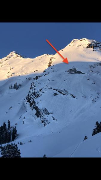
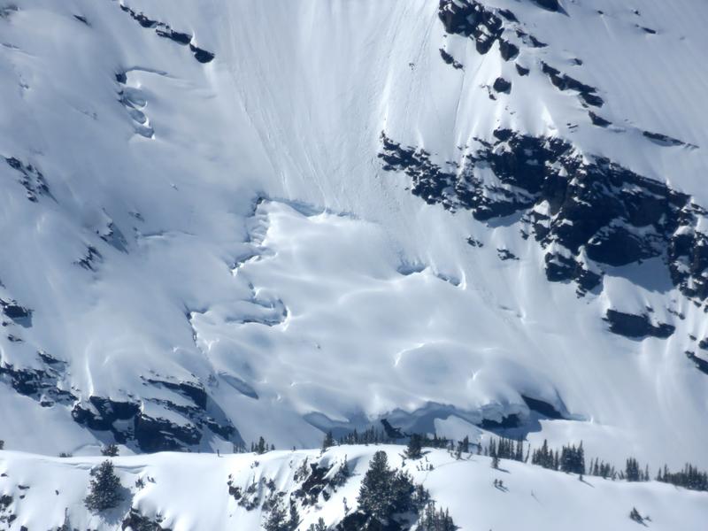
Low danger doesn't mean No danger: Wet sluff push-alanches possible in terrain that had a poor overnight refreeze. Dry sluffs and pockets of shallow new wind drifts up high.
Follow safe travel protocol, carry and know how to use your rescue gear, and minimize your exposure in high consequence terrain.
Low
Moderate
Considerable
High
Extreme
Learn how to read the forecast here
Special Announcements
When the forecasting ends, the UAC’s work keeps going strong. Summer is a busy time for the UAC. During the summer we are working hard on our fall and winter planning; putting together the Fall Fundraiser and the Utah Snow and Avalanche Workshop; updating our awareness and education programs; this summer we will be finishing up the website redesign project. Your donation shows you’re invested in this community all year round! You can still be part of the UAC’s success in 2019.
Weather and Snow
As of 5am, skies are mostly cloudy ahead of the advancing storm. Mountain temperatures along the higher elevations are back to or have exceeded yesterday's daytime highs of the upper 20s to low 30s. Mid-elevations have struggled to dip below freezing at all. Winds backed to the southwest overnight and are blowing 10-15mph with gusts to 25. At the 11,000' level, hourly wind speeds are 20-30mph with gusts to near 50. A trace of rain or snow fell in some areas overnight.

For today, we'll see thickening clouds and a few inches of afternoon snow (2-4"?) with pulses of graupel and maybe a clap of thunder or two. Temps will still reach into the low 40s down low and the low 30s up high. The south to southwesterlies will blow 15-20mph with occasionally higher gusts in the afternoon. The failing heart of the storm passes through tomorrow morning and all told, we should see 4-8" of snow by midday Wednesday with an unsteady rain/snow line hovering between 7-7500'. Locally higher amounts up to a foot possible by tomorrow.
Recent Avalanches
Minor wet and dry sluffing noted with one shallow wind slab pried out with explosives in upper LCC.
Ad
Avalanche Problem #1
Normal Caution
Type
Location
Likelihood
Size
Description
Observe normal caution if ignoring your taxes yet again and headed into the backcountry today. Expect minor pushalanches in warm, protected areas that suffered a mimimal refreeze; dry sluffing in weak surface snow up high and maybe a couple new shallow drifts from the advancing southwesterly winds. Shallow new snow activity may be expected during periods of peak snowfall intensity in the afternoon.
Avalanche Problem #2
Gliding Snow
Type
Location
Likelihood
Size
Description
It's glide avalanche season in the standard areas of Broads, Stairs, and Mill B South of BCC, upper Porter Fork (Raymond Slabs), and other areas where the glide cracks are opening. A large glide release ran in mid-Broads Fork (Bonkers) on Saturday (pic below). Bill Nalli has an excellent pic of the many glide cracks in steep east to northeast facing Broads from Sunday. Glide avalanches are not human triggered - they run spontaneously as full depth releases and would likely be unsurvivable. Avoidance and/or minimizing exposure is the best course of action. For more info on glides, click here and here.
Historical Note: We suffered two glide avalanche fatalities in Stairs Gulch in April 2001...and a very close call and serious injuries below the Diving Board in Broads Fork of February 2013.
Additional Information
Bonus Track: Owing to the clear skies, weak surface snow (facets and patches of small surface hoar) developed on many aspects and elevations over the past few days. Good observations by Meisenheimer/Staples enroute the Coalpit Headwall...and Chester in the Brighton periphery highlighting these snow surface conditions yesterday.
I do suspect, however, that the wind, warmth, and overcast skies will have softened the edges of these potential weak layers and otherwise left them greatly diminished. They're now likely most found in the high shady terrain this morning. Help us out and let us know how well the new snow is bonding to these layers.
General Announcements
This information does not apply to developed ski areas or highways where avalanche control is normally done. This forecast is from the U.S.D.A. Forest Service, which is solely responsible for its content. This forecast describes general avalanche conditions and local variations always occur.