Human Factor Research: Researchers Ian McCammon and Sara Boilen are developing new tools for managing human factors for backcountry skiers and boarders. This survey asks about personal experiences with human factors and will take 7-8 minutes to complete. Link is HERE.
This morning, skies are broken, and overnight temperatures dropped into the mid 30s °F. Winds have shifted more southeasterly and generally decreased, though easterly winds are not well measured across the range. Weather stations are showing ridgetop gusts around 20–30 mph. Given the broken cloud cover and slightly warmer temperatures, I would expect a more superficial refreeze this morning compared to the last few.
Today, skies will be partly sunny, with a chance of light showers this afternoon. Expect winds to shift more southwesterly and increase to moderate, with gusts around 30 mph along the high ridges and up to 50 mph along the highest peaks. Temperatures will rise into the upper 50s °F and low 60s °F.
Looking ahead, things cool down and turn stormy this weekend into early next week, though details are still coming together. Saturday brings the first system, followed by a colder and more promising storm Sunday into Monday. Snow levels should stay below 8,000 feet with that second system. Snowfall looks light on Saturday, with more substantial accumulation Sunday into Monday. Totals could reach 6–16 inches of new snow, with up to 1.3 inches of water.
The Week in Review has been published and highlights the previous week's key avalanche and weather events contributing to conditions in the backcountry. Check it out.

One report came in from the northwest side of Cardiff Pass near 10,000 feet, where a wet loose avalanche initially triggered high on the rocks and then stepped down into a deeper wet slab lower on the slope. Crowns were visible at the top of the main break near the rocks. Though the exact timing is unknown, it likely occurred on 4/7 or 4/8.
On Tuesday, a skier triggered a soft slab avalanche in Wolverine Cirque on a steep northeast-facing slope at 10,500 feet. The skier was briefly caught before skiing off the slab.
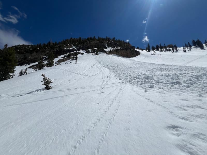
Wet slab on the Northwest side of Cardiff Pass. Photo: M. Maier and E. Fullmer


