Donate to the 2024 Spring Campaign to help rebuild the UAC website.

Forecast for the Salt Lake Area Mountains

Evelyn Lees
Issued by Evelyn Lees for
Wednesday, March 27, 2019
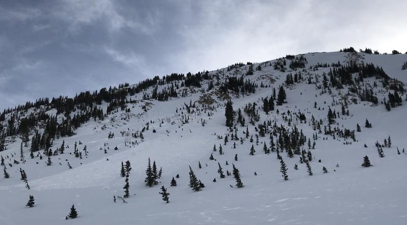
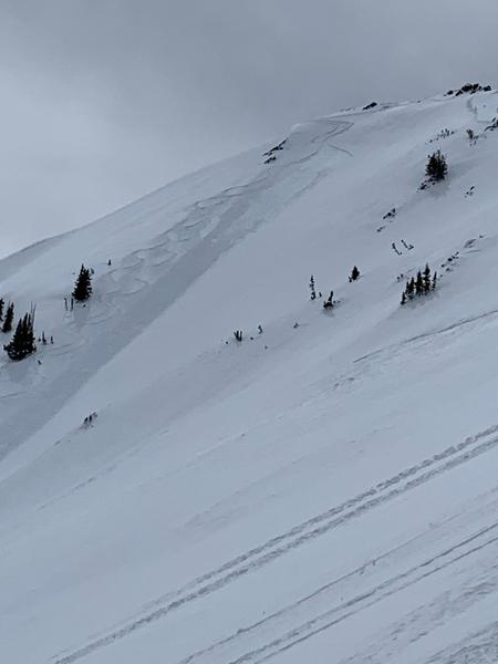
The avalanche danger is MODERATE for wet avalanches - both loose sluffs and shallow wet slab avalanches are possible in all steep terrain, except for the northerly upper elevations. The danger of wet snow avalanches will peak during the heat of the day or any periods of more direct sun.
The avalanche danger is MODERATE on steep upper elevation slopes for triggering a slab of wind drifted snow. These drifts will be most widespread on slopes facing the north 1/2 of the compass.
Low
Moderate
Considerable
High
Extreme
Learn how to read the forecast here
Special Announcements
We need your help. In an effort to increase awareness and prevent future fatalities we need to reach more people with our daily avalanche forecasts, expand the Know Before You Go program, and increase the number of on-snow avalanche courses. Please consider a donation to the UAC to help us raise $25,000 by April 8. Help your support of the UAC by making a donation HERE. Thank you -
Weather and Snow
Under a blanket of high thin clouds, temperatures are in the mid 20s to near 30°F above about 10,000’. Below 10,000’, readings are too warm for comfort - in the low to mid 30s, with no overnight refreeze. The southerly winds are the cooling feature - averaging 15 to 25 mph, with gusts in the 30s at the 9 and 10,000’ elevations, with the high ridge lines gusting in the 50s. Speeds are forecast to remain in this range, and possibly increasing a bit throughout the day. Temperatures should warm into the low 50s at 9,000’, and mid 30s at 10,500’.
The winds are eating away at the remaining dry snow, so powder is a scarce commodity today - any remnants will be on upper elevation, wind sheltered northerly facing slopes. Elsewhere, a challenging mix of breakable and supportable sun and wind crusts.
Recent Avalanches
Yesterday, two wind slabs were triggered at the upper elevations. One on west facing Hogum 200, about 20 inches deep by 80 feet wide, taking a person for a 700’ ride, no injuries. The other was a shallower, intentionally triggered wind slab on Cardiac ridge, that then became a long running sluff.
On Monday, a steep east facing slope at 7,500’ on the Park City side, collapsed on the basal facets.
Hogum 200 slide, observation here.
Ad
Avalanche Problem #1
Wet Snow
Type
Location
Likelihood
Size
Description
Winds and clouds won the battle yesterday, keeping the snow cool, and I’m hoping the same combination will minimize the wet avalanche activity again today. Fighting on the other side are the warm temperatures, many mid and lower elevations stations have been above freezing for 48 hours, and the snowpack at these elevations will struggle with heating today. Below is a 7 day temperature graph from the Mill-D north Snotell, 8,961'. ° F on the left axis, red line is 32° F
Wet loose sluffs are the simpler problem - when the surface snow gets damp, head to lower angle slopes and avoid travel in and below run out zones. Be especially alert for the snow to rapidly heat if the sun comes out, the clouds thin or the wind stops blowing where you are.
Wet Slabs are the tricky problem - this is when deeper layers of snow have remained wet, hiding beneath shallowly frozen crusts. Signs to watch for - collapsing, punchy or bending crusts, or when you are breaking through the crusts. A wet slab can break loose when you think you’re on a supportable frozen snow. Stopping to dig down just a foot or two can let you search for layers of weak, wet snow in the upper snowpack.
Roof slides can occur at any time, especially with warming temperatures - always avoid travel beneath snow laden roofs and warn others.
Glide cracks become more active during prolonged heating, sending the whole season’s snowpack down slope. Avoid spending time below the yawning cracks.
Avalanche Problem #2
Wind Drifted Snow
Type
Location
Likelihood
Size
Description
The southerly winds will continue to find snow to erode today, depositing it into shallow, sensitive wind drifts. The drifts will be most widespread on northerly facing slopes, but cross loaded onto any aspect and the winds were drifting snow well off the ridge lines yesterday. Look for smooth, round drifts and areas of denser, cracky snow. Cornices grew a bit yesterday, are too large to tangle with or try to intentionally trigger. Avoid these monsters.
Intentionally triggered wind drift, Cardiac Ridge. photo: Jesse W
General Announcements
This information does not apply to developed ski areas or highways where avalanche control is normally done. This forecast is from the U.S.D.A. Forest Service, which is solely responsible for its content. This forecast describes general avalanche conditions and local variations always occur.