Forecast for the Salt Lake Area Mountains

Dave Kelly
Issued by Dave Kelly for
Saturday, March 16, 2024
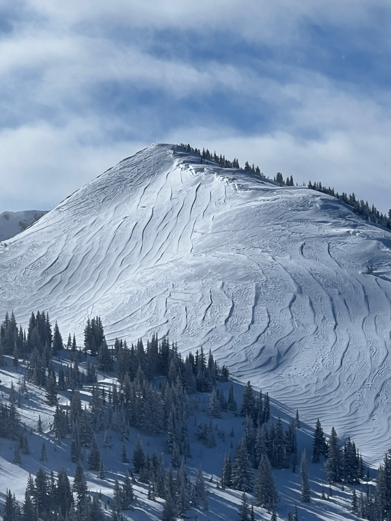
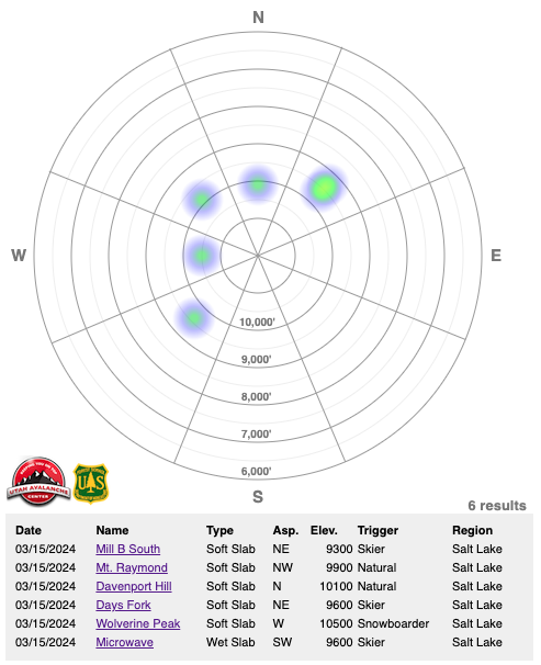
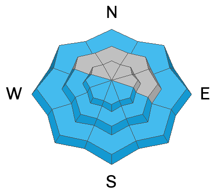
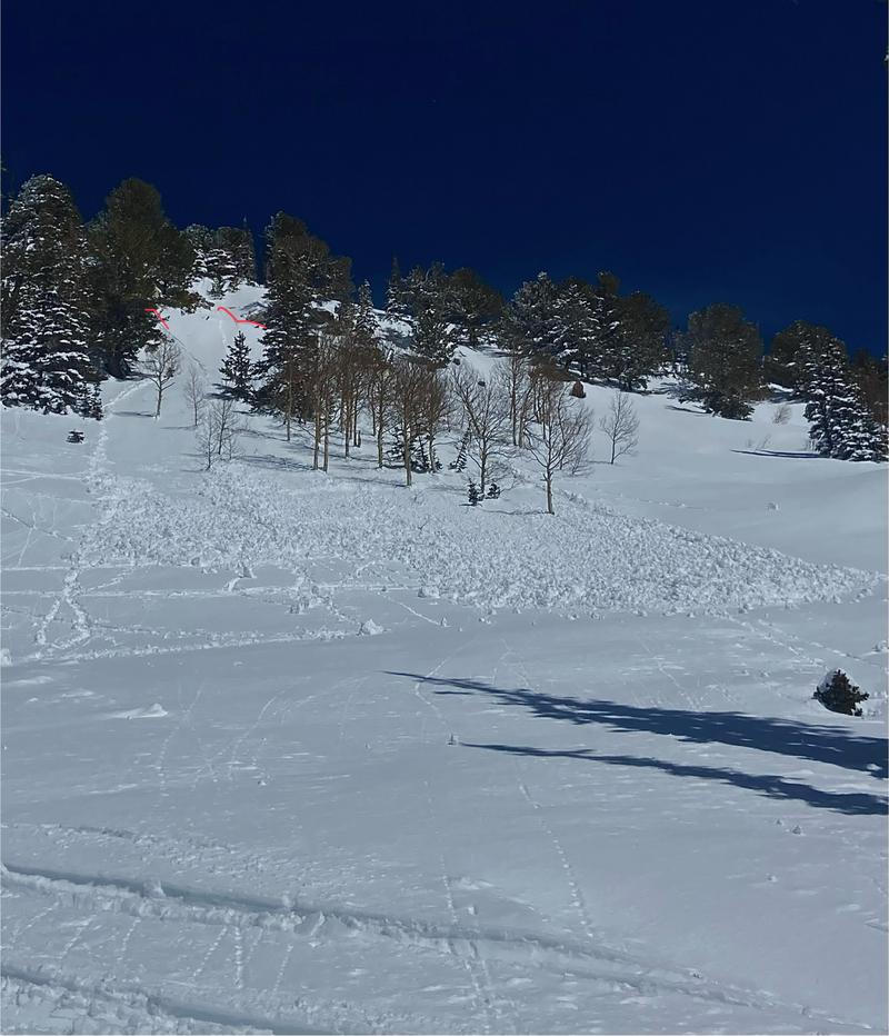
The avalanche danger is MODERATE in upper elevation terrain, where it will be possible for humans to trigger wind-drifted snow avalanches near ridgelines and on terrain features lower on the slope. With strong winds over the last few days, you may find areas of wind-drifted snow below 9,500' that will be sensitive to backcountry travelers and act more like high-elevation terrain.
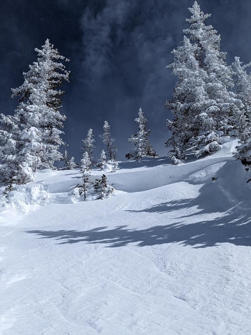
Outside of the wind zone there is a LOW avalanche danger. With daytime warming there will be rollerballs, pinwheels, and small point releases potentially leading to shallow wet slab avalanches on solar aspects and the lowest elevation northerly facing terrain.
Low
Moderate
Considerable
High
Extreme
Learn how to read the forecast here
Special Announcements
Support the UAC website rebuild by donating to our Spring Campaign.
The Utah Avalanche Center is hosting The Banff Film Festival on Thursday, March 21, and Friday, March 22 in Moab.
Weather and Snow
Currently, under broken skies trailhead temperatures are in the mid 20's °F and the highest elevations are in the high teens °F. Winds are blowing from an easterly direction in the single digits gusting to the teens MPH at the lower elevation weather stations and from the south-east in the mid 20's gusting to the 30's MPH at the 11,000' ridge-lines. Downslope winds are still blowing strong at the mouths of the canyons and there is potential to see higher wind speeds and some snow being transported lower than you might expect.
Today, expect clear sunny skies. Temperatures will be 40-45 °F with a freezing level from 7,000'-8,000'. Winds will blow from the southeast 10 gusting to 15 MPH at the 9,000' ridge-lines and 15 gusting to 25 MPH at the 11,000' ridge-lines. No new snow is expected today. High pressure is forecast for the next five days with warm temperatures, before unsettled stormy weather returns later next week. Read more from our partners at the National Weather Service HERE.

The snow surface has taken a beating from the onslaught of easterly winds. This has led to wind drifted snow on all aspects and terrain features at upper, mid, and lower elevations. Warmer temperatures yesterday out of the wind zone affected the snow surface on south-west facing slopes and expect to find a melt-freeze crust on these aspects this morning. Sheltered terrain on the north-east facing side of the compass is still holding soft surface snow.
Photo (Bonners) showing wind affected snow on Patsy Marley
Recent Avalanches
Yesterday, there were a number of reports of wind-drifted snow avalanches throughout the Central Wasatch. A few of these involved close calls with backcountry travelers. These wind-drifted snow avalanches varied in depth and aspect which shows the spotty nature of wind deposited snow over the last few days. The avalanche rose below shows the distribution of these avalanches in the Salt Lake Area Mountains from yesterday where 4 out of the 6 reported avalanches involved backcountry travelers at some level; either directly involved or close by when the avalanche was triggered. The lone avalanche on a southwest aspect was a wet loose/wet slab avalanche at 9,600' (photo below in wet snow problem).

Check out all recent Observations HERE.
Ad
Avalanche Problem #1
Wind Drifted Snow
Type
Location
Likelihood
Size
Description
The easterly flow, combined with soft snow available for transport, has created soft slabs of wind-drifted snow 1'-3' deep. These will be most pronounced on leeward-facing slopes; but high winds have loaded many aspects due to swirling and changing wind directions that have loaded terrain features lower on the slope and you can't discount finding an area of wind-drifted snow below 9,500'
Look for and avoid signs of wind-drifted snow such as texture and pillow-shaped features. Approach steep terrain features that could accumulate drifting snow cautiously.

Recently formed CORNICES are extremely hazardous. Limit your exposure to ridgelines near cornices and slopes below them. A cornice fall could trigger a slab of wind-drifted snow below and there was a report of a cornice triggered avalanche in Silver Fork yesterday.
Wind-drifted snow avalanche on Mount Wolverine 10,500' on a west facing aspect (Photo: Donkey)
Avalanche Problem #2
Wet Snow
Type
Location
Likelihood
Size
Description
With today's decreasing winds and increased temperature expect to see wet loose avalanche activity on solar aspects with daytime warming. This will be most evident in areas out of the wind zone and in steep rocky gully features facing the southerly half of the compass and at low elevation terrain. The best way to avoid this problem is to be off of sunny slopes before they start to take too much heat. Roller balls, dripping water off of rocks, and your boots or skis sinking into the surface snow are signs it's time to move to higher elevation terrain.
With warming temperatures and decreasing wind speeds, roof slides are a concern this weekend. Be aware of adults working solo outside or children playing as these are the people most susceptible to roof slides.
Photo below of late afternoon wet loose turned shallow wet slab avalanche on a southwest facing slope at 9,600' (Photo: O'Brien)
General Announcements
This information does not apply to developed ski areas or highways where avalanche control is normally done. This forecast is from the U.S.D.A. Forest Service, which is solely responsible for its content. This forecast describes general avalanche conditions and local variations always occur.