Join us at our 2nd Annual Blizzard Ball

Forecast for the Salt Lake Area Mountains

Greg Gagne
Issued by Greg Gagne on
Friday morning, February 28, 2020
The avalanche danger is LOW on all aspects and elevations and Normal Caution is advised. The primary avalanche hazard to watch for today is small, wet-loose activity on steep, sunny slopes.
Slide for life conditions exist in some of the alpine terrain across the range, and an ice axe, whippet, and (ski) crampons may be useful. Remember that risk is inherent in mountain travel and even a small avalanche in steep terrain can have significant consequences.
Low
Moderate
Considerable
High
Extreme
Learn how to read the forecast here
Special Announcements
The UAC's Avy Awareness Auction is currently underway with tons of great gear, jewelry, artwork and experiences available. Visit the auction page HERE to help support the UAC's spring avalanche awareness and outreach efforts.

A new version of the UAC IOS application is now available on the Apple App Store. This version fixes many of the issues that occur when running IOS 13. Download it now!
Weather and Snow
Currently, skies are clear and temperatures range through the 20's F. with some teens at trailhead bottoms where the colder air is sinking. Winds are out of the west/northwest and light, less than 10 mph below 10,000'. Above that elevation, winds are gusting in the teens, with gusts in the 20's at 11,000'
For today, expect sunny and mild conditions. Temperatures will rise into the mid and upper 30's, and about freezing along upper elevation ridgetops. Winds will be westerly and light, gusting into the teens at the upper elevations, with gusts into the 20's at 11,000'.
Looking ahead, skies will begin to cloud up this evening and winds will turn southwesterly on Saturday. A much-needed reset to winter with snowfall expected to begin later Saturday night and into Sunday. Current models are showing about a foot of snow by later Sunday evening.
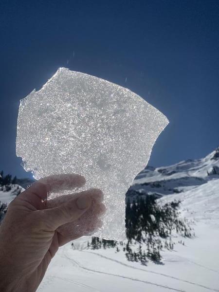
Mark White has a great observation from Broads Fork on Thursday where he describes the current snow surface as "a mixed bag of wind crust, rime crust and some recrystallized powder". Wind-exposed slopes have been stripped down to the February 7 ("Dickens") rain/rime crust.
Recent Avalanches
Minor, wet-loose activity on steep southerly aspects.

Our Week in Review - where we highlight snow and avalanche activity from the past week - is available HERE.
Ad
Avalanche Problem #1
Normal Caution
Type
Location
Likelihood
Size
Description
Currently, the avalanche danger is Low and avalanche conditions are generally safe. Avalanches are always possible, and the things to watch for today include (1) small loose wet avalanches on steep, sunny slopes and (2) very isolated pockets of recent wind slabs along upper elevation ridgelines. Slide-for-life conditions exist on steep aspects that have been scoured down to the Feb 7 crust.
Additional Information
With increasing winds and snow in the forecast, the avalanche danger will rise by Sunday morning. Pay attention to the current snow surface - look for weak, faceted (sugary) snow on shady aspects, especially where it is sitting on top of the Feb 7 crust. Any weaknesses at our current snow surface may provide weak layers once we put a load of new - or wind-loaded - snow on top.
General Announcements
This information does not apply to developed ski areas or highways where avalanche control is normally done. This forecast is from the U.S.D.A. Forest Service, which is solely responsible for its content. This forecast describes general avalanche conditions and local variations always occur.