Forecast for the Salt Lake Area Mountains

Trent Meisenheimer
Issued by Trent Meisenheimer for
Sunday, February 26, 2023
The avalanche danger is CONSIDERABLE across all upper-elevation steep slopes for wind-drifted snow avalanches (wind slabs). These avalanches are likely to be triggered by a human and could be 1-2 feet deep and up to 150 feet wide.
If you plan to recreate in any low-elevation foothill terrain surrounding the city, please watch this video HERE and know it's possible to trigger an avalanche on a slope steeper than 30 degrees.
Low
Moderate
Considerable
High
Extreme
Learn how to read the forecast here
Weather and Snow
As storms head toward northern Utah, the National Weather Service has issued a Winter Storm Warning from 11:00 am this morning to 5:00 pm on Wednesday. These storms will mainly track on a southwest flow and will bring 30-40 inches of new snow to the mountains over the next few days.
This morning under mostly cloudy skies, the mountain temperatures are in the mid-to-low 20s °F. Winds picked up once again overnight and are now blowing from the southeast at 15-25 mph, gusting into the 30s along the upper elevations.
Snowfall should begin mid-morning today. Mountain temperatures will rise into the upper 20s and low 30s today. Winds will remain from the south and southeast and blow 15-25 mph. By the end of the day, we could see 3-6 inches of new snow. Overnight the storm kicks in as we are expecting the heaviest snowfall to be overnight Sunday into Monday and overnight Monday into Tuesday.
Recent Avalanches
Avalanches continue to pour into the observation and avalanches cue. Most of the avalanches are caused by southerly winds whipping the new snow into dense slabs of wind-drifted snow. These avalanches are roughly 1-2 feet deep and 150 feet wide. Be sure to check out the avalanche list.
Over the past three days, ten avalanches were reported that might have failed on a weaker interface roughly 1-3 feet down. This interface is the old snow / new snow interface, and in some areas, it has become slightly weaker (faceted), and we feel it's worth mentioning and paying attention to. More on this in additional information below.
Ad
Avalanche Problem #1
Wind Drifted Snow
Type
Location
Likelihood
Size
Description
Southerly winds have been blowing strong 15-35 mph averages across many aspects and elevations for the past 48 hrs. This morning these winds now blow from the southeast at similar speeds. This will be a new loading pattern today, and you can expect to find fresh wind slabs dotted around the mid and upper-elevation terrain. These avalanches have been 1-2 feet deep and 150 feet wide. It's possible some of these wind slabs could break to the old snow / new snow interface (1-3 feet deep) that may have some weaker snow grains (see additional info)

If the new snowfall comes with high precipitation intensity (heavy snowfall), be on guard in any terrain for the new snow to sluff and cause dry-loose avalanches or create shallow new snow (storm slab) avalanches. Shovel tilt tests are a great and easy way to test the bond of the new snow.
Additional Information
Yesterday, we looked at all the avalanche activity. We found that enough of the avalanche observations had reports of weaker snow at the old/new snow interface that we felt was important enough to bring up. By my count, roughly ten avalanches have been reported over the past three days. Observers reported the interface to be either a slight crust with weak snow above or below or just a layer of weaker grains roughly 1-3 feet deep. My advice would be to dig down and perform an extended column test and look for any weak snow before committing to steep avalanche terrain. We will wait and get a little more info before we call this a new Persistent Weak Layer.
BCK via Hardesty: Silver Fork, Big Cottonwood. 9,000' east facing 2.5 feet deep, 60 feet wide. Sun crusts SH / Faceted snow. Link to ob HERE.
SLC Foothills: Avenues Twin Peaks. 6,500' west facing 12 inches deep, 150 feet wide. Faceted snow. Link to ob HERE.
AAI Pro 1: White Pine, Little Cottonwood. 8,900' northwest facing 12 inches deep, 150 feet wide. Rounding faceted snow. Link to ob HERE.
Staples via 3rd party: Parleys North. 7,500' southeast facing 14 inches deep, 400 feet wide. Unknown weak layer, remote trigger. Link to ob HERE.
Gordon via 3rd party: Figure 8 Bowl, Big Cottonwood. 9,700' northeast facing 2 feet deep, 125 feet wide. Unknown weak layer, wide propagation. Link to ob HERE.
Meisenheimer via 3rd party: The Notch, Upper Little Cottonwood. 10,300' northeast facing 2 feet deep, 60 feet wide. Faceted snow. No ob.
Meisenheimer via 3rd party: Upper Little Cottonwood. 10,600' west-facing, 2 feet deep, 260 feet wide. Possible faceted snow. No ob.
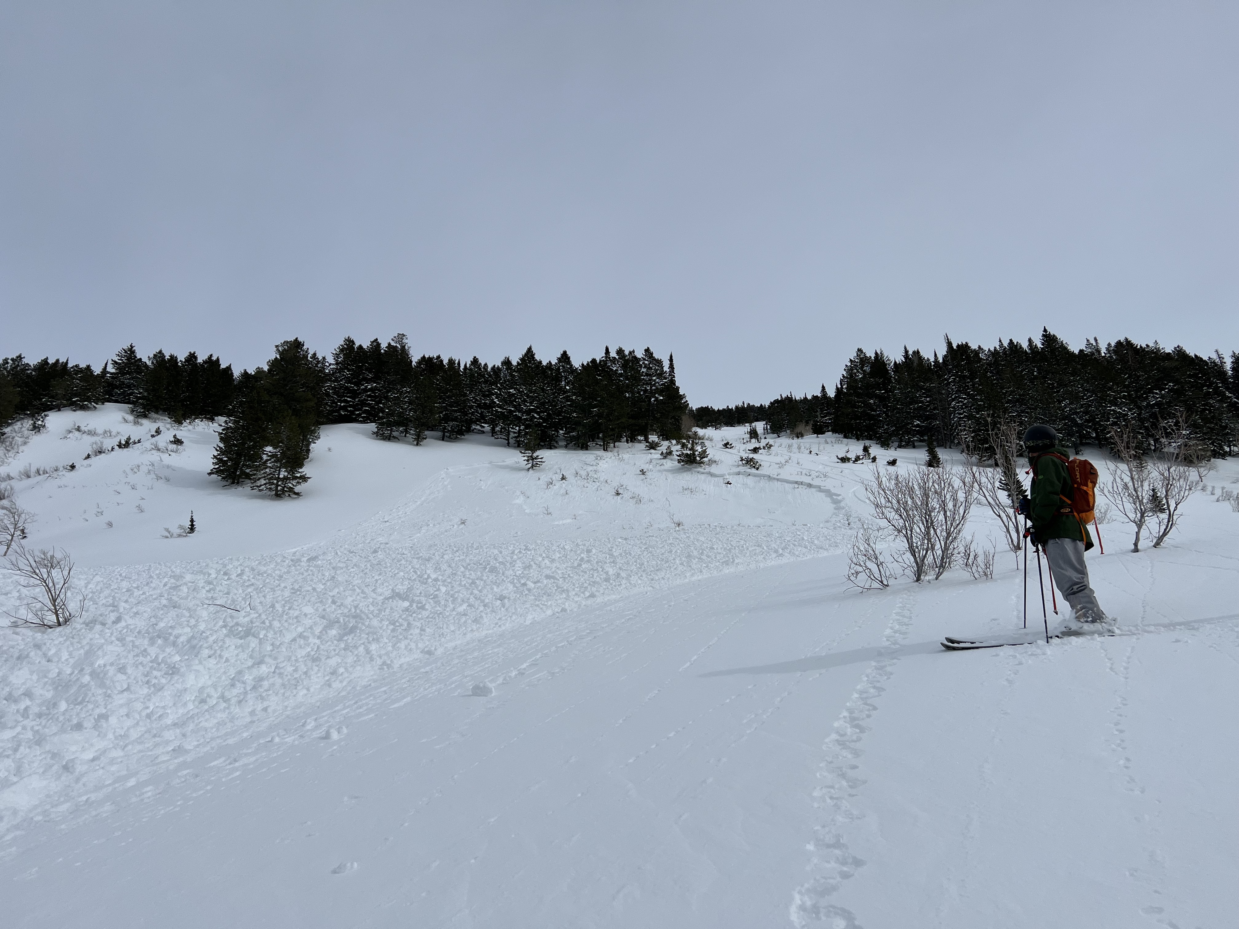
Powderbirds: Cascade, Provo. 8,800 west-facing 2 feet deep, 100 feet wide (pic below). Possible faceted snow. No ob.
Brackelsberg: Park City Ridgeline. 8,800' west-facing slope. No avalanche, but a great video showing some faceted snow and a crust. Link to ob HERE.
Coyne, Champion, Gagne: Raymond Glades, Millcreek. 9,500' north facing. ECTP22 failing on some small grain faceted snow. Link to ob HERE.
General Announcements
This information does not apply to developed ski areas or highways where avalanche control is normally done. This forecast is from the U.S.D.A. Forest Service, which is solely responsible for its content. This forecast describes general avalanche conditions and local variations always occur.