Forecast for the Salt Lake Area Mountains

Nikki Champion
Issued by Nikki Champion for
Monday, February 20, 2023
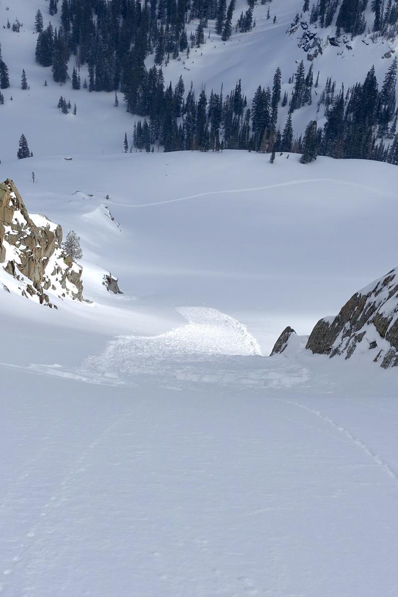
The avalanche danger is MODERATE across all upper elevation terrain for shallow slabs of wind-drifted snow. Be on the lookout for pockets of reactive wind-drifted snow, especially in steep, consequential terrain where even a small avalanche can have a detrimental outcome. Out of the wind zone, the avalanche danger is LOW.
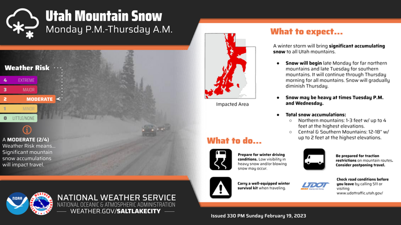
Avalanche danger will be on the rise with the incoming storm, think about shifting the mindset to stepping back over the next few days.
Low
Moderate
Considerable
High
Extreme
Learn how to read the forecast here
Weather and Snow
This morning, the skies are overcast with light snowfall in the upper cottonwoods, no measurable accumulation as of 7 AM. Mountain temperatures have increased since yesterday, sitting in the upper teens and low 20s F. Along 9000' ridgelines winds are blowing primarily west-northwest at speeds of 10-20 mph, with gusts between 30-40 mph. At 11,000 feet, the winds are west-northwest gusting up to 70 mph.
Today will be mostly cloudy with a few snow showers. We could get 1-3" of new snow before the evening. Temperatures will rise into the upper 20s and low 30s°F today. At the 9000' ridgelines, winds will remain from the west-northwest and blow at speeds of 15-25 mph with gusts to 35 mph. At the 11,000' ridgelines winds will blow 35-45 mph, with gusts up to 60 mph.
Tomorrow, a winter storm warning goes into effect from 2 PM Tuesday until 6 AM Thursday. Mid-level warm air advection will bring snow showers to the mountains through the next two periods. One of the stronger storms of the winter is expected to begin on Tuesday. Snow totals could be impressive, with 32-42 inches of new snow. If you're in Southern Utah, you better hold onto your hats as wind speeds are forecast to hit 60-70 mph Tuesday into Wednesday. Find more details on the incoming storm in additional information.
Surface conditions have greatly improved with the new snowfall. Out of the wind zone, in protected terrain, the new snow will still be soft.
Recent Avalanches
Yesterday, multiple human-triggered, and natural avalanches were reported in the backcountry. The majority of these avalanches failed as small soft slabs or shallow, loose dry new snow avalanches on the old snow interface. See one observation from Tuscarora yesterday that propagated 15' wide, on an East aspect near 10,300'. Photo (Katz)
Find all recent avalanche activity HERE.
Ad
Avalanche Problem #1
Wind Drifted Snow
Type
Location
Likelihood
Size
Description
Winds picked up overnight, with gusts near 70 mph. The high winds, in combination with a few inches of soft snow, will continue to form fresh slabs of wind-drifted snow along all aspects at upper elevations. These wind drifts will be shallow and generally less than a foot deep but could be sensitive to the weight of a rider today.
Use small test slopes to see how the new snow behaves before committing to a more aggressive terrain objective.
Additional Information
Forecaster Corner: The incoming storm is impressive. Trent described it as "a beast of a trough" yesterday, the NWS is calling it one of the stronger storms of the Winter. The bulk of this storm will push into Northern Utah Tuesday afternoon and will last into Thursday for the Wasatch Range. Looking at some numbers, the snow totals are expected to be between 32-42" of new snow, containing 2.10 - 3.00" of water. Accompanying the heavy snowfall will be a strong cold front and an overall shift to Southerly winds.
With the new snowfall, comes a lot of uncertainty. Before yesterday's new snowfall, we had a wide variety of snow surfaces in the backcountry from stout wind board, to firm sun crusts, to a few pockets of lingering cold snow. Along with overall variable snow surface conditions, observers had also begun to note that the snow surface was weakening and small grain facets were present in some areas. See Greg's observation from Mill Creek Canyon.
What does this mean for avalanche conditions? Well, I am unsure how yesterday's snow will overall bond to the variety of surfaces in the backcountry - and I am unsure how tomorrow's storm will bond to that. What I do know is that we have a lot of water, snow, and wind on tap for Tuesday through Thursday. The avalanche danger is going to rise, the storm snow will be unstable, and we are going to see avalanches within the new snow. The uncertainty is how long it will take to stabilize and how it will react with the old surfaces. While we have this much uncertainty, it would be a good time to adjust the overall mindset to stepping back, see how the new snow reacts, and with time we can eliminate some of those variables of uncertainty.
General Announcements
This information does not apply to developed ski areas or highways where avalanche control is normally done. This forecast is from the U.S.D.A. Forest Service, which is solely responsible for its content. This forecast describes general avalanche conditions and local variations always occur.