Join us at our 2nd Annual Blizzard Ball

Forecast for the Salt Lake Area Mountains

Mark Staples
Issued by Mark Staples on
Monday morning, December 30, 2019
Today the avalanche danger is MODERATE at upper elevations where some soft slabs of wind drifted snow exist.
The avalanche danger at mid and low elevations is LOW and avalanche conditions are generally safe.
Most slopes have great powder and are unaffected by recent northerly winds. The new snow is so light that it may sluff on the steepest slopes. Despite the generally safe conditions, some amount of avalanche danger always exists. Carry rescue gear, only expose one person at a time, and keep eyes on your partners from a safe location while they are in avalanche terrain.
Low
Moderate
Considerable
High
Extreme
Learn how to read the forecast here
Special Announcements
Get discount lift tickets HERE. Thanks for this generous support from Utah Ski Resorts and Ski Utah. All proceeds go directly to supporting the UAC.

Landmines - Notes from an Army officer frequently deployed to the middle east who is also a skier living in Utah.

Podcasts - Check out two recent ones with Doug Workman and Jenna Malone.

Weather and Snow
Since yesterday another few inches of very light snow fell. Temperatures remain cold but are a lot warmer than yesterday morning. At nearly all elevations temperatures are near 15 degrees F. Winds are light and only blowing 5 mph and gusting 10 mph from the W and NW at ridgelines.

Today will remain mostly cloudy with a little bit of very light snow falling in the morning. Temperatures today should be near 20 degrees F and winds will remain very light. Low level clouds should remain in place most of today but there should be clearing of high clouds by afternoon. If you're at upper elevations this afternoon, you could see some sunshine.

Riding conditions are about as good as they get with a few inches of very light new snow falling each of the last few days. Cloudy skies, cold temperatures, and light winds in many places have all preserved great powder. Looking ahead more snow and strong winds should arrive Wednesday afternoon. Total snow amounts from Weds to Thursday should be 1-2 feet.
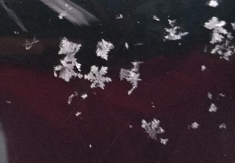
Photo (Hardesty&Wilson) below of perfect snowflakes that have fallen recently making the Greatest Snow on Earth!
Recent Avalanches
Ski areas and ski guides reported some soft slab avalanches of wind drifted snow yesterday. Some were stubborn and some were easy to trigger.
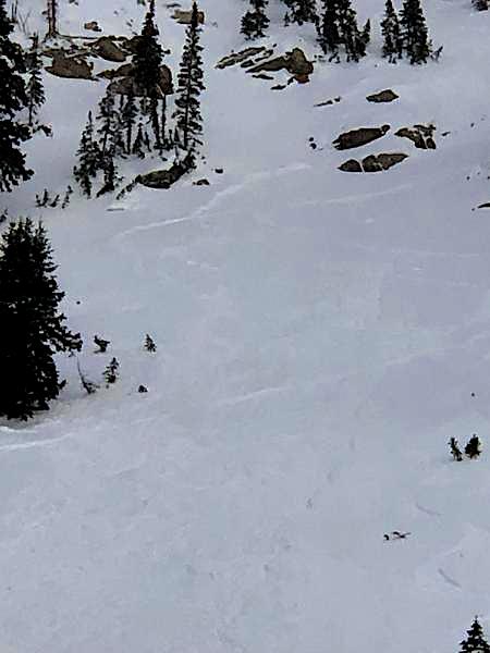
On Saturday a group in lower Mineral Basin had another group enter the slope above them and trigger one of these wind slabs about 10 inches deep and 90 feet wide (photo below). Please watch who is below you and what is above you.
Ad
Avalanche Problem #1
Wind Drifted Snow
Type
Location
Likelihood
Size
Description
The main avalanche problem today is soft slabs of wind drifted snow found mostly at upper elevations. These wind slabs were created by increased northerly winds during the last two days, and they are not a widespread problem. Most slopes were not affected by winds and just have light powder which may sluff because it is so light and cohesionless.
Avalanche Problem #2
Persistent Weak Layer
Type
Location
Likelihood
Size
Description
We sound like a broken record (does anyone even remember what a vinyl record is?) with this persistent weak layer which has a hard slab 3-5 feet thick resting on top of it. This layer is dormant and has generally been gaining strength, but it is not extinct. We have been keeping an eye on it because it could come definitely to life (video) in the future and produce avalanches if it is stressed by a heavy load of new snow. This layer exists above 9000 feet but is more widespread above 9500 feet on NW though E aspects.
How will this layer react to the coming storm? The short answer is I don't know for sure. There may not be enough of a load of new snow to awaken it except on heavily wind-loaded slopes. What I do know for sure is that avalanches breaking on this layer would be massive and deadly. I will be dialing back my terrain choices this week and waiting to see what happens. Stay tuned.
Yesterday, Drew and his partner skied near Mt. Aire and looked at the snowpack below 8,500 feet where they could find this layer but it was basically a non-issue.
General Announcements
This information does not apply to developed ski areas or highways where avalanche control is normally done. This forecast is from the U.S.D.A. Forest Service, which is solely responsible for its content. This forecast describes general avalanche conditions and local variations always occur.