Thanks to the generous support of our local resorts, Ski Utah, and Backcountry, discount lift tickets are now available.
Support the UAC while you ski at the resorts this season. Tickets are available
here.
Allure of fresh snow.
Persistent weakness. One should
This Morning: Some high thin clouds and a temperature inversion with lower-elevation trailheads in the teens and low 20's F and in the upper 20's F along upper elevation ridges and peaks. Winds are out of the south/southwest and very light - less than 10 mph - with gusts in the teens at 11,000'.
For Today: High thin clouds with clearing this afternoon. Temperatures will remain mild, rising slightly above freezing in most mountain locations, with lower-elevations reaching the mid 30's F. Winds will be out of the southwest and remain light, with an uptick this afternoon with gusts in the teens and low 20's mph at the mid and upper elevations.
This Weekend: Increasing clouds tonight with a weak system for Saturday which may bring a few inches of light snow. Looking further ahead, chances for light snow early this coming week and then perhaps right around the New Year.
Week in Review: It has been active this past week, with snowfall, wind and over 30 natural and human-triggered avalanches reported. Catch up by reading our
Week in Review - where we highlight significant snow and weather events from the past week.
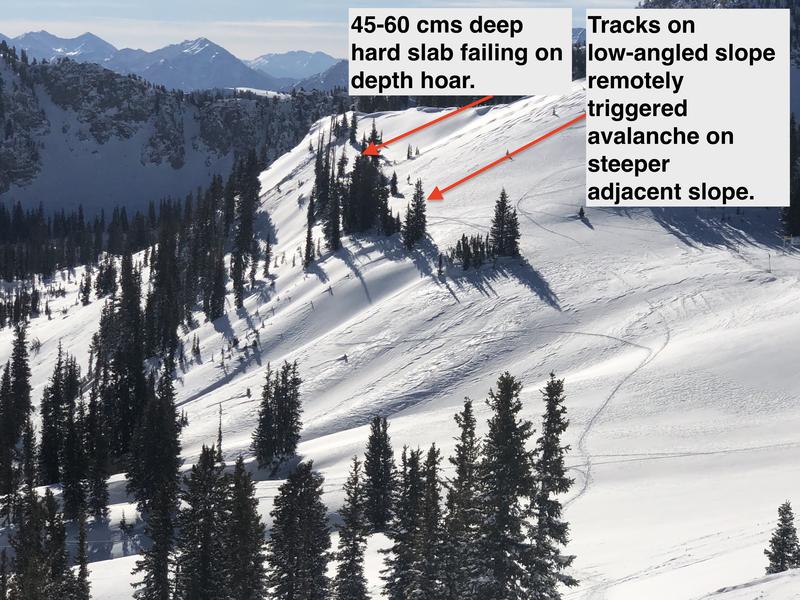
Reports of remotely and sympathetically-triggered avalanches continue to roll in:
Thursday 12/24 -
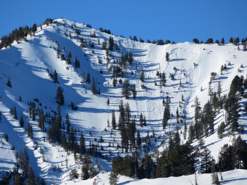
West Monitor on Park City Ridgeline. Control work from Park City resorts triggered slides up to 500' wide and 1-2' deep. In Days Fork a remotely-triggered avalanche at the top of
Banana Days which then sympathetically pulled out two avalanches in adjacent
Main Days. [Photos B. Nalli]
This
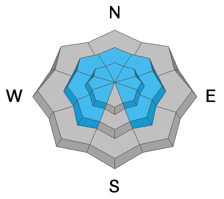
heat map shows the distribution of avalanches in the Salt Lake mountains since Thursday, December 17. They have been on aspects facing northwest through east - focused on northeast and east - above 9000'.


