Join us at our 2nd Annual Blizzard Ball

Forecast for the Salt Lake Area Mountains

Greg Gagne
Issued by Greg Gagne on
Friday morning, December 22, 2023
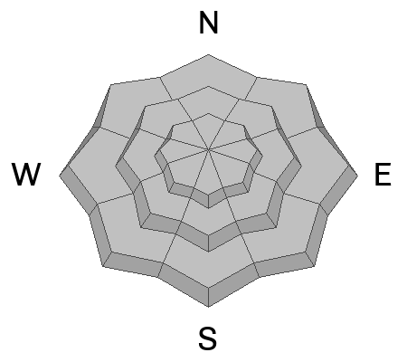
The avalanche danger is LOW and natural and human-triggered avalanches are unlikely.

Continue to maintain safe travel habits; this means exposing one person at a time to avalanche terrain, having someone watch them from a safe location, and not traveling above or below other parties.
Low
Moderate
Considerable
High
Extreme
Learn how to read the forecast here
Special Announcements
Our partners at the National Weather Service are looking for feedback on their mountain and avalanche weather information page. If you use their site, take a few minutes to give them feedback through this survey.
Weather and Snow
Happy first day of winter!
As of 6 am, skies are partly cloudy and temperatures range through the 20's F. Winds are from the south/southwest and light, gusting into the teens mph along some exposed upper-elevation ridges and peaks.
Today won't quite feel like the first day of winter with periods of sun and temperatures warming into the mid and upper 30's F. Winds will be from the south/southwest and remain light, gusting into the teens, with stronger gusts possible by the afternoon.
The weekend storm looks less promising with each model run, but hopefully, we'll pick up 3-6" of new snow by Sunday. High pressure to return on Monday and lasting through at least mid-week.

Above about 9,000', recent warm weather has firmed up the snowpack making for supportable travel conditions and the few inches of dense snow from the past few days has greatly improved the riding. Any snow we receive this weekend will only enhance the conditions.

To celebrate the first day of winter, a few lines from Mary Oliver's poem "Snowy Night"
Snow was falling,
so much like stars
filling the dark trees
that one could easily imagine
its reason for being was nothing more
than prettiness.
Recent Avalanches
No avalanches were reported from the backcountry, but control work at a local resort pried out an avalanche 1-4' deep failing in the persistent weak layer (PWL) down near the ground.

Pro observer Sam Kapacinskas toured around Wolverine on Thursday and found a stable snowpack, noting that warm temperatures this past week have helped heal the weak snow that had formed at the old snow surface.
Ad
Avalanche Problem #1
Normal Caution
Type
Location
Likelihood
Size
Description
Normal caution is used as an avalanche problem when there is a Low danger and avalanches are unlikely. However, risk is inherent when traveling in avalanche terrain, and many experienced and savvy people are still paying attention to the poor snowpack structure of strong snow on top of weak snow that exists on mid and upper-elevation aspects facing west, north, and east. Although triggering an avalanche on this buried persistent weak layer (PWL) is unlikely, it is not impossible.
Two other things to keep in mind today:
Although winds are light, wind speeds may increase this afternoon, and pockets of shallow wind drifts could form on north and east aspects along exposed upper elevation ridge lines.
Small wet/loose avalanches are possible on steep, south-facing terrain.

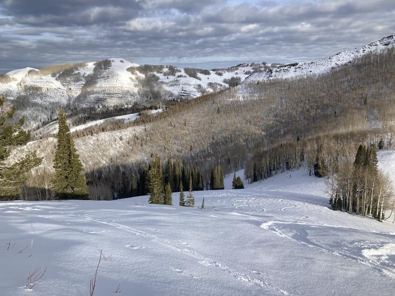
Sean Zimmerman-Wall photo from Thursday in Mill D North.
Additional Information
What happened to the Persistent Weak Layer (PWL) problem? The PWL problem first appeared in the December 1 forecast and was removed from the forecast on Wednesday, December 20. On Thursday, December 21, forecasters Nikki Champion and Greg Gagne talked about the PWL problem over a Zoom call and their 5-minute discussion is below.
General Announcements
This information does not apply to developed ski areas or highways where avalanche control is normally done. This forecast is from the U.S.D.A. Forest Service, which is solely responsible for its content. This forecast describes general avalanche conditions and local variations always occur.