Join us at our 2nd Annual Blizzard Ball

Forecast for the Salt Lake Area Mountains

Nikki Champion
Issued by Nikki Champion on
Friday morning, December 20, 2019
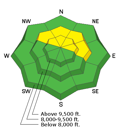
Today the avalanche danger is MODERATE on NW, N, NE, and East facing mid and upper elevation slopes. The avalanche activity is decreasing, but the possibility of triggering an avalanche 2-5 feet deep in the persistent weak layer remains possible. We just need to give the snowpack more time. Carefully evaluate steep, upper-elevation terrain with signs of additional loading due drifts of wind-blown snow. Watch for slabs of wind drifted snow and avoid them.

LOW avalanche danger is found on all other slopes where generally safe avalanche conditions exist and human triggered avalanches are unlikely.
Low
Moderate
Considerable
High
Extreme
Learn how to read the forecast here
Special Announcements
Final report for the Dutch Draw avalanche fatality is available HERE.
Consider donating to the Matt Tauszik Memorial Fund to help his wife and young son.

Spruces Parking Lot in Big Cottonwood Canyon - UPD and UDOT will be closing this parking lot at 1:30 a.m. during storms to facilitate plowing in the morning. The closure will last until at least 4:30 a.m. or possibly longer. Overall this should mean more parking spaces. Follow @udotcottonwoods to know when these closures will occur.
Weather and Snow
This morning there is an inversion in the mountains. Trailhead temperatures are in the low teens F, and ridgetop temperatures are in the low 20s F. Winds are north and westerly currently blowing in the single digits to low teens mph.
Yesterday winds shifted from southwesterly to northwesterly and then back to southwesterly, averaging in the single digits and low teens mph, and gusting up to 25 mph at ridgelines.
Today, temperatures should be warm, in the mid and upper 20s F. As a ridge of high pressure continues to build over the area, skies will remain clear and sunny. Winds will continue to blow from the southwest and remain in the mid-teens to mid-20s mph. The winds should begin to increase this afternoon into the evening.
Sun and warm daytime temperatures have taken a toll on south-facing slopes where the snow has gotten damp, refrozen at night and formed an ice crust.
Our Week in Review - summarizing the significant weather and avalanche events of the past week - can be found here.
Recent Avalanches
Ski resorts continue to use explosives to test high north-facing terrain. Yesterday, there were only reports of shallow explosive triggered avalanches in the surface snow and small D1 avalanches in previously untested north-facing terrain above 9000 feet.

No new avalanches were reported in the backcountry yesterday. There were few reports of faceting and weakening in the surface snow that allowed small sluffs.
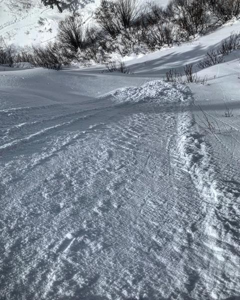
Photo of surface sluff in Big Cottonwood Canyon (photo: M. White)

All other avalanches and observations are listed HERE.
Ad
Avalanche Problem #1
Persistent Weak Layer
Type
Location
Likelihood
Size
Description
It still remains possible to trigger a deadly 2-5 ft deep slab on a persistent weak layer near the ground on NW, N, NE and E facing slopes. After a couple days of sunshine and no recent avalanche activity reported, the temptation to step out onto untracked high-north facing terrain is undeniable. The issue we face is that the weak snow lurking under the surface is far from gone. In this situation, time continues to be our friend. How much time is hard to say because the odds of triggering an avalanche decrease a little with each day.
There will come a time we can begin pushing it out onto upper-elevation north-facing slopes with confidence, but that time isn't quite here yet. Just because the likelihood has decreased doesn't mean the problem no longer exists. If you choose to ride slopes where this layer exists, stack the odds in your favor by choosing slopes with a clean runout zone free of trees and rocks that would cause trauma if you do trigger an avalanche.
Throughout the week winds have blown from the north, west, and southwest with gusts above 40 mph at times. Additional wind-loading on north-facing slopes that have the persistent weak layer will increase the chances of triggering a large avalanche. Look for signs of wind drifted snow and avoid those areas.
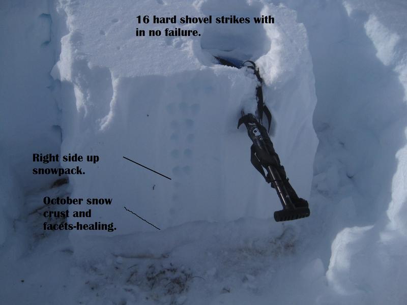
A photo from the Park City Ridgeline shows a persistent weak layer exists near the ground. While the improving stability test scores are a positive sign, the overall poor structure still remains a concern. (photo: PJM)
Additional Information
General Announcements
This information does not apply to developed ski areas or highways where avalanche control is normally done. This forecast is from the U.S.D.A. Forest Service, which is solely responsible for its content. This forecast describes general avalanche conditions and local variations always occur.