Check out our Holiday Auction - Sign Up for the Utah Snow and Avalanche Workshop (USAW)

Forecast for the Salt Lake Area Mountains

Drew Hardesty
Issued by Drew Hardesty on
Tuesday morning, November 29, 2022
With heavy snowfall and moderate to strong winds, the avalanche danger will spike to HIGH for a few hours this morning in the upper elevations. Natural and human triggered avalanches will be likely in steep terrain of all aspects. On some west to north to east facing aspects, you will be able to trigger soft slab avalanches at a distance. Collapsing and shooting cracks are to be expected. Note that human triggered avalanches are also likely in the low elevation bands.
***Choose low angle terrain with nothing steep overhead.
The overall danger is expected to trend toward CONSIDERABLE by the afternoon.
Low
Moderate
Considerable
High
Extreme
Learn how to read the forecast here
Special Announcements
A backcountry closure is in place in Little Cottonwood Canyon with an expected reopening by 8am this morning. UDOT Little Cottonwood requests backcountry travelers to avoid Superior to Cardiff this morning.
Join the Utah Avalanche Center and the Division of Outdoor Recreation to celebrate the Fourth Annual Avalanche Awareness week, from December 4 - December 11. Click HERE to view the full list of events for the week.
Weather and Snow
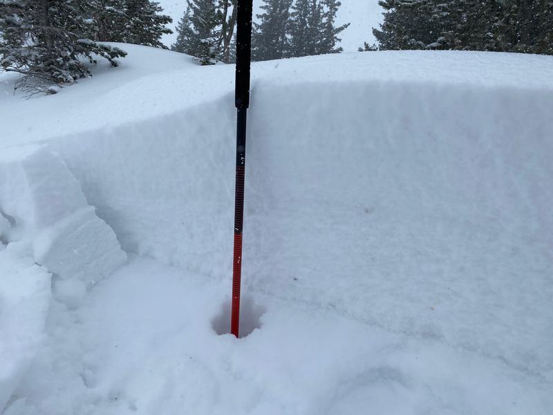
As of 5am, it's still snowing hard with 6-10" of snow overnight and storm totals since yesterday of 10-15". It's cold smoke with densities of 5-6%. Winds remain gusty out of the west northwest with hourly averages of 20-25mph with gusts to 40mph. The highest elevation anemometers have hourly averages of 35mph with gusts to 50. Gusts at those elevations reached toward 70mph in the darkest hours of the night. Mountain temperatures have, of course, plummeted to the single digits. Wind chill at 11,000' is -32°F.
For today, I expect heavy snowfall through the morning hours, drying out by early afternoon. Winds will blow 25-30mph but lose steam in the afternoon. Temperatures will remain in the single digits.
Skiing and riding conditions will be much improved but dangerous in steep terrain. Stick to known low angle slopes with nothing steep overhead.

We'll start to dry out tonight and tomorrow as the flow backs to the southwest and increases Wednesday/Wednesday night ahead of another storm Thursday night into Friday. Another storm is expected late weekend into early next week.

From Ogden to the central Wasatch to the Provo mountains, we have received several excellent observations. You can find them HERE. Please keep these reports coming.
Recent Avalanches
Along the Patsy Marley ridgeline in upper LCC yesterday afternoon, a skier intentionally triggered a 12-18" deep soft slab of wind drifted snow that failed on our November drought layer of weak faceted snow. This was on an ENE facing slope at 10,300'. The slope was not steep enough to avalanche, but it did give a hint of things to come.
(photo: Bo Torrey)
Ad
Avalanche Problem #1
New Snow
Type
Location
Likelihood
Size
Description
Expected continued heavy snowfall this morning will lead to natural avalanching on all aspects in the steepest terran of the mid and upper elevations. These natural avalanches will include both loose snow and very soft slab avalanches. The danger will spike during periods of snowfall intensity this morning. Avalanches may fail both within the new snow and at the interface of our November drought layer of weak sugary facets...leading to larger and more dangerous avalanches (see photo above).
TREND: INCREASING THIS MORNING, DECREASING IN THE AFTERNOON
Avalanche Problem #2
Wind Drifted Snow
Type
Location
Likelihood
Size
Description
Moderate to strong westerly-northwest winds will easily whip the low density snow into cohesive slabs on many aspects in the mid and upper elevations. Wind loading will be most prevalent on north through east through south facing aspects, but soft slabs of wind blown snow may be found on any aspect. These soft slabs may also run naturally with enough wind loading and will certainly be sensitive to human provocation. Avoid any steep wind drifted areas: lee of ridgelines, cross-loaded gullies, around rocky outcroppings, etc.
On steep west to north to east facing slopes, avalanches may fail both within the new snow and at the interface of our November drought layer of weak sugary facets...leading to larger and more dangerous avalanches. (see photo above).
TREND: INCREASING THIS MORNING
Additional Information
Owing to the prolonged dry spell, the snow surface has become excessively weak and faceted on - at a minimum - westerly to northerly to easterly facing aspects. Patches of surface hoar exist in the more protected terrain. Once buried with a cohesive slab of snow, these layers will become problematic as a PWL (persistent weak layer) in that they (1) remain prone to avalanching with subsequent loading events (snowfall and/or wind) and (b) become tricky and often more unpredictable than other types of avalanches. Avalanches involving PWLs account for most of our accidents and fatalities.
These layers of faceted snow are so weak that I don't believe it will take much for them to become active and dangerous.
General Announcements

This information does not apply to developed ski areas or highways where avalanche control is normally done. This forecast is from the U.S.D.A. Forest Service, which is solely responsible for its content. This forecast describes general avalanche conditions and local variations always occur.