Check out our Holiday Auction - Sign Up for the Utah Snow and Avalanche Workshop (USAW)

Forecast for the Salt Lake Area Mountains

Drew Hardesty
Issued by Drew Hardesty on
Tuesday morning, November 26, 2024
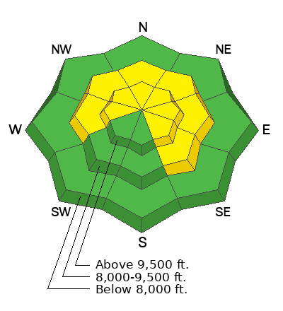
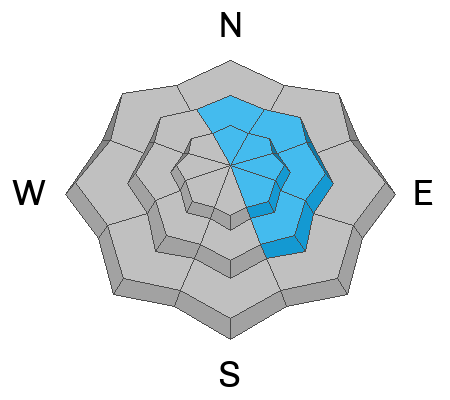
The avalanche danger will rise to MODERATE today, particularly on steep west to north to easterly facing aspects at the mid and upper elevations. Human triggered avalanches 1-2' deep are possible, particularly in areas that see the most snow and wind. Avalanches may fail within the new storm snow and they may also fail in the old faceted snow.
Remember that cracking and collapsing are not to be ignored: they are key clues to instability. Remember also that some avalanches can be triggered at a distance, even from below.
Extra Caution should be advised with today's changing conditions.
Low
Moderate
Considerable
High
Extreme
Learn how to read the forecast here
Special Announcements
The 17th Annual Utah Snow and Avalanche Workshop (USAW) is scheduled for Saturday December 7th - Information and tickets available here.
Weather and Snow
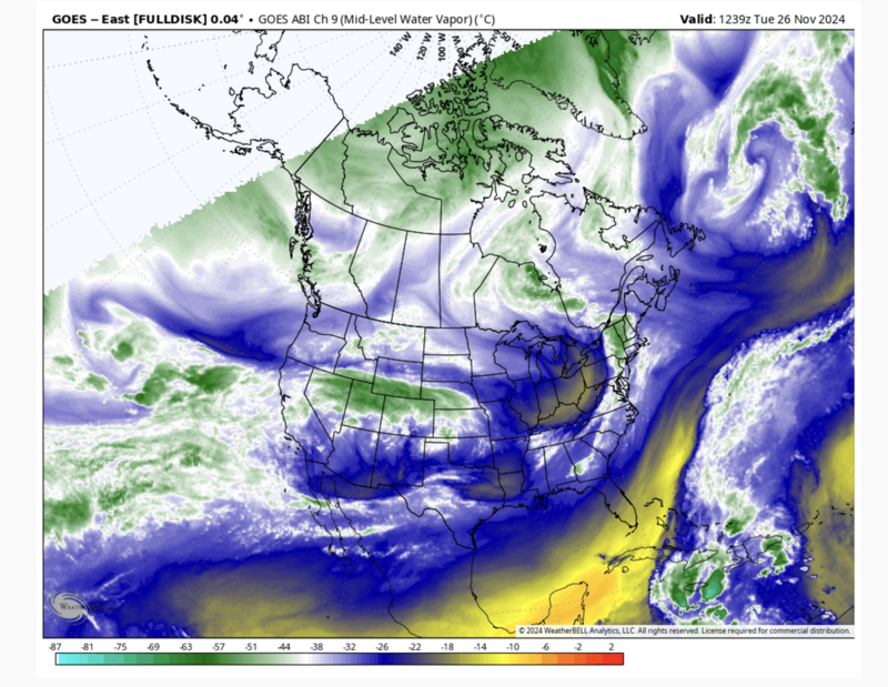
Let's start with capital 'U' Uncertainty with how this whole decaying atmospheric river will play out. We used to call these storms The Pineapple Express because of their subtropical origins and they often led to wet warm and windy storms. But as always, the devil is in the details: Where will the firehose point?
As of 5am, the Cottonwoods and Park City ridgeline have picked up just 1-2" of new snow. Ogden has 3-5" and upwards of 0.5-0.7" of snow water equivalent. Provo has picked up 2-4" with 0.4" of SWE. This is heavy dense snow. Temperatures have warmed radically over the past 24 hours, from the low teens and to the mid to upper 20s. Winds are 15-20mph with gusts to 30 from the west-northwest with hourly wind speeds of 25-30mph at 11,000'. The highest peaks have gusted into the 70s overnight.
Here's my best guess at today's weather: We'll see continued heavy dense snowfall adding up to 4-8" (by early dinnertime) in the Cottonwoods and PC ridgeline with temps in the mid to upper 20s. Winds will blow 20mph from the west. A cold front pushes through around rush hour and snowfall rates will increase at this time with snowfall continuing overnight. Snow totals may reach 8-14" with just under an inch of snow water equivalent. I expect a bit more in the Ogden mountains and perhaps a lot more in the Provo mountains.
By tomorrow, snowfall should start to peter out by mid-morning. Temps will be in the teens. Winds will be light from the northwest.
The weather outlook does not look good. You may need binoculars to see the next storm. And even that may not help.
Recent Avalanches
Ski areas on the PC ridgeline reported shallow soft slabs of wind blown snow yesterday with the increasing winds from the southwest. Otherwise, nothing.
You can find the most recent observations HERE.
Ad
Avalanche Problem #1
Persistent Weak Layer
Type
Location
Likelihood
Size
Description

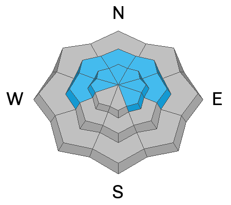
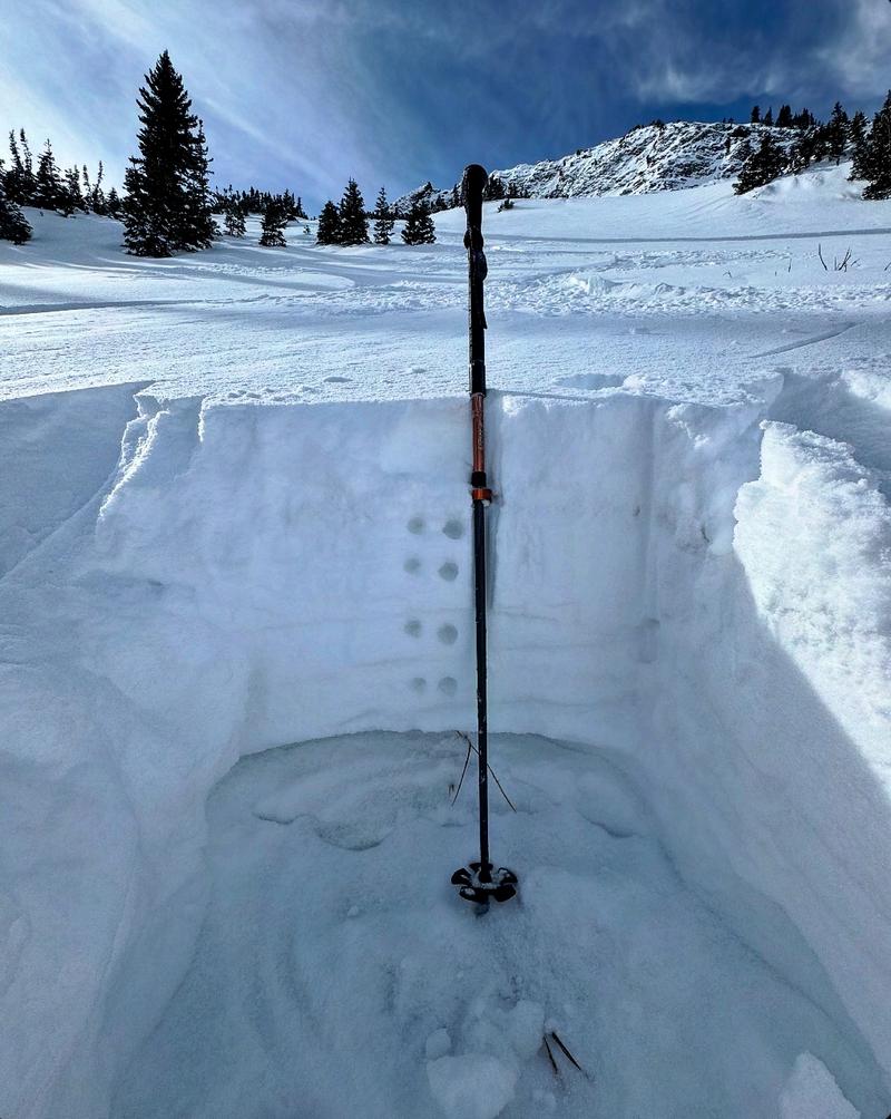
One can easily tell by looking at Mark White's photo above that we have a structure just made for avalanches: it's a classic strong-over-weak tenuous architecture and we're just waiting for enough new snow and wind for the creaky Jenga tower to fall down. Will we see enough snow and wind? Will people trigger avalanches today?
Yes. Yes, I do think so, but only in areas that see the most snow and wind. If I were out today (particularly in the afternoon after we've had more snow and wind), I would proceed very cautiously and listen for audible whumphs or collapses. I would jump on test slopes to see how they react. I'd watch for shooting cracks. I'd do a few Extended Column Tests and see how the snow reacts to these tests.
Avalanche Problem #2
Wind Drifted Snow
Type
Location
Likelihood
Size
Description
New and developing soft slabs should be on your radar today. In some areas they will be sitting on yesterday's new drifts of wind blown snow. Any of today's developing wind drifts will be primarily confined to the lee of ridgelines at the mid and upper elevations and primarily on north to east to southeast facing slopes. These and other new snow avalanches may be particularly sensitive as the new snow will be coming in on a warming trend and "feel" dense and upside down.
*I don't think there is enough pre-existing snow on south and southwest aspects to be a problem and so snow will generally be falling on mostly bare ground.
General Announcements
This information does not apply to developed ski areas or highways where avalanche control is normally done. This forecast is from the U.S.D.A. Forest Service, which is solely responsible for its content. This forecast describes general avalanche conditions and local variations always occur.