UDOT PLANNED AVALANCHE CLOSURES!!

Forecast for the Salt Lake Area Mountains

Drew Hardesty
Issued by Drew Hardesty for
Thursday, November 15, 2018
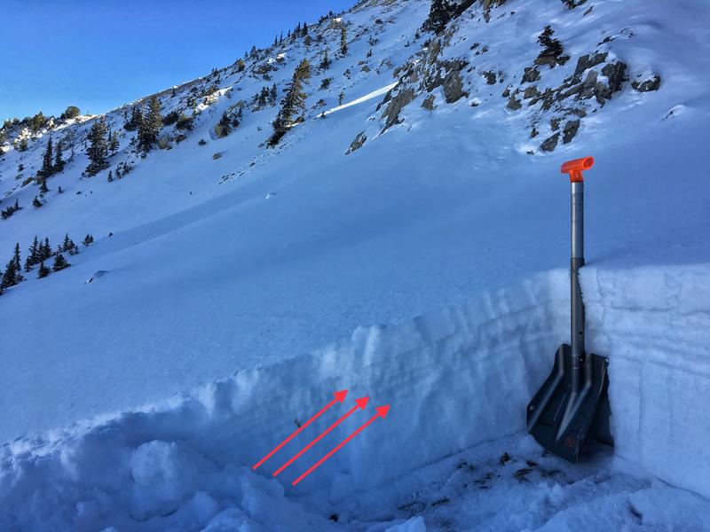
We are not issuing danger ratings with our forecasts at this time, but if there is enough snow to make turns or a slope is solid white - there is enough snow for avalanches. However, the greatest current hazard is hitting buried rocks, stumps, and downed timber. Most ski areas are now closed for uphill traffic. Until more snow comes, there are few options.
Low
Moderate
Considerable
High
Extreme
Learn how to read the forecast here
Special Announcements
Alta (and most other ski areas) is now closed to uphill traffic. The Catherine's area remains open with access via the summer road.
Weather and Snow
Skies are clear, ain't it a shame.
One to almost two feet of snow exists in the high shady terrain with bare ground on the aspects facing the sun. Mountain temperatures are in the upper 20s; winds are generally light from the west-northwest with hourly averages of 15-20mph at 11,000'. Skiing and riding conditions are not half bad in a few inches of settled snow over a supportable mid-pack crust. Low angle grassy slopes offer the best options for the glass-is-half-full types. Stack the odds in your favor by taking wide boards and by riding slowly, taking care to avoid the rocks, stumps, and other deadfall.
Recent Avalanches
No avalanches have been reported since November 5th when a few wind slabs and sluffs were reported.
You can check in on what people have been finding on our observations page here.
Ad
Avalanche Problem #1
Normal Caution
Type
Location
Likelihood
Size
Description
Today's snow surface is tomorrow's weak layer. The weakening ("faceting") snow surface overlying even weaker facets below indeed allow for soft, turnable snow, but the writing is on the wall: these weak layers I suspect won't be shy in reacting to the first storms of the year and avalanches will be the rule and not the exception.
It's best to make a mental map of where this pre-existing snow exists for when winter arrives. These places will be the areas to avoid at the outset. Until then, enjoy what little snow we have.
Several crusts (indicated by red arrows in first photo) are making the snowpack supportable. Obvious faceting just starting in new snow that fell Saturday night/Sunday Morning. Small facets under the new snow and above the crusts. Big facets under the crusts. (Staples photo)
Additional Information
High pressure looks to keep its stranglehold over Utah for perhaps another week with perhaps a pattern change in store for Thanksgiving weekend. Keep your fingers crossed.