UDOT PLANNED AVALANCHE CLOSURES!!

Forecast for the Salt Lake Area Mountains

Evelyn Lees
Issued by Evelyn Lees for
Wednesday, January 9, 2019
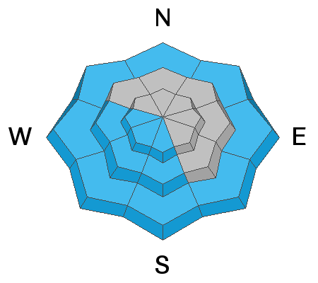
Today the avalanche danger is CONSIDERABLE on steep upper elevation slopes for triggering new drifts of wind blown snow, which will be most widespread on the north 1/2 of the compass. There is a MODERATE danger at the mid and low elevations for triggering wind drifts, new snow slides and for wet loose sluffs, on both southerly and northerly facing slopes.
In isolated locations with a thin snowpack avalanches could break near the ground, mostly likely where they have a new load of wind drifted snow.
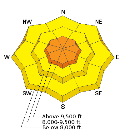
Low
Moderate
Considerable
High
Extreme
Learn how to read the forecast here
Special Announcements
Join the UAC, Greg Stump, and Scot Schmidt for the 30th Anniversary of Blizzard of Aahhh's at Brewvies on January 24. Scott Schmidt and Greg Stump will be signing posters and the MCs for an evening of big air, big hair, and lots of laughs.
Weather and Snow
Under partly cloudy skies, it’s warm and breezy this morning - temperatures are in the upper 20s in the Cottonwoods and mid 30s on the Park City side. Winds have been southeast to southwesterly, peaking overnight 20 to 35 mph range, with gusts in the 40s. Speeds have decreased into the 10 to 20 mph range this morning. Today, temperatures will warm to near 40 at 9,000’, with periods of high, thin clouds and wind speeds slowly diminishing throughout the day. The snow is slowly settling and becoming less punchy, especially in wind sheltered areas. Sunny slopes are crusted, but will soften later today.
Recent Avalanches
Clearing skies made for good views, with widespread natural avalanche activity noted in the Ogden and Provo area mountains. In the Salt Lake and Park City area mountains, very little natural activity was noted, one slide on Cardiac Ridge. Yesterday, a couple big, wet loose sluffs ran in steep, southerly facing chutes in Little Cottonwood, and the resorts continued to release new snow avalanches with explosives.
Ad
Avalanche Problem #1
Wind Drifted Snow
Type
Location
Likelihood
Size
Description
The overnight southerly winds will have created a new batch of drifts, mostly on upper elevation slopes facing the north 1/2 of the compass. The new surface wind drifts will be rounded and smooth, and there may be new cornices to avoid along the ridge lines. Previous wind events in the last week has left a string of stubborn, scattered, old drifts at upper and mid elevations, some buried deeper beneath the new snow.
Avalanche Problem #2
Persistent Weak Layer
Type
Location
Likelihood
Size
Description
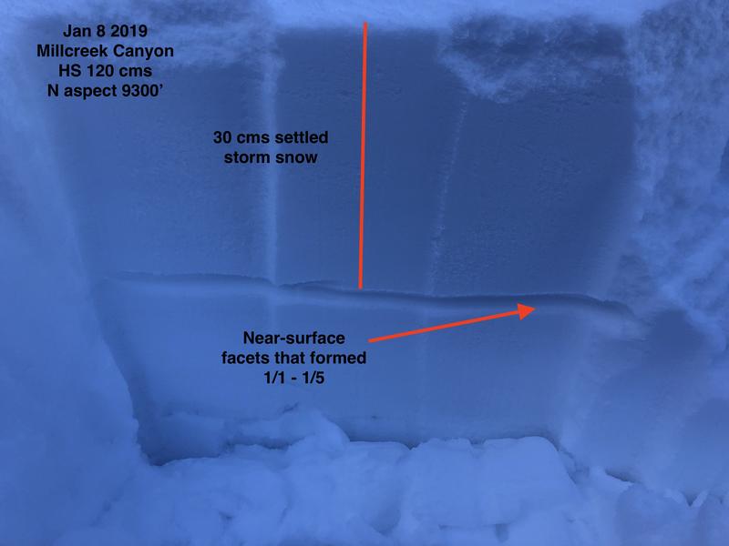
It's a complicated - there is weak, sugary faceted snow mid snowpack and near the ground. You are most likely to trigger a slide on the mid-pack faceted weak that formed early January, especially where they are sheltered beneath the Jan 5th winds slabs. But the sensitivity is very variable. The solution is to dial back the steep angles for a while, or get out your shovel and dig about 3 to 4 feet down to see . Two outstanding observations from yesterday show the approach of gathering information and the variability of this weak layer.
“Dug 2 pits in the starting zone of Days Draw...found the dragon in the basement... New snow sitting on top of pre storm wind slab on top of 6-8 inches of small to medium facets, grabbed a scoop and it would pour out like sugar. So 3-4 ft of snow/slab sitting on top of sugary facets. Both pits were identical...Probability....rolling the dice, consequences massive...headed to the lower angle terrain of Days Draw...”
“Dug two pits today (Cardiff Fork) to evaluate how the snow was behaving on the storm interface buried near surface facet layer...9400' NE and the other at 9700' NE...In both pits we had similar results: ECTN, on layers within the storm snow... in neither pit did I have a failure on the storm interface.”
If you dig down and soon hit the ground, you’re in shallow snowpack area, where it’s possible to trigger a deeper slide on weak snow near the ground. Shallow snowpack terrain includes slopes that have slid one or more times this year and some terrain in the the Mill Creek and Park City area mountains.
Greg Gagne photo, snow pit in Mill Creek
Avalanche Problem #3
Wet Snow
Type
Location
Likelihood
Size
Description
Small, wet loose sluffs may occur again today on steep sunny slopes and on all low elevation slopes, including shady, northerly facing slopes. When the snow gets damp where you are, move off steep slopes. Avoid travel beneath snow loaded roofs of mountain buildings, which may slide.
General Announcements
This information does not apply to developed ski areas or highways where avalanche control is normally done. This forecast is from the U.S.D.A. Forest Service, which is solely responsible for its content. This forecast describes general avalanche conditions and local variations always occur.