Sign Up for the Utah Snow and Avalanche Workshop (USAW) on December 7th!

Forecast for the Salt Lake Area Mountains

Greg Gagne
Issued by Greg Gagne on
Friday morning, January 22, 2021
The avalanche danger is MODERATE on all aspects at the mid and upper elevations where human-triggered avalanches are possible, especially on slopes that are wind-loaded. If snowfall rates intensify earlier this afternoon, the danger may rise to CONSIDERABLE.

Heavy snowfall beginning this evening will increase the avalanche danger this weekend, with dangerous avalanche conditions likely. It's been a frustrating season so far, and now with a storm on the doorstep, you will have to exercise more patience than ever.
Low
Moderate
Considerable
High
Extreme
Learn how to read the forecast here
Avalanche Watch
The Utah Avalanche Center has issued an AVALANCHE WATCH for the entire Wasatch Range. HEAVY SNOWFALL TONIGHT AND TOMORROW WILL OVERLOAD A VERY WEAK SNOWPACK AND CREATE VERY DANGEROUS AVALANCHE CONDITIONS. THE AVALANCHE DANGER IS EXPECTED RISE TO HIGH ON SATURDAY.
Special Announcements
Do you have the essential avalanche rescue gear (transceiver, probe, and shovel), and do you know how to use it? Watch this video to see how the three pieces of equipment work together.

Thanks to the generous support of our local resorts, Ski Utah, and Backcountry, discount lift tickets are now available.
Support the UAC while you ski at the resorts this season. Tickets are available here.
Weather and Snow
Temperatures this morning range through the upper teens to mid 20's F and winds are southwesterly, averaging in the teens at mid-elevations and in the 30's mph with gusts over 50 mph at 11,000'. Skies are clouding up in advance of a storm that is expected to bring a decent dose of much-needed moisture. (Yes, you read that correctly, a "storm").
For today, expect cloudy skies with temperatures rising to the upper 20's and low 30's F. Winds will be from the southwest and increasing throughout the day. At mid-elevations, winds will average in the teens with gusts in the 20's mph. Along upper-elevation ridges, winds will average in the 20's to low 30's mph, with gusts near 50 mph.
This will be a warm and wet storm on a southwest flow, meaning higher snow-densities (7% to perhaps 10%.) Snowfall should slowly begin this afternoon, and although we should expect at most an inch or two towards sunset, snowfall is expected to intensify overnight and into Saturday. This is a tricky storm to determine snowfall amounts, but in areas favored by a southwest flow (Park City mountains and upper Big Cottonwood) snowfall totals should easily exceed a foot with upwards of 1.5" of water weight by later Saturday afternoon. (Water amounts - not necessarily depth of new snow - are more important when considering how much stress storm snow places on a snowpack. If water amounts come in as forecast, this will be a significant loading event on our very-weak snowpack.)
Looking further ahead, we get a break on Sunday with another system forecasted early this coming week, and then again later in the week. Beyond that, the pattern appears (hopefully) progressive.
Recent Avalanches
No avalanches were reported from the backcountry on Thursday.

Our Week in Review - where we highlight significant weather and avalanche events from the past week - has been published.

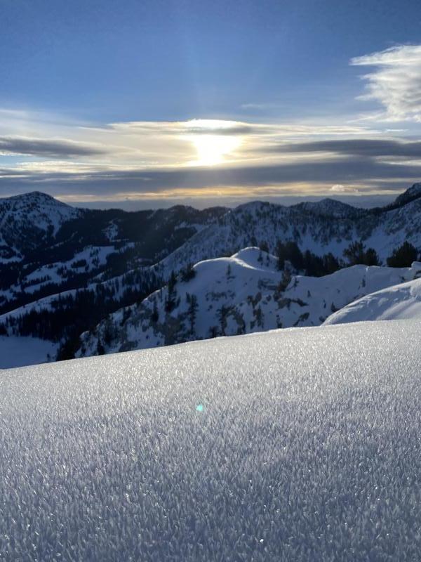
Many observers noticed a widespread layer of surface hoar on Thursday. [Hunter Nerison photo]
Ad
Avalanche Problem #1
Persistent Weak Layer
Type
Location
Likelihood
Size
Description
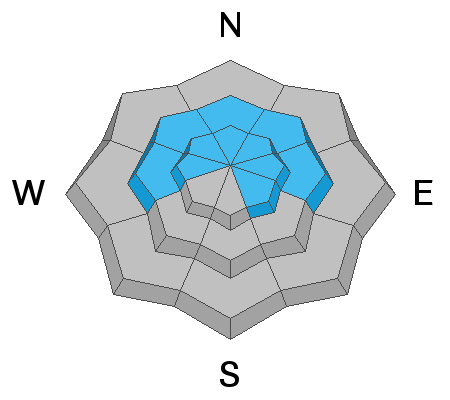
The entire Wasatch Range is plagued with a poor snowpack of weak faceted snow and depth hoar. This avalanche problem - known as a persistent weak layer (PWL) - exists on mid and upper elevation slopes facing west, through north, and east. This weak snow can also be found on some upper elevation southeast aspects. And to keep us on our toes, many snow surfaces were covered with a 5mm layer or surface hoar on Thursday. One long-time avalanche professional described our current snowpack structure as an "unprecedented weakness." A touch hyperbolic? Perhaps. But our thin 1-3' deep snowpack contains some of the weakest snow many have ever seen this late into January.
Over this past week, this PWL problem has been moving to a period of dormancy, but it will quickly come to life as we place a new load of storm and/or wind-driven snow on top of it. To put things in perspective, during the entire week of Jan 1-7 the central Wasatch received about 12" of snow containing nearly 1" of water. During this time, over 20 human-triggered avalanches were reported to the UAC, almost all failing in the PWL. Since that first week in January, our snowpack has grown even weaker, and we are now talking about placing an even greater load in roughly a 24-hour period.
Danger Trend: Rising
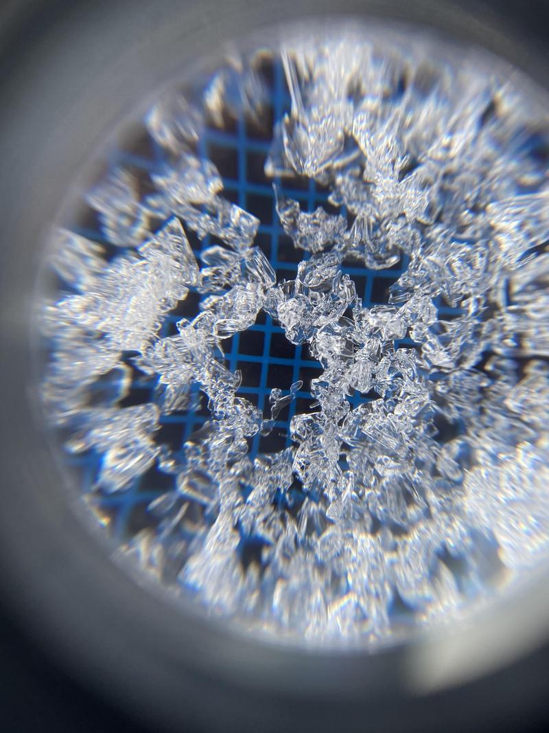
Angular, faceted snow crystals. [Dave Ream photo]
Avalanche Problem #2
Wind Drifted Snow
Type
Location
Likelihood
Size
Description
Today's southwesterly winds may create pockets of fresh wind-drifts at the mid and upper elevations. Some of these drifts may be sensitive, especially if they form on top of weak snow at the existing surface.
Additional Information
NOW is the time to again practice your companion rescue skills.
For a primer on backcountry emergencies, click HERE
General Announcements
Please visit this website with information about Responsible Winter Recreation by the Utah Office of Outdoor Recreation.

This information does not apply to developed ski areas or highways where avalanche control is normally done. This forecast is from the U.S.D.A. Forest Service, which is solely responsible for its content. This forecast describes general avalanche conditions and local variations always occur.