Join us at our 2nd Annual Blizzard Ball

Forecast for the Salt Lake Area Mountains

Dave Kelly
Issued by Dave Kelly on
Tuesday morning, January 21, 2025
With increased wind speeds and snow available for transport, there is a MODERATE avalanche danger for triggering a wind drifted snow avalanche in mid and upper elevation terrain. There is a possibility of triggering an avalanche failing into the buried facets on mid and upper elevation northwest-north-east facing aspects, particularly on slopes with a thinner snowpack. There is a LOW avalanche danger in low elevation terrain.
Strong winds can often load slopes on all aspects at mid and upper elevations, keep an eye out for pillowy, rounded areas of wind-drifted snow and avoid those slopes.
Low
Moderate
Considerable
High
Extreme
Learn how to read the forecast here
Special Announcements
Join the UAC at Deer Valley on January 30th for the 2nd Annual Blizzard Ball Gala. Former Director of the Utah Avalanche Center, Bruce Tremper will deliver the keynote address.
UAC forecaster Craig Gordon presents a FREE State of the Snowpack Presentation on Tuesday, January 21st from 6:00-7:30 PM at Alpha Coffee in Cottonwood Heights, get more information and reserve your spot HERE.
Weather and Snow
Under clear skies trailhead temperatures are still below 0 °F in many locations. Upper elevation weather stations are in the single digits °F. Winds are blowing from a westerly direction in the teens gusting to the 20's at the 9,000' ridgelines and from the northwest in the 30's gusting to the 40's at the 11,000' ridgelines with gusts to the 60's. There was no new snow overnight
Today, look for mostly clear skies with temperatures rising to 22-28 °F. Winds will blow from the west-northwest at the 9,000' ridgelines in the 20's gusting to the 30's and from the northwest at the 11,000' ridgelines in the 40's gusting to the 50's and ramping up to the 80's MPH by later this afternoon. There is no new snow expected today.

Even with extremely cold air temperatures some south and west facing aspects will have a slight melt freeze crust just below the surface that in most locations won't affect the sliding conditions, but is a unique occurrence, and worth noting if it still exists before our next storm.
Recent Avalanches
Yesterday, we had no reports of avalanches to the UAC from the Salt Lake Region. We had a number of great observations from the backcountry and you can read all observations HERE.
Ad
Avalanche Problem #1
Wind Drifted Snow
Type
Location
Likelihood
Size
Description
  • Wind drifts will be easy to spot as they will be pillowy, rounded, and located on the windward side of ridgelines, gullies, and terrain features
  • Cornices on ridgelines are a sign that the slope below has been wind-loaded, and these cornices will be sensitive today
  • Cracking and collapsing in the snow are warning signs that the wind drifted snow is sensitive and would make an avalanche on slopes steeper than 30 °
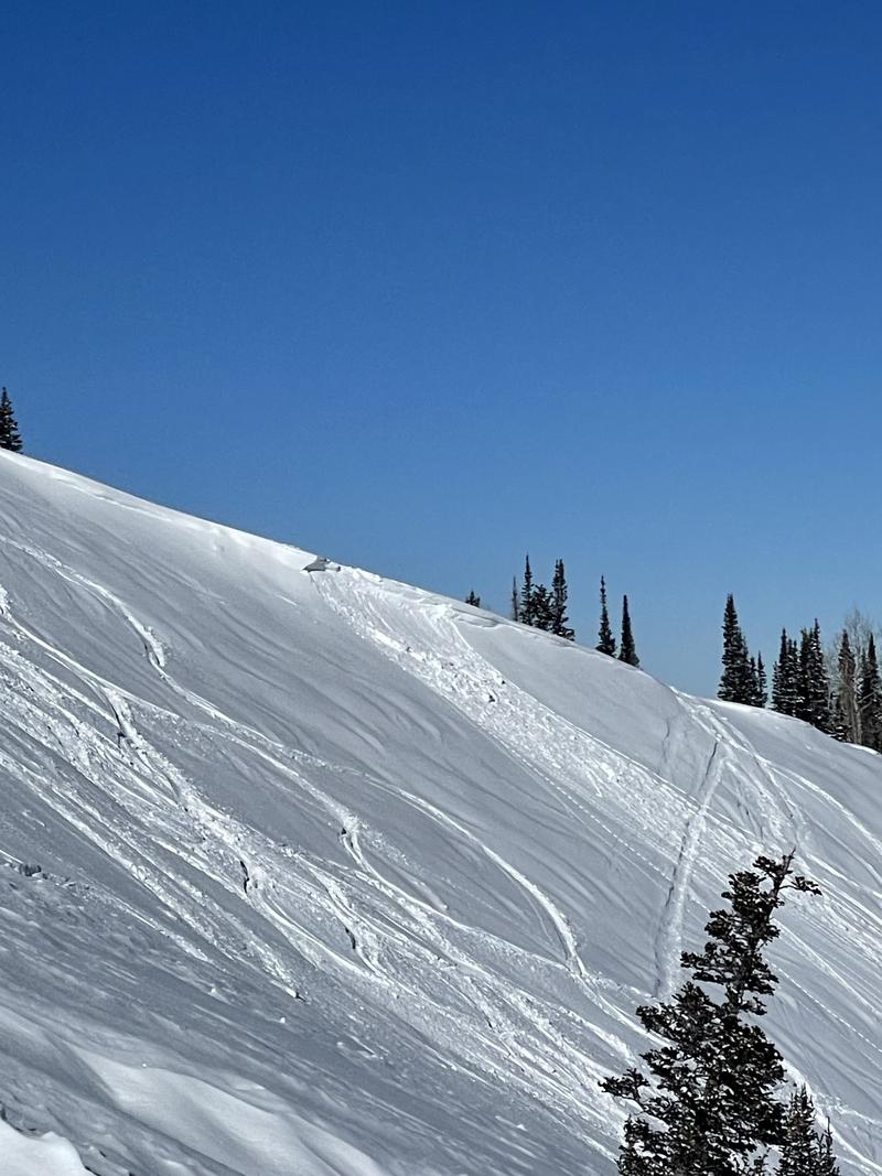
Photo (B. Honey) of a cornice fall on the east face of Reynolds
Avalanche Problem #2
Persistent Weak Layer
Type
Location
Likelihood
Size
Description
The buried facets that are near the ground have been with us since early December with most avalanche activity on this layer starting around Christmas. The last avalanche that failed on these facets was a skier triggered avalanche in Upper Big Cottonwood on Thursday January 16th. This layer of weak facets is no longer giving us obvious signs that it is going to avalanche. The cracking, collapsing, and whumpfing has subsided and the lack of in-your-face weakness makes for a tricky problem.
Most likely areas to trigger an avalanche 2'-4' deep and up to 100' wide are thin rocky areas, gully features, and locations that have avalanched earlier this season and have reloaded with new storm and wind-drifted snow. Any slope that matches these characteristics and receives additional wind loading today will be suspect.
General Announcements
This information does not apply to developed ski areas or highways where avalanche control is normally done. This forecast is from the U.S.D.A. Forest Service, which is solely responsible for its content. This forecast describes general avalanche conditions and local variations always occur.