Join us at our 2nd Annual Blizzard Ball

Forecast for the Salt Lake Area Mountains

Trent Meisenheimer
Issued by Trent Meisenheimer on
Saturday morning, January 11, 2025
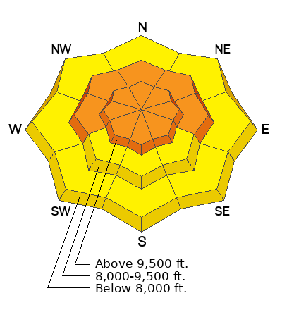
The avalanche danger is CONSIDERABLE on mid and upper-elevation slopes facing west, north, and east where there is a buried persistent weak layer. Avalanches may be 2-4+ feet deep and potentially hundreds of feet wide.
There is also a CONSIDERABLE danger for wind-drifted snow across all upper elevations where sensitive slabs of wind-drifted snow may be found. You will find wind-drifted snow on all aspects and elevations today due to the strong and erratic winds.
There is a MODERATE danger on all aspects and elevations for new snow soft slabs and dry-loose avalanches.
Low
Moderate
Considerable
High
Extreme
Learn how to read the forecast here
Special Announcements
Receive forecast region-specific text message alerts to receive messages about changing avalanche conditions, watches, and warnings. Sign up and update your preferences HERE.
Weather and Snow
It's snowing! Overnight snow totals are 2 to 7 inches of new snow with 0.20 to 0.59 inches of water. The wind has picked up from the northwest, blowing 15-20 mph with gusts into the 20s and 30s across the upper elevations. The free air (11,000') also moves from the northwest, blowing 40-50 mph with gusts into the 50s and 60s. Temperatures are cold and range from 10-20 °F.
Today, we should see snowfall into the early morning hours, and if the flow stays northwest, we could see more snow than anticipated in the Upper Cottonwoods. Currently, the storm snow is ahead of the forecasted snow amounts. We may see another 2-6 inches of snow throughout the day. Bringing totals to 6-12 inches of new snow and perhaps 10-14 inches of new snow in favored areas. The wind will stay elevated for the morning and slowly decrease throughout the day. Temperatures will remain cold and top out in the low to mid-20s °F today.
Recent Avalanches
Yesterday, backcountry observers noted the poor snowpack structure. In Upper Little Cottonwood, a surprising wind slab in upper elevation east-facing terrain propagated widely and was large enough to bury a human. This hard slab of wind-drifted snow was roughly 1 to 2 feet deep and 400-500 feet wide. A persistent weak layer avalanche was reported in lower Mineral Fork that was 3 feet deep, 70 feet wide, and running 400 vertical.
Dave Kelly and crew found two recent avalanches in the Session Mountains in their travels. One was a wind slab, and the other broke into weak faceted snow. Wet-loose avalanche activity was also reported from steep, southerly-facing terrain in Tanners Gulch. You can click the button below to see all observations.
Ad
Avalanche Problem #1
Wind Drifted Snow
Type
Location
Likelihood
Size
Description
Strong northwest winds are blowing at speeds of 15-25 mph, with gusts into the 30s this morning. The wind also blows across the low elevations, with gusts into the 20s and 30s at 8,000'. This wind will indeed create new shallow soft slabs of wind-drifted snow. The unfortunate news is we've seen wind over the past 48 hours from all directions, and now the old hard slabs of wind-drifted snow will be covered, making it more challenging to see.
If the snow is pillowy or rounded, you've likely found a new drift of wind-blown snow. If the snow is hard and hollow-sounding, you likely found a hard drift of wind-blown snow. I would expect wind-drifted snow on all aspects and elevations today.
It's possible these drifts break to the old snow surface, as many observers noted the old snow surface becoming loose and faceted from the past few days of clear and cold weather. Any wind-drifted snow avalanche can also step down to deeper weaker layers on terrain facing west to north to east at the mid and upper elevations (see PWL below).
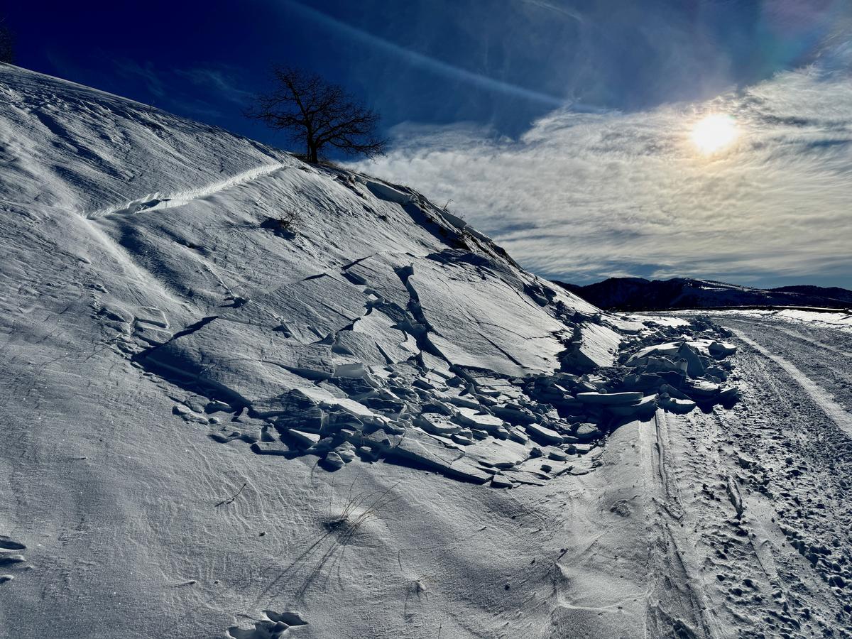
Photo: Showing a wind-drifted snow avalanche (Kelly).
Avalanche Problem #2
New Snow
Type
Location
Likelihood
Size
Description
This avalanche problem will depend on how much new snow falls and at what rate. Currently, 2-7 inches of new snow have already fallen, and I would expect new snow soft slabs and dry-loose avalanches as the snow accumulates.
In southerly-facing terrain, this new snow will fall on slick crusts, and avalanches could run fast and far. On shady slopes, the old snow surface was slightly faceted, and we may see a new snow soft slab avalanche fail at this interface. Use slope cuts and shovel tilt tests to see how the new snow behaves.
Avalanche Problem #3
Persistent Weak Layer
Type
Location
Likelihood
Size
Description
The persistent weak layer (PWL) slowly continues to gain strength, and it is getting more difficult to trigger avalanches. Although the last reported avalanche failing on the PWL was on Tuesday on Cardiac Ridge, we continue to hear reports of collapsing on the PWL, and snow safety teams at nearby resorts are still getting avalanches 2-4 feet deep. The type of terrain you are more likely to trigger an avalanche failing on the PWL is thinner snowpack areas such as:
  • Mid-elevations (particularly between 8,000 - 9,000') where there is less snow.
  • Steep, rocky areas.
  • Slopes that have already avalanched (aka "repeater" slopes) and have partially filled in.
If you trigger an avalanche in one of these thinner snowpack areas, it could propagate widely and up to 5 feet deep. These are unsurvivable avalanches.
Additional Information
Nikki's Week in Review which summarizes significant avalanche and weather activity over the past week is available.
General Announcements
This information does not apply to developed ski areas or highways where avalanche control is normally done. This forecast is from the U.S.D.A. Forest Service, which is solely responsible for its content. This forecast describes general avalanche conditions and local variations always occur.