Forecast for the Salt Lake Area Mountains

Issued by Trent Meisenheimer on
Sunday morning, December 21, 2025
Sunday morning, December 21, 2025
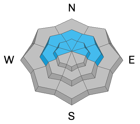
Today, a MODERATE avalanche danger exists on steep slopes facing west through north through east at the mid and upper elevations for triggering a slab avalanche 1–2 feet deep that fails on a buried persistent weak layer. There is also a MODERATE danger for wind-drifted snow across all upper elevations, where it will be possible to trigger fresh drifts of wind-blown snow.
Evaluate snow and terrain carefully, identify features of concern, and remember that human-triggered avalanches are possible.

Low
Moderate
Considerable
High
Extreme
Learn how to read the forecast here