Join us at our 2nd Annual Blizzard Ball

Forecast for the Provo Area Mountains

Nikki Champion
Issued by Nikki Champion on
Tuesday morning, April 6, 2021
This morning the overall avalanche danger is MODERATE. The strong westerly winds in combination with new snow will create unstable slabs of wind-drifted snow. Look for any signs of wind drifted snow, and avoid these slopes. In areas not impacted by the wind, the new snow may produce long-running sluffs.
Additionally, if the snow surface warms today, avalanches involving wet snow are possible. Have a flexible plan that allows you to quickly respond to changing conditions.
Low
Moderate
Considerable
High
Extreme
Learn how to read the forecast here
Weather and Snow
This morning, it finally feels like winter has returned to the mountains! Skies are overcast, and there is light to moderate snowfall accumulating. Mountain temperatures range from the upper teens to low 20s F. The westerly winds have increased drastically overnight and now blow at speeds of 15-20 mph with gusts near 30 mph. Current snowfall totals are between 1-2" of new snow.
Today, snow showers will continue through the morning as this storm system makes its way across northern Utah. As this system exits the area this afternoon, the snowfall will diminish. Mountain temperatures will rise into the upper 30s F and low 40s. Westerly will remain elevated and average 10-20 mph with gusts up to 30 mph at mid-elevations, and average 25-35 mph with gusts up to 50 mph at upper elevations. We should get another Trace-2" of snow before the snowfall stops, bringing the storm totals between 1-4" of snow.
Looking into the future, a more active pattern looks to set up sometime around April 12th, with the hope of some more powder riding. Stay tuned.
Recent Avalanches
No new avalanches reported in the Provo backcountry. Resorts continue to report wet loose avalanches occurring throughout the day.

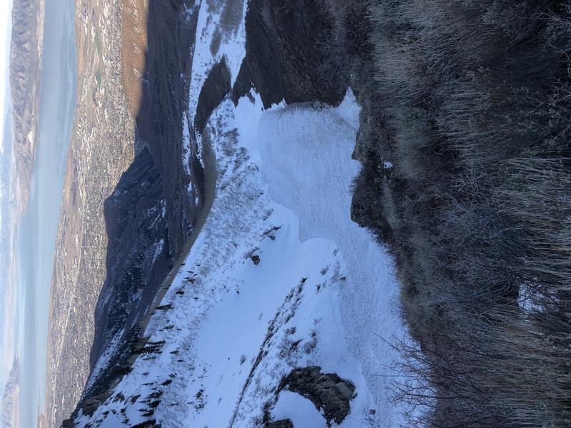
Reports of large wet loose avalanches occurring on Timpanogos over the weekend do continue to roll in.
Photos from a large wet loose that likely occurred 4/3 or 4/4. (Photo: BC)
As always, find all recent observations HERE.
Ad
Avalanche Problem #1
Wind Drifted Snow
Type
Location
Likelihood
Size
Description
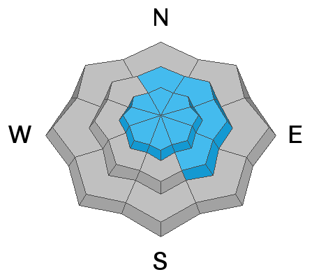
The westerly winds continue to blow across the upper elevations at speeds near 60 mph and now have a bit of new snow to move around. Shallow drifts of windblown snow will be the biggest concern for today. These shallow drifts will be most pronounced just off the ridgelines and on steep slopes that face easterly, but with elevated winds, cross-loading is possible on any aspect. As well look for these shallow drifts around terrain features like cliff bands, scoops, gully walls, and sub-ridges at mid-elevations.
Look for obvious signs of wind-drifted snow, such as pillow-shaped slopes, cracking, and whumfing, and avoid those slopes.
Avalanche Problem #2
New Snow
Type
Location
Likelihood
Size
Description
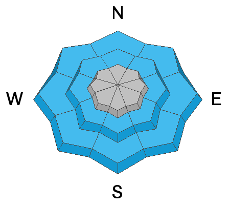
With such warm temperatures for the past week, I would guess most of the new snow should bond well to the older damp snow surfaces. However, fast running sluffs are likely to occur today if the snow surface was able to freeze into a firm crust before the cold new snow fell. While these far running sluffs don't entrain much snow they can be dangerous in areas they could knock you off your feet and sweep you through complex terrain, or into terrain features where the shallow snow could pile up deeply.
It's best to use slope cutting techniques and terrain management skills to your advantage. Using small, steep test slopes (slopes not large enough to bury you) are a great way to test how the new snow is behaving before committing to slopes large enough to bury you.
Watch for obvious signs of instability such as cracking and sluffing.
Avalanche Problem #3
Wet Snow
Type
Location
Likelihood
Size
Description
Clouds, cool temperatures, and snow showers should prevent much wet activity today, but if the sun peeks out for an extended period or you notice green housing (where clouds trap warmer temperatures), you can expect the snow to quickly become reactive. This includes both wet loose sluffs as well as larger wet slabs - which we haven't seen yet, but know the snowpack is now saturated. I would be especially aware of this problem on steep sunny aspects as well as all aspects at the lower and mid-elevations.
Watch for rapid changes in the snow surface such as rollerballs, and have an exit plan that allows you to quickly respond to wet snow activity.

HEADS UP - The avalanche danger could rise if any amount of rain occurs. The snow is already damp. Rain would make it lose cohesion and cause more wet avalanches to occur. Pay attention to changing weather patterns, and where that rain/snow line falls throughout the day.
Additional Information
General Announcements
Please visit this website with information about Responsible Winter Recreation by the Utah Office of Outdoor Recreation.

This information does not apply to developed ski areas or highways where avalanche control is normally done. This forecast is from the U.S.D.A. Forest Service, which is solely responsible for its content. This forecast describes general avalanche conditions and local variations always occur.