UDOT PLANNED AVALANCHE CLOSURES!!

Forecast for the Provo Area Mountains

Evelyn Lees
Issued by Evelyn Lees for
Wednesday, April 17, 2019
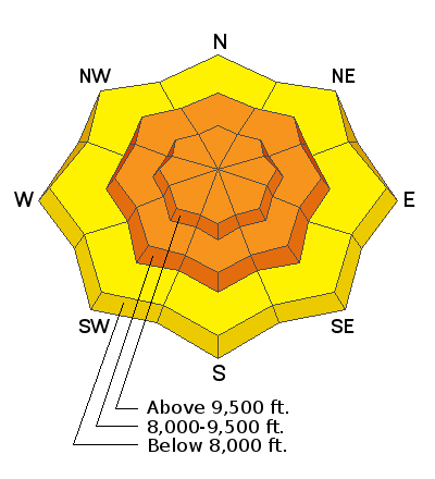
The avalanche danger will rapidly rise from LOW to CONSIDERABLE with sun and daytime heating on steep slopes of almost all aspects and elevations. Wet snow avalanches will entrain snow as they move down slope, resulting in large piles of cement like debris. As soon as the snow becomes damp, it’s time to get off of and out from under steep slopes. Avoid travel in avalanche runout zones - below gullies and chutes - where long running natural avalanches could reach even the lower elevations.

Mark will update the Salt Lake City, Ogden and Provo forecasts Thursday morning (April 18th) by 7:30 am.
Low
Moderate
Considerable
High
Extreme
Learn how to read the forecast here
Special Announcements
Winter's not stopping, and neither are we! More snow = more forecasts through April 21st. We'll be doing early morning online forecasts for Ogden, Salt Lake and Provo most days this week, and definitely on Friday, Saturday, and Sunday of Easter weekend (April 19-21). Check the Bottom Line each day for the time of the next up date. We will continue posting observations every day this week.
Resorts closed for the season are now backcountry terrain - no avalanche mitigation is being done. Utah ski resorts are on a mix of private and public Forest Service land, and each resort has a different uphill policy - contact the individual resort for details.
Weather and Snow
The warm, spring storm moved on, leaving behind 1" to 1.25" of rain at the mid and lower elevations. The rain/snow line finally lowering to about 7,500’ yesterday, and there is probably 4 to 8" of dense settled snow at the upper elevations of the Provo area mountains. Temperatures have cooled below freezing, and are in the upper 20s at 7,000' and 8,000'.
Today: Sunshine!! Skies will be mostly clear today, with occasional puffy cumulus moving through. Temperatures will warm to near 50 at 7,000', and into the low 40s at 9,000’ and low 30s at 10,000’. Northwesterly winds will remain light, averaging less than 15 mph, with speeds across the high alpine ridgelines just a tad stronger at 20 to 25 mph. Most snow surfaces will be crusted early this morning, rapidly becoming wet with daytime heating. Any window of cold, dry snow at the very highest elevations will be short lived.
Recent Avalanches
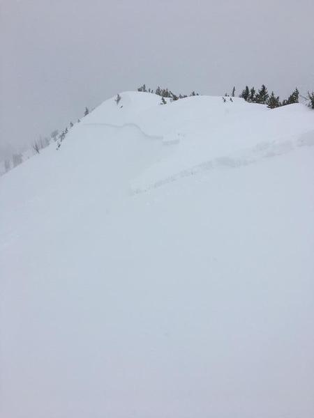
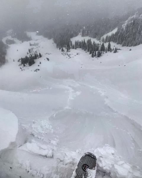
No new reports from the Provo area mountains. To the north, in Little and Big Cottonwood, yesterday, in the backcountry, a foot deep slide in was triggered in Jaws, upper Days Fork, from a cornice drop. A large slide was triggered in Days Fork with a ski cut, propagating much wider than expected, and entraining a lot of wet snow as it ran downhill.
Resort mitigation work triggered dense wind drifts at the upper elevations with explosives and ski cuts in the morning, most large enough to bury a person. By late morning, the snow had warmed, and wet slabs became easy to trigger.
Ski cut triggered slide in Days Fork slide, photo by JP
Ad
Avalanche Problem #1
Wet Snow
Type
Location
Likelihood
Size
Description
In spring, forecasts only get you so far, and then you have to become a Nowcaster - with direct sun and warming temperatures, be alert to when the snow heats and becomes wet and sloppy. Wet loose sluffs and wet slabs can then be triggered on almost all aspects and elevations, with a natural avalanche cycle possible.
Clues will be abundant when the snow heats - you will feel the hot April sun, surface crusts melt, the snow becomes punchy, sticky or damp, pinwheels or swarms of roller balls race downhill, you’re triggering small sluffs or the snow is falling off rocks and trees. The danger for wet sluffs or wet slabs can rise from LOW to CONSIDERABLE in minutes.
With a hard ice crust beneath the new snow, slides will entrain snow and run further than expected. Wet avalanche debris piles up instead of spreading out, and even small slides can deposit 4 feet of cement like debris. Avoid all steep terrain, including being in and below steep chutes and gullies, even at the mid and lower elevations today - natural avalanches are possible, and could run long distances from above.
30’ wide slide running full track yesterday in West Monitor. Mark White photo.
Avalanche Problem #2
Normal Caution
Type
Location
Likelihood
Size
Description
If you find some dry snow on the highest northerly facing slopes, it may be possible to trigger a lingering wind drift or new snow slide. Signs of wind drifts include cracking of the snow and looking for and avoiding smooth, rounded pillows of snow. Dig down and look at the layering. After the day has heated, any dry snow slides will turn into wet slides as they move downhill.
New and old cornices may break back further than expected and even from a distance. Stay well back from corniced edges when traveling on ridge lines and avoid travel beneath them.
Glide cracks - after the deluge of rain, expect glide cracks to continue growing, releasing at random with the entire snowpack crashing down. Glide cracks have been spotted in many of the classic places one could expect.
General Announcements
This information does not apply to developed ski areas or highways where avalanche control is normally done. This forecast is from the U.S.D.A. Forest Service, which is solely responsible for its content. This forecast describes general avalanche conditions and local variations always occur.