Forecast for the Provo Area Mountains

Nikki Champion
Issued by Nikki Champion on
Wednesday morning, March 27, 2024
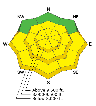
This morning, there is MODERATE avalanche danger on all aspects at mid and upper elevations, where human-triggered soft slab avalanches are possible.
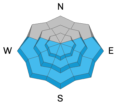
Throughout the day, the strong sunshine will cause avalanche danger will rise to MODERATE at all elevations facing east-south-west, where it will be possible for humans to trigger wet loose snow avalanches that could lead to shallow wet slab avalanches on steep solar aspects. Dealing with a wet snow problem is a matter of timing, and avoiding being on damp surfaces during the warmest part of the day is the best approach.
Low
Moderate
Considerable
High
Extreme
Learn how to read the forecast here
Special Announcements
Support the UAC website backend platform to ensure the ongoing security of the website and the data stored on the site rebuild by donating to our spring campaign.
Weather and Snow
This morning, under broken skies there is lingering light snowfall. Trailhead temperatures are in the mid-teens °F, while the highest peaks are in the single digits °F. Winds have picked up since yesterday, blowing from the west-northwest, gusting to the 30s MPH. There was another Trace amount of snow overnight. This storm has stealthily added a decent amount of water to some locations, particularly in the Upper Cottonwoods where the settled new snow depth is now over 2' feet.
Today, expect lingering lake-effect precipitation in northern Utah to fade by morning due to incoming high pressure, resulting in warming and drying conditions. The day will start mostly sunny but become mostly cloudy later. Temperatures will range from 34-37°F with no snow accumulation expected. Winds will be moderate, with gusts up to 20-25 MPH at mid-elevation and up to 30-40 MPH at upper-most elevations.
Looking ahead, after a brief break today, a strong cold front will move across northern Utah on Thursday, slowing over central or southern Utah by Thursday night or Friday morning. It will weaken and return northward on Friday, with more precipitation likely through the weekend. Expect a storm bringing 0.6-1.2 inches of water and 8-16 inches of snow.

Read the updated forecast discussion from our partners at the National Weather Service HERE.
Recent Avalanches
No new avalanches were reported in the Provo area mountains yesterday.

North of Provo, in the Central Cottonwoods, reports came in of soft slab avalanches up to 2 feet deep in Conehead, Benson and Hedges, the Brighton Perimeter, Argenta, and Little Superior Bowl. Among these, the avalanche that particularly caught my attention occurred in Little Superior Bowl. Although details are limited, it was reported as being 2 feet deep and 400 feet wide. This incident more closely resembles the avalanche in Silver Fork from Monday, which I went and checked out yesterday. The Silver Fork avalanche was notable as it seemed to have originated as a dry snow avalanche, but had more characteristics of a wet snow avalanche by the time the debris pile settled. You can find a more detailed observation, crown profile, and additional pictures HERE. Both of these avalanches stand out for their considerable depth compared to other reported avalanches over the last two days, displaying more slab-like characteristics.

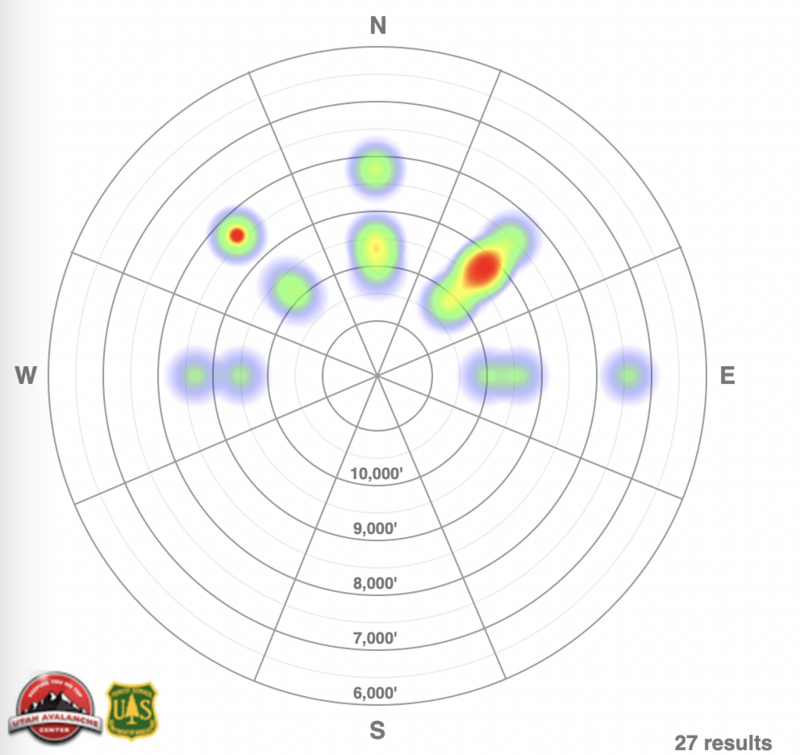
Avalanche Heat map from the past 5 days for the Salt Lake, Provo and Ogden area mountains.

Read all the observations HERE.
Ad
Avalanche Problem #1
New Snow
Type
Location
Likelihood
Size
Description
Over the last few days, the new snow has been reactive to backcountry travelers. The two layers of weakness, in most cases, have been density changes within the newest snow or a bit deeper at the new snow/old snow interface in general. This morning the new snow, in combination with the bump in winds will remain a concern.
A few standout avalanches were the slide in Silver Fork and the avalanche on LSB. Both of these avalanches were much deeper and had more slab characteristics than other reported avalanches. The debris in these slides would be deep enough to have buried a rider, and while it still meets the description fitting of moderate avalanche danger, it would be considered a large avalanche in an isolated area. With the bump in ridgetop winds last night and the increased sun effect we will see today, I would expect to see more cohesive avalanches occurring today.
Today, it will be possible to trigger a soft slab avalanche avalanche failing on a density change or on the new snow/old snow interface. If the slope has had any wind or sun affect, you may be able to trigger deeper more cohesive avalanches 14"-24" deep, breaking above you.
Avalanche Problem #2
Wet Snow
Type
Location
Likelihood
Size
Description
With today's clear skies and increased temperature, expect to see wet-loose avalanche activity on all solar aspects with daytime warming. This will be most evident in areas out of the wind zone and in steep rocky gully features facing the southerly half of the compass. With the warmer temperatures and strong sun, there is also a chance for more cohesive slab avalanches that have more wet characteristics like the one on Ricardo's Roll. The best way to avoid this problem is to be off of sunny slopes before they start to take too much heat. Roller balls, dripping water off of rocks, and your boots or skis sinking into the surface snow are signs it's time to move to higher elevation terrain.
With warming temperatures and a lot of cold snow available, roof slides are a concern. Be aware of adults working solo outside or children playing, as these are the people most susceptible to roof slides.

It's the time of year when it's easy to fall back on heuristic traps based on past experience, particularly familiarity. Keep your head about you when traveling in the mountains as even a small avalanche could have real consequences. Read more about heuristics and decision making from local avalanche researcher Ian McCammon HERE.
General Announcements
This information does not apply to developed ski areas or highways where avalanche control is normally done. This forecast is from the U.S.D.A. Forest Service, which is solely responsible for its content. This forecast describes general avalanche conditions and local variations always occur.