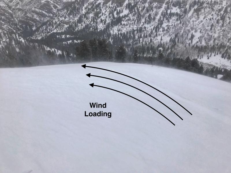
The southerly winds continue to be the headline news in the mountains overnight and through out the day today. Upper elevation averages are in the 15-25 mph range gusting into the 40's and 50's. It's going to be hard to escape the winds with even the mid elevation anemometers reading speeds in the 15-25 mph range with gusts into the upper 30's.
Yup - it's avalanche weather. The rain snow line will ebb and flow around the 6,000' level today. Temperatures remain on the warm side with upper elevations in the low 20's °F. Rough snow totals are as follows:
Provo Area: 18" snow (3.38" h20)
Upper LCC: 16" snow (2.37" h20)
Upper BCC: 25" snow (2.87" h20)
Park City Ridge Line: 8-18" snow (1.0 - 2.1" h20)
The riding and turning conditions are excellent if you're in wind sheltered terrain and above about 7,000' where you'll ditch the rain drenched snow and be rewarded with dense, surfy, snow. We will remain in an active storm pattern under a southwest flow for much of the day today. Another 3-6" of new snow is possible with more in favored locations. Tuesday morning/afternoon a trough will slice overhead bringing colder temps and more snow.
There are no new observations from the Provo area. However in the SLC mountains - there was one slab avalanche triggered by a snowmobiler in the Guardsman's area. This avalanche was about 1' deep and 100' wide. It's likely it failed on surface hoar.