Forecast for the Provo Area Mountains

Dave Kelly
Issued by Dave Kelly on
Tuesday morning, February 25, 2025
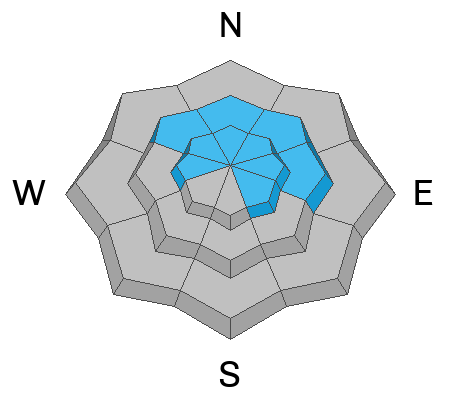
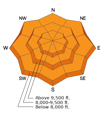
The avalanche danger is CONSIDERABLE at all aspects and elevations. With changing conditions careful snowpack evaluation, cautious route finding and conservative decision making are essential.
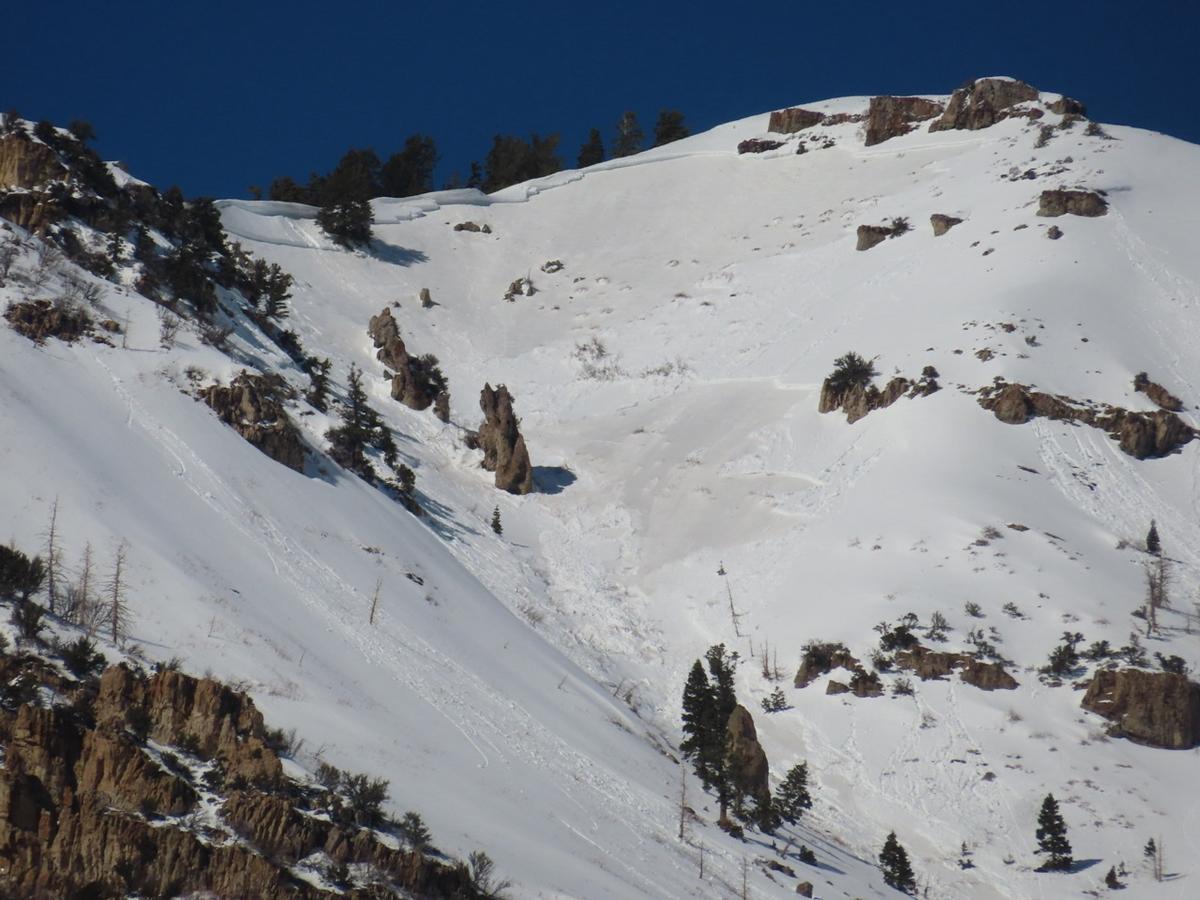
Long running wet slab avalanches starting high in the alpine can run down past the snowline. Give avalanche runout zones space particularly with daytime heating. This applies to dog walkers, snowshoers, and ice climbers that aren't directly in starting zones.
When all else fails choosing to travel on or underneath terrain less than 30 ° in steepness will find you the softest turns and safest routes.
Low
Moderate
Considerable
High
Extreme
Learn how to read the forecast here
Weather and Snow
Under light clouds, temperatures are in the high 30's °F. Lower elevation zones have been above freezing for over twenty-four-hours. Winds are blowing from the southwest in the 20's gusting to the 40's MPH. There was no new snow last night and with these warm temperatures we are seeing settlement within the snowpack throughout the forecast region.
Today, look for partly cloudy skies with temperatures ranging from 42-46°F. Winds will blow from the west at the lower ridgelines 25 gusting to 35 MPH and at the highest peaks 40 gusting to 50 MPH with gusts to 70MPH. There is a cold front moving through today and a chance of light precipitation. Winds will increase with the frontal passage and should shift to the northwest.
Recent Avalanches
Yesterday, we had reports of wet loose and wet slab avalanches. Our recent observations page has all the updated details.
UAC forecasters went to check out recent close call from Ant Knolls, read their observations HERE.
Ad
Avalanche Problem #1
Persistent Weak Layer
Type
Location
Likelihood
Size
Description
A variety pack of buried persistent weak layers are variable and make for a complex problem. Thinner, rockier spots, and areas that avalanched earlier in the season are more likely to be places where you could trigger an avalanche failing on a buried layer of facets. These facets near the ground were responsible for the recent avalanche on Ant Knolls in the Northern Provo Region. If you hear any signs of collapsing at any elevation or aspect then find a lower angle slope to travel on or underneath.
We are not done with this buried persistent weak layer yet and as much as the mindset in late February typically turns to open-season, it's not that type of season. Give this snowpack some time to settle into its spring coat.
Video (Champion and Hardesty) discussing the recent rider triggered persistent weak layer avalanche from Ant Knolls.
Avalanche Problem #2
Wet Snow
Type
Location
Likelihood
Size
Description
Many weather stations have had no refreeze in almost two days. The snowpack in the mid and lower elevation terrain out of the wind zone may be saturated and the chance of triggering a gouging wet snow avalanche will increase with warming temperatures. Areas with long run out zones where avalanches could start as dry snow avalanches and turn into wet snow avalanches may overrun the snow line and people not traveling in starting zones could be susceptible to avalanches.
Avoid being underneath avalanche terrain on mid and lower elevation slopes, particularly during the heat of the day.
Photo (Woody UDOT) showing wet slab avalanches in the Provo Region
Avalanche Problem #3
Wind Drifted Snow
Type
Location
Likelihood
Size
Description
With increased wind speeds overnight and throughout the day today, there will be drifting snow in mid and higher elevation terrain. Look for and avoid slopes with overhanging cornices and smooth rounded deposits of snow. If you see signs such as cracking and collapsing within the wind-drifted snow then you may be able to trigger avalanches in steep terrain (greater than 30°). Any slope involving wind-drifted snow on a buried layer of facets will be deeper and more likely to bury a human.
General Announcements
This information does not apply to developed ski areas or highways where avalanche control is normally done. This forecast is from the U.S.D.A. Forest Service, which is solely responsible for its content. This forecast describes general avalanche conditions and local variations always occur.