Join us at our 2nd Annual Blizzard Ball

Forecast for the Provo Area Mountains

Nikki Champion
Issued by Nikki Champion on
Tuesday morning, December 10, 2024
The avalanche danger is LOW, meaning natural and human-triggered avalanches are unlikely, but not impossible today. Recent snowfall and elevated winds may have formed isolated wind slabs near ridgelines, which could fail on buried facets in specific, wind-loaded terrain. Pay extra attention to areas that have received additional wind or snow.
Carefully assess snow and terrain in wind-loaded areas, and avoid thin snowpack zones where buried obstacles may be just below the surface.
Low
Moderate
Considerable
High
Extreme
Learn how to read the forecast here
Weather and Snow
This morning, under overcast skies, temperatures have dropped significantly. Trailhead temperatures are in the low teens, with higher elevations in the single digits. By 5 AM, a trace of snowfall was reported at Mid Mountain, with little else in the Provo area. Winds at mid-elevation ridgelines are west at 20 mph, gusting to 30 mph. At upper elevations, winds are northwest, sustained in the mid-30s mph, with gusts up to 45 mph.
High pressure will build today and stay through Thursday morning. Expect sunny skies and temperatures in the mid-20s. Winds at mid-elevations will be northwest at 10 mph, gusting to 15 mph, and northwest at 45 mph, gusting to 50 mph, at upper elevations.
A weak Pacific storm will bring light precipitation to northern Utah late Thursday into Friday, favoring the northern mountains. Snow levels will drop overnight with modest totals expected. Another break in weather is forecasted before the next system, with potential snow in the northern mountains by Sunday. A high-pressure ridge is likely to return, bringing drier and warmer conditions into next week.
Recent Avalanches
No new avalanche activity was reported from the Provo area mountains.

Check out all recent observations HERE.
Ad
Avalanche Problem #1
Persistent Weak Layer
Type
Location
Likelihood
Size
Description
The persistent weak layer (PWL) on north-facing slopes in the Provo area is losing strength daily and will struggle to support additional weight from new snow or wind loading. Even small amounts of snow or wind, like we saw over the past two days, can form sensitive slabs in exposed areas.
Pay close attention to which slopes and aspects are holding snow now to identify areas to avoid during the next storm.

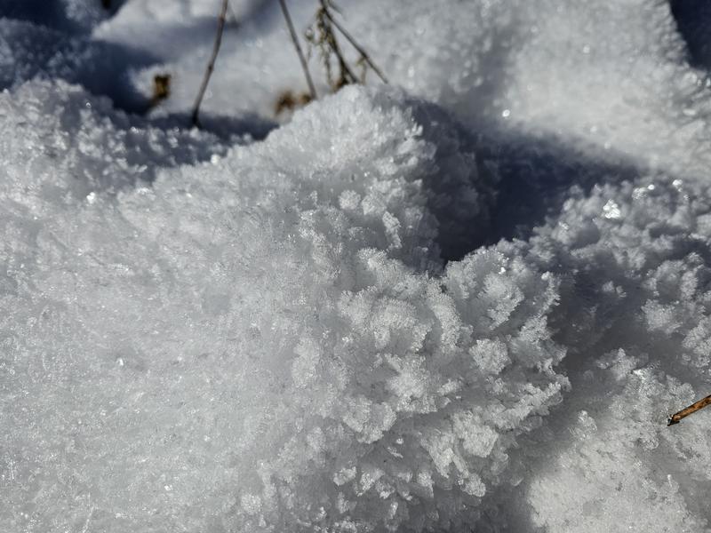
Massive surface hoar Joey observed from our day in Snake Creek last week, it only continues to grow and form.
Weak snow, including surface hoar, is also forming at the surface. The key question is whether warmer temperatures and wind will destroy this instability before the next snowfall. Learn more about surface hoar.
Additional Information
While you're waiting for more snow, dive deeper into avalanche philosophy with Drew Hardesty HERE and HERE.
General Announcements
This information does not apply to developed ski areas or highways where avalanche control is normally done. This forecast is from the U.S.D.A. Forest Service, which is solely responsible for its content. This forecast describes general avalanche conditions and local variations always occur.