Join us at our 2nd Annual Blizzard Ball

Forecast for the Provo Area Mountains

Dave Kelly
Issued by Dave Kelly on
Monday morning, November 14, 2022
The snowpack is generally stable and avalanches are unlikely.
There is a chance you may find loose dry sluffing in steep northerly terrain. It may also be possible to trigger a shallow pocket of wind drifted snow in isolated areas or extreme terrain.
We will be temporarily suspending daily forecasts and will be issuing intermittent updates and publishing backcountry observations as they arrive. Please consult our updated Salt Lake Advisory.
Low
Moderate
Considerable
High
Extreme
Learn how to read the forecast here
Special Announcements
Many ski areas are now closed to uphill travel in order to prepare for winter operations. Resort uphill travel policies can be found HERE.
Weather and Snow
For this week sunny skies, temperatures in the mid-20's (F) and variable winds. Updated NWS forecast here. Snow depths are 1-2' in the Provo mountains. Coverage is decent for this time of year and riding conditions on the northerly aspects are good. There will be some sun crusted slopes and areas of wind damage above tree line.

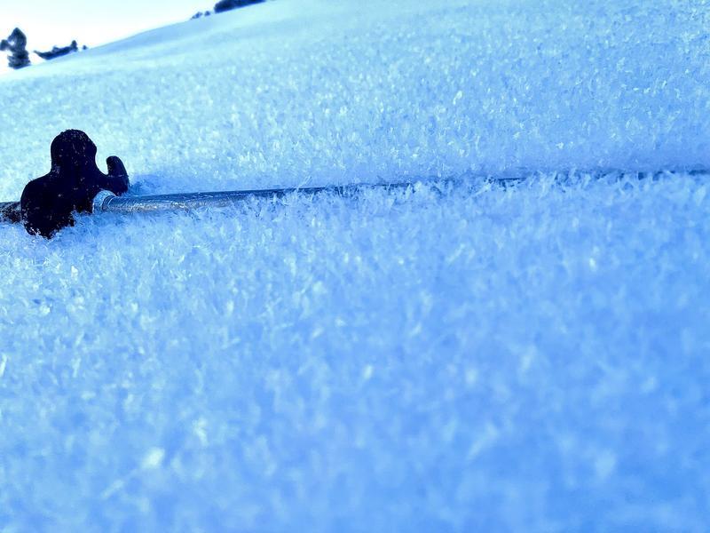
As we move into a high pressure cycle, skiers are noting feathery crystals forming on the snow surface throughout the Wasatch. Cold clear nights with higher humidity and light winds create surface hoar, which is the wintertime equivalent of dew. While these crystals are fun to ski and pretty to look at, they can create a future persistent weak layer if they are not destroyed prior to being buried. If you're out and about take note of where you find these crystals and submit an observation here.
Read more about Surface Hoar here.
Photo of Surface Hoar from Broads Fork (Grainger)

Recent Avalanches
A group encountered avalanche conditions they did not like in the upper elevations of the UFO Bowls and wisely turned around.
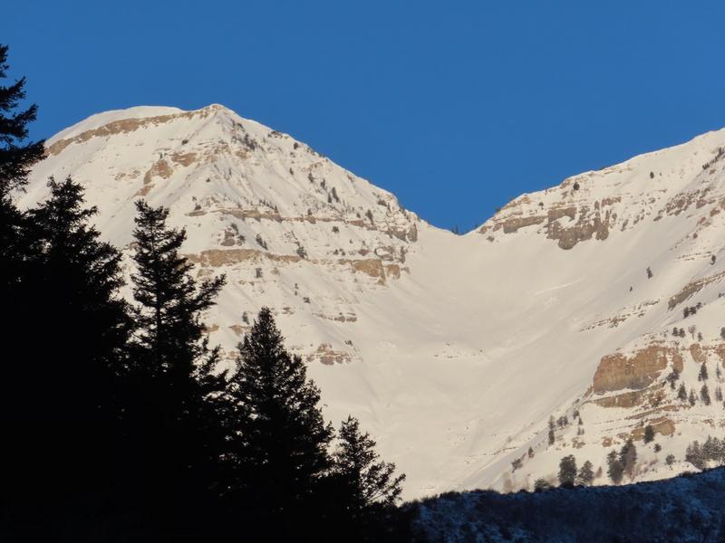
Provo UDOT reported slides in the new/old interface from last week.
Mount Timpanogos (Provo UDOT)

Read the most recent observations from the backcountry HERE.
If you see anything we should know about, please submit your own observations HERE.
Ad
Avalanche Problem #1
Normal Caution
Type
Location
Likelihood
Size
Description
The current snowpack is mostly stable and normal caution is advised. Loose dry sluffing is possible in steep northerly terrain. It may also be possible to trigger a shallow pocket of wind drifted snow in isolated areas or extreme terrain.
Even with a generally stable early-season snowpack you may find isolated areas with weak surface snow. As we go into an extended high pressure areas with a thinner snowpack may break down faster. If you hear whoomping or feel collapsing the snowpack is telling you things are unsettled and you may want to re-assess your travel plans.
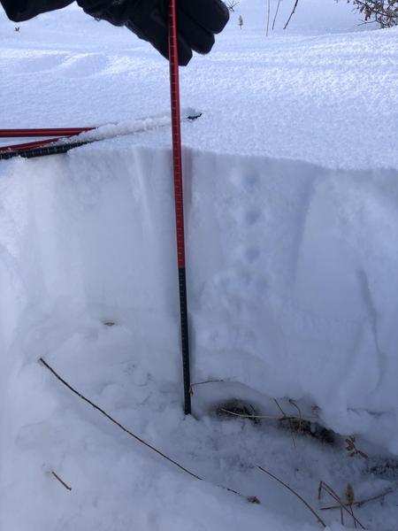
This observation from Maple Mountain shows a thinner snowpack in the Provo Region.
9090' (Martineau)
Additional Information
A Few Things to Remember:
  • Whether you're-hiking, hunting, skiing, boarding, snowshoeing or firing up the snowmachine: be prepared for avalanches
  • Any avalanche can produce serious trauma because of a thin snowpack
  • Hitting rocks and stumps is a real danger. Don't end your season.
  • Treat ski resorts as backcountry terrain and check out the UAC site for resort uphill travel policies
General Announcements

This information does not apply to developed ski areas or highways where avalanche control is normally done. This forecast is from the U.S.D.A. Forest Service, which is solely responsible for its content. This forecast describes general avalanche conditions and local variations always occur.