SNOW
The first two rounds of mid October snowfall were followed by several wind events this past week. The shady slopes at 8 to 9,000' in the Provo area mountains now have 2 to 4" of snow on the ground, with greater amounts likely at the upper elevations. Most of this snow is now sugary and weak, forming a poor base for any additional snow or wind drifts that develop.
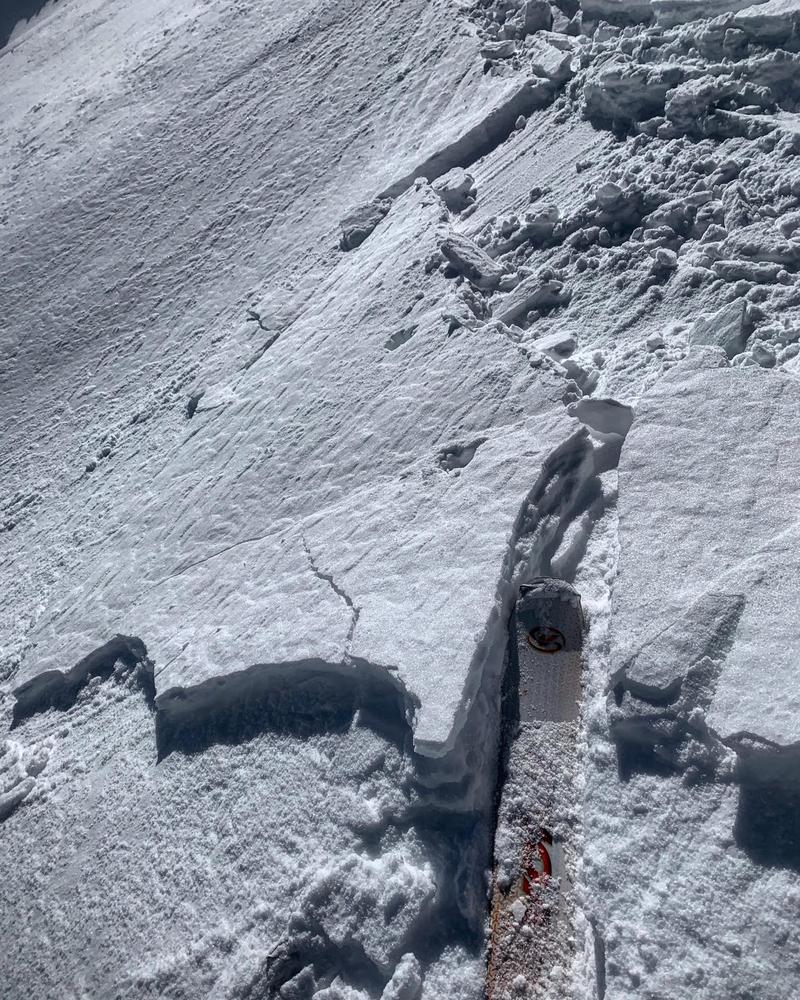
Shallow wind drift triggered Thursday in the Salt Lake area mountains. Mark White photo
WEATHER
Saturday: Sunny, with 10,000' highs near 40. Southwesterly winds increasing into the 15 to 20 mph range.
Sunday: Cloudy and cold, with 2-4" of snow possible, 10,000' highs in the teens and low 20s. Northwesterly winds 15 to 20 mph.
Monday through Wednesday: Sunny to partly cloudy, and really cold, with lows 5 to 10 degrees F and highs in the teens and low 20s.
If you go out, there are a few things to remember:
- Hitting rocks and stumps is a real danger. Don't end your season before it starts with an injury from hitting one of these obstacles.
- Avalanches are a possibility in upper elevation terrain.... It doesn't matter if you are hiking, hunting, skiing, etc., be prepared with rescue gear and a partner.
- Ski resorts all have different uphill travel policies. Some are closed, like Snowbird, others are open. These closed resorts can be great places to get in a little skiing especially in you know of a rock free slope, but it should be treated as backcountry terrain. More info HERE but check with each resort for the latest info.
EVENTS
12th Annual Utah Snow and Avalanche Workshop - USAW will be November 2nd this year.
- Register HERE for the regular Saturday session.
- There is a special morning session on Saturday specifically for snowmobilers. Register for that session HERE.
- Lastly there is a special session designed for avalanche workers like ski patrollers on Friday to cover work related topics. Register for that session HERE.
Boondockers 16 Utah Premiere and Fundraiser - October 26th at the Brewvies. Get tickets
HERE.