Forecast for the Provo Area Mountains

Greg Gagne
Issued by Greg Gagne for
Monday, January 14, 2019
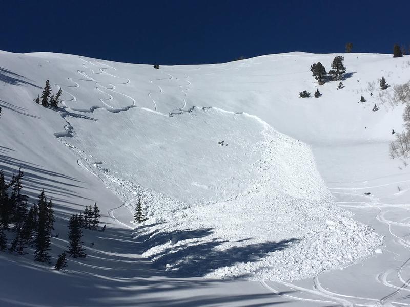
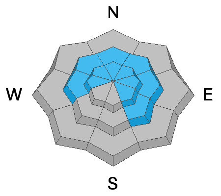
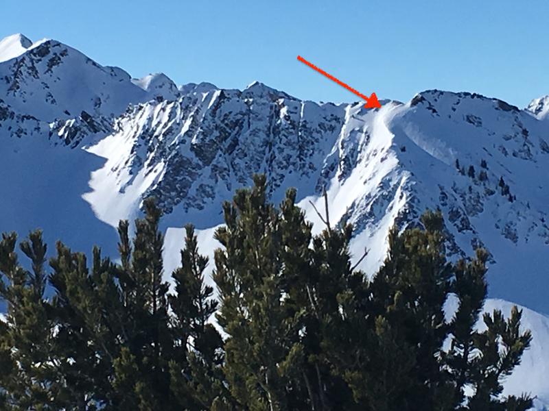
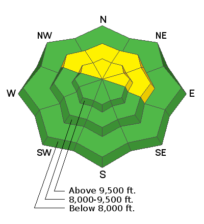
The avalanche danger is MODERATE where there is a chance for triggering an avalanche that breaks 1-3' deep into faceted snow at the mid and upper elevations. The most likely place to trigger an avalanche would be in steep, wind loaded, unsupported terrain, that faces northwest through east. Continue to approach recent wind drifted slopes with caution, and consider the consequences of getting caught in any slide.

Safe travel protocol is key: make a plan, communicate, ride slopes one-at-a-time, and keep eyes on your partner at all times.
Low
Moderate
Considerable
High
Extreme
Learn how to read the forecast here
Weather and Snow
Skies are partly cloudy and mountain temperatures range throughout the teens and low 20's F. Winds are out of the south/southeast, and generally light, with gusts in the 20's mph at upper elevations.
Another day of beautiful - albeit boring - weather with mountain temperatures in the 20's and low 30's F. Winds will be out of the south/southeast, and generally light, with some gusts in the 20's mph along upper elevation exposed ridges. Skies will be mostly sunny, with a few high clouds passing by from time to time. We can expect to return to a more active weather pattern beginning Tuesday
Recent Avalanches
The only reported human-triggered avalanche in the backcountry from Sunday was on Mill Canyon Peak in American Fork Canyon. This was on east-facing slope at 9200'. This slope had been wind-loaded, and the slide broke down 18-36" deep and an estimated 125' wide, likely failing on a layer of faceted snow that formed the first few days of January. The slide was triggered by the 5th skier on the slope, but fortunately no one was caught or carried.
In addition to yesterday's avalanche activity in American Fork Canyon, there were also two close calls on Saturday to our south and north. One was on the Skyline as a rider triggered a large slab avalanche that was on a heavily wind loaded slope (observation), and another in the Logan area mountains (observation). Both occurred on wind-loaded slopes that had previous tracks, failing in weaker faceted snow.
Our embarrassment of riches is on full display as we have received several excellent state-wide observations from this past weekend (link).
Ad
Avalanche Problem #1
Persistent Weak Layer
Type
Location
Likelihood
Size
Description
The various faceted layers in our snowpack are mostly dormant and are adjusting to the load of snow and wind from early last week. However, as evidenced by the skier-triggered wind slab avalanche in American Fork Canyon on Sunday, avalanches remain possible. The areas of biggest concern are wind-loaded slopes at the mid and upper elevations that face northwest through east where the wind slabs are sitting on top of weak, faceted snow. Notice the rounded pillow of snow in the photo below (Hardesty/Wilson/Pine) - illustrating a wind-drifted slope.
Safety in avalanche terrain (admittedly a very generous relative term) always goes back to the basics, and one simple rule is avoid the structure of strong snow over weak snow. This past weekend my partners and I were able to enjoy riding some steep lines on northerly aspects at the mid and upper elevations. But we constantly evaluated each slope, looking for the presence of a stronger slab (such as a hard wind drift) on top of weaker faceted snow. One one instance where we found this structure, we simply moved on to different slope where this structure was absent.
Additional Information
On Saturday my regular touring partners and I decided to skip a run and instead use the time to practice companion rescue techniques. This included beacon searches and strategic shoveling. Time yourselves, and improve with each time you practice. You are accountable to your partners, and those waiting when you return home. Unsure of how to conduct a rescue or feeling a bit rusty, take a companion rescue course!
General Announcements
This information does not apply to developed ski areas or highways where avalanche control is normally done. This forecast is from the U.S.D.A. Forest Service, which is solely responsible for its content. This forecast describes general avalanche conditions and local variations always occur.