Forecast for the Ogden Area Mountains

Trent Meisenheimer
Issued by Trent Meisenheimer for
Sunday, April 9, 2023
There is a CONSIDERABLE avalanche danger for wet avalanches on almost all aspects and elevations. Avalanches will happen naturally today, and the debris can stack up very deep, especially in terrain traps like gullies. It's possible with enough sunshine today that the avalanche danger could spike to HIGH for wet snow avalanches.
You will find a CONSIDERABLE avalanche danger on all upper elevation slopes for Cornice Fall. Stay well back from corniced ridgelines and avoid traveling on slopes with large, overhanging cornices above.

With so much snow, watch for roof avalanches, especially as the day heats up.
Low
Moderate
Considerable
High
Extreme
Learn how to read the forecast here
Avalanche Warning
What: The avalanche danger for the warning area will rise to CONSIDERABLE and HIGH today.
Where: For the mountains and foothills of Northern Utah, including the Wasatch Range...Bear River Range...Wellsville Range...Oquirrh Mountains...Stansbury Range...Cache Valley...Ogden Valley
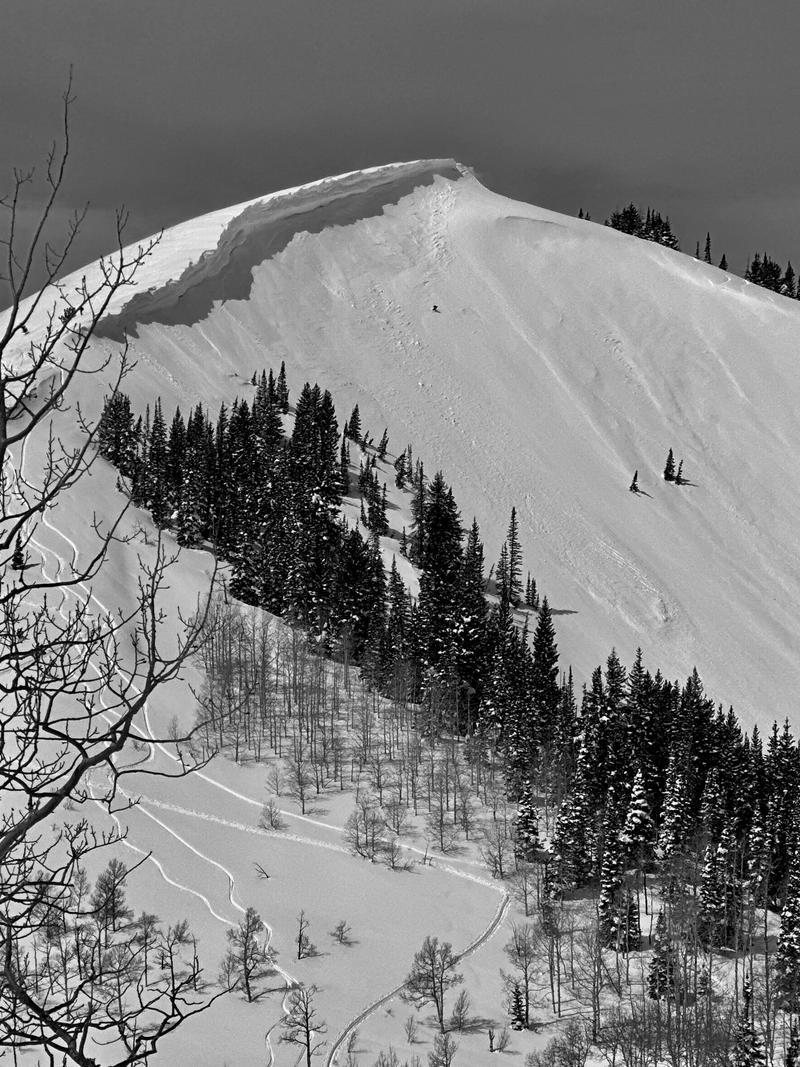
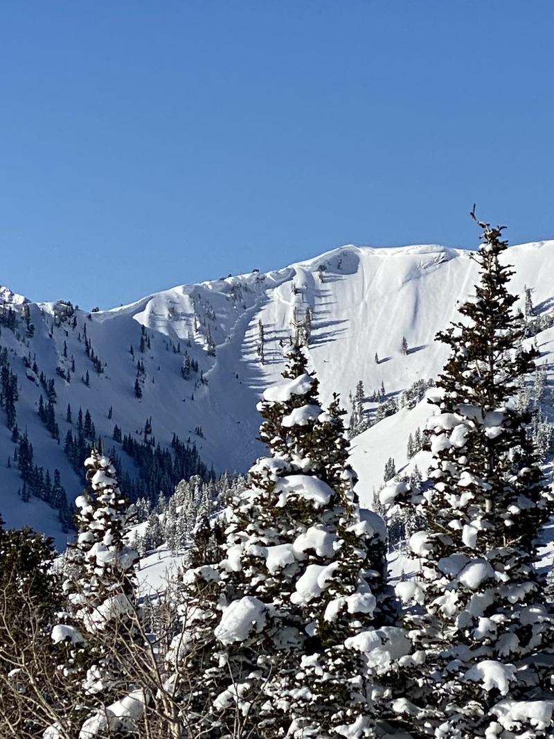
Impacts: Warm temperatures and the intense sun will create widespread areas of unstable wet snow. Natural and human-triggered cornice falls and wet avalanches are likely. People should avoid being in avalanche terrain (off of and out from under slopes steeper than 30°) and stay clear of avalanche run-outs on all aspects and elevations.
Special Announcements
The report for the Pole Canyon Accident is available HERE. Thank you to the people involved for sharing so much information so that we can all learn from this accident and come home safely to our loved ones.
Weather and Snow
High pressure, plenty of sunshine, and warming temperatures will build in this morning and take hold over Northern Utah for the next few days. Overnight the mountain temperatures dropped just below freezing in some places, allowing for a very shallow re-freeze of the snow surface. Ben Lomond weather station at 7,700' had an overnight low of 37°F. This morning, current mountain temperatures range from 29-39 °F and will change quickly once that giant sun ball comes over the hill. Winds are generally light and are blowing from the west at 15-20 mph on exposed ridglines.
Sunshine, light winds, partly cloudy skies, and temperatures rising into the 40s and even 50s will be on tap for the day. Bring plenty of skin wax, sunscreen, hats, and water if you're heading out today. The forecast for the next few days is grim, with no overnight re-freezes and temperatures remaining above freezing up to 9,500' in elevation. YUCK! Can someone teach me to play golf?
Recent Avalanches
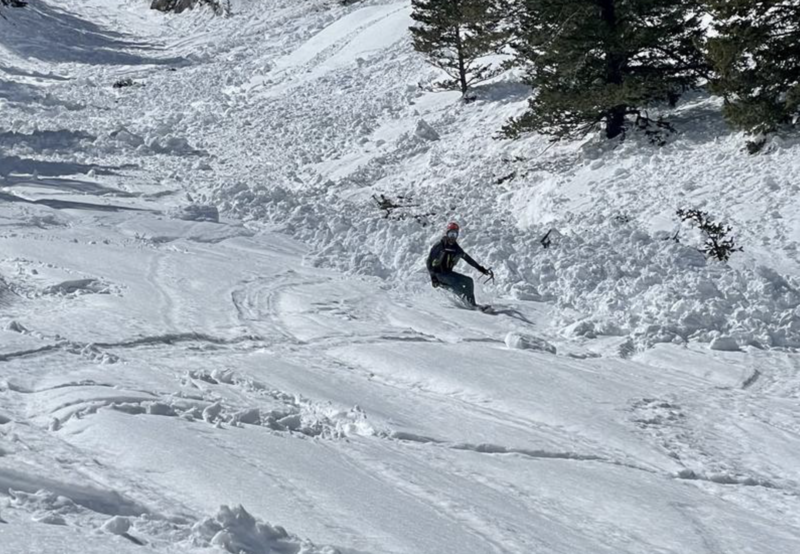
Yesterdays temperatures maxed out at 37-48°F across the range and led to another wet loose avalanche cycle on almost all aspects and elevations. Today will be no different, except the avalanche could be larger. Cornice falls are also being reported and caught on video (utavy IG account). Be sure to check out our Instagram utavy and the observations tab HERE.
Dave Kelly put together some pictures of the recent carnage in Little Cottonwood Canyon. Tanners Gulch / Lisa Falls / Maybird Chute / Coalpit 4
Photo: Wet avalanche activity in Porter Fork, Millcreek Canyon. Link
Ad
Avalanche Problem #1
Wet Snow
Type
Location
Likelihood
Size
Description
This morning you can expect a shallow re-freeze of the snow surface. As the day warms and the temperatures rise, the snowpack will become damp, wet, and then unstable. Yesterday, I was uncertain how wet the snow would get. However, today I am certain the snow will become wet, unstable, and avalanche on many aspects and elevations.
While most of the avalanche activity will be wet-loose type avalanches, there remains the possibility that you can trigger an avalanche deeper into the snowpack that fails on old crusts or softer (colder) layers deeper down, as seen by the recent avalanche activity. Remember to watch your exits and plan to avoid terrain traps in the heat of the day.
Avalanche Problem #2
Cornice
Type
Location
Likelihood
Size
Description
Immense cornices have overtaken the most exposed ridgelines and are likely to become increasingly sensitive to warming temperatures. Cornice falls have two primary hazards:
1. Large and hard chunks of cornice debris could fall and crush you.
2. Cornice falls can trigger an avalanche onto the slope below, such as in Upper Days that occurred either Tuesday or Wednesday.

Glide avalanches are a real threat this time of year, and many glide cracks are starting to yawn and sag more and more with each passing day. At any point, these full-depth catastrophic avalanches could release. Therefore, I would advise not traveling in areas known for glide avalanches like Stairs Gulch, Broads Fork, Mill B, Mineral Fork, Mineral Slabs, Chili Peak Slabs (Ogden) and many others.
General Announcements
This information does not apply to developed ski areas or highways where avalanche control is normally done. This forecast is from the U.S.D.A. Forest Service, which is solely responsible for its content. This forecast describes general avalanche conditions and local variations always occur.