Forecast for the Ogden Area Mountains

Mark Staples
Issued by Mark Staples for
Thursday, April 6, 2023
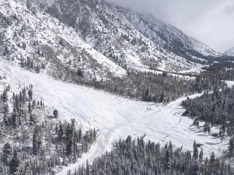
Today will be a shock to the snowpack as this will be the first real day of strong sunshine. Wet avalanches are likely on south and west facing slopes where the avalanche danger will rise to CONSIDERABLE.
Even though there is barely a breath of wind this morning, I still wouldn't trust wind loaded slopes at upper elevations which also have a CONSIDERABLE danger.
North and east facing slopes should have dry snow today and a MODERATE avalanche danger for soft slab avalanches in the new snow.
With so much snow watch out for roof avalanches especially as the day heats up.
Low
Moderate
Considerable
High
Extreme
Learn how to read the forecast here
Special Announcements
The report for the Pole Canyon Accident is available HERE. Thank you to the people involved for sharing so much information so that we can all learn from this accident and come home safely to our loved ones.
Weather and Snow
This morning temperatures are 10-15 degrees F and winds are barely moving. Yesterday most areas received a trace of snow.
Today will have clear skies and strong sunshine and light winds. Air temperatures will climb into the upper 20s F, but it will feel a lot warmer with light wind and plentiful sunshine.

On south aspects and at low elevations, there should be an ice crust on top of the snow this morning. Mid and upper elevation northerly facing slopes should have great dry powder.
Recent Avalanches
There were two large natural avalanches spotted north of Farmington Canyon near Thurston Peak that maybe happened Tuesday. Further south there was plenty of avalanche activity in Little Cottonwood Canyon where UDOT is still digging through avalanche debris. With higher water numbers in the Ogden area mountains, I suspect there were plenty of avalanches but weren't witnessed. Generally, all the avalanches seemed to have been confined to the new snow.
Photo of one of many large slides in LCC (UDOT)

Check out all observations HERE.
Ad
Avalanche Problem #1
Wet Snow
Type
Location
Likelihood
Size
Description
Despite a cold start this morning, today's strong sunshine will quickly heat up south and west facing slopes. Today will be the first real dose of sunshine, and I expect plenty of naturally occurring loose wet avalanches. Areas with exposed rocks will heat up the most and produce more avalanches.
What about wet slabs? We don't necessarily expect any, but there is some uncertainty, and we will have to see what happens during the next few days.
Go to north facing slopes where the snow remains dry to avoid wet avalanches.
Avalanche Problem #2
Wind Drifted Snow
Type
Location
Likelihood
Size
Description
Winds at 9000 feet yesterday were blowing 25-35 mph gusting to 45 from the west, and there should be slabs of wind drifted snow at upper elevations in the typical places. These may or may not be easy to trigger today, but I wouldn't trust them. Avoid any slopes that were loaded by winds during this week's storm.

Cornices are massive. When these break they are a significant hazard by themselves which often break much further back than you expect.
Avalanche Problem #3
New Snow
Type
Location
Likelihood
Size
Description
Conditions can change really fast this time of year, and I expect that the new snow should be bonding to itself and underlying layers fairly quickly. With so much new snow; however, I still have some uncertainty with how quickly this is happening. To be sure, assess the new snow by looking for obvious signs of instability like collapsing. Evaluate bonding within the new snow by diging a snowpit only 2-3 feet deep and perform an extended column test. Also, jump on small test slopes to see how they react.
General Announcements
This information does not apply to developed ski areas or highways where avalanche control is normally done. This forecast is from the U.S.D.A. Forest Service, which is solely responsible for its content. This forecast describes general avalanche conditions and local variations always occur.