Forecast for the Ogden Area Mountains

Drew Hardesty
Issued by Drew Hardesty for
Wednesday, April 12, 2023
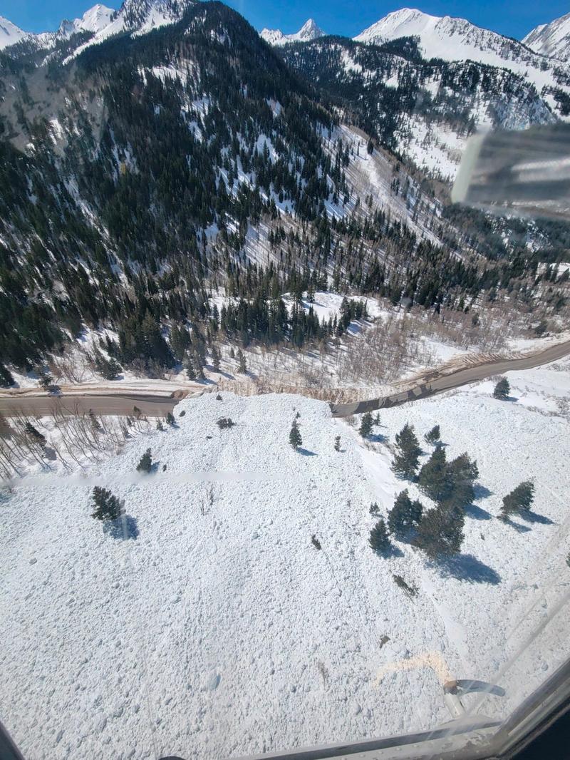
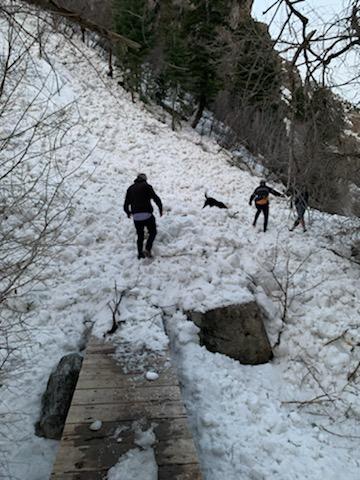
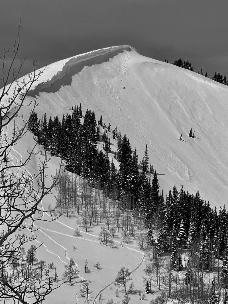
A HIGH avalanche danger exists on all aspects and elevations. These are dangerous conditions.
Naturally occurring wet loose, wet slab, and glide avalanches are expected again today. Avalanches will run long distances - even areas where there is currently little to no snow, such as trailheads or onto spring hiking trails. Avoid being on or beneath steep terrain.
Cornices and roof-alanches present a real danger today as well.
Low
Moderate
Considerable
High
Extreme
Learn how to read the forecast here
Avalanche Warning
What: The avalanche danger for the warning area will very quickly rise to HIGH today with daytime heating.
Where: For the mountains and foothills of Northern Utah, including the Wasatch Range...Bear River Range...Wellsville Range...Oquirrh Mountains...Stansbury Range...Cache Valley...Ogden Valley...Uinta Mountains
Impacts: Warm temperatures will create widespread areas of unstable wet snow. Natural and human-triggered cornice falls and wet avalanches are likely. People should avoid being in avalanche terrain (off of and out from under slopes steeper than 30°) and stay clear of avalanche run-outs on all aspects and elevations.
Special Announcements
The final UAC report for the Upper Weber Canyon avalanche accident on March 9 has been published and is available HERE. The UAC would like to thank Park City Powder Cats for sharing information about the timeline of the accident and allowing UAC staff access to the avalanche after the incident.

Join Snowbasin Ski Patrol at their Annual Dog Fundraiser 630PM on Saturday April 15th at the Union Grill. See the flyer below.
Weather and Snow
High, thin clouds moved in overnight, portending relief, sweet relief, in the form of tonight's cold front.
But one more day in the broiler.
Mountain temperatures are in the low to upper 40s. Many areas have not seen a decent refreeze since the weekend.
Winds from the southwest increased overnight, blowing 15-25mph with gusts to 40. The highest elevations average 35mph with gusts to 40.

High and then mid-level clouds will push through today, along with moderate to strong winds from the southwest. Temperatures will be a touch cooler than yesterday, with highs in the 40s and 50s. It won't be pretty.
Tonight's cold front plummets temperatures tomorrow to the low teens. We might squeeze 3-6" out of the storm.
Recent Avalanches
More wet avalanche carnage across the range yesterday. A few of note:
  • Adams Canyon waterfall trail down to roughly 6000' (Monday)
  • Large wet slabs on Timpanogos and Cascade ridgeline
  • Raymond Slabs full depth glide avalanche release
  • Mill A Maxfield Basin in BCC left a large debris pile filling the gulley 10' deep and within 300 yards of the road
  • LCC - At least one and possibly two avalanches crossed a closed LCC road (7 Sisters, possibly one of the W Pine Chutes)
  • Emigration Canyon roadcut avalanched and crossed both lanes
Photo of a natural wet avalanche in the White Pine Chutes in mid Little Cottonwood canyon (Photo UDOT)

We continue to document and update avalanche observations from last week's historic avalanche cycle. Check out all avalanche observations HERE.
Ad
Avalanche Problem #1
Wet Snow
Type
Location
Likelihood
Size
Description
Sweltering temperatures will again create dangerous and unstable wet avalanche conditions today on all aspects and elevations.
For many areas, last night was the third night (or longer) with a poor, if superficial, refreeze. This doesn't allow the snowpack to bounce-back from the day's intense sun and warm temps. The result is melt-water that filters down, looking for crusts, coarser snow, or cold snow (among many) to pool and, eventually, avalanche. Divining exactly when and where these avalanches occur is difficult, to say the least.
Cloud cover and wind will have some say in the matter today, yet the temperature regime and free water running through the snowpack is just too much to bear. Avalanches are expected again on many aspects and elevations. Avoid being on or beneath steep terrain today.
***Special Note on runout zones - We have a historic amount of snow in the mountains which means that avalanches could run further than anyone has seen. Some of these avalanches will continue to hit roads, trail heads, and summer hiking trails low on the slopes. Avoidance is the best tactic to deal with these avalanches.
Photo below of wet avalanche debris across the Rock Canyon trail at 5700' elevation above Provo. (pc: Champenois). This occurred yesterday morning at 630AM.

A large wet avalanche crossed the Adams Canyon waterfall trail in the Layton foothills probably Monday morning. (video Jake Pruett)
Avalanche Problem #2
Cornice
Type
Location
Likelihood
Size
Description
Huge cornices are sensitive to warming temperatures and can trigger an avalanche on the slope below.
Historically, cornice fall has resulted in the death of 6 individuals in Utah since 1940.
Avalanche Problem #3
Gliding Snow
Type
Location
Likelihood
Size
Description
Glide avalanches are extremely dangerous and destructive as the entire season's snow avalanches to the ground. Continued warm temperatures and water greasing rocky bed surfaces have opened up glide cracks throughout the range. One full depth glide avalanche on the Raymond slabs in Porter Fork of Mill Creek released yesterday (Ambler pic below).

Because of how much snow we have had this season I would keep an eye out for glide avalanches in zones that don't normally see glide cracks. I would avoid traveling in areas known for glide avalanches like Chilly Peak and the north side of Willard Peak, etc. We have had accidents and fatalities involving Glide Avalanches in the past.
Additional Information
General Announcements
This information does not apply to developed ski areas or highways where avalanche control is normally done. This forecast is from the U.S.D.A. Forest Service, which is solely responsible for its content. This forecast describes general avalanche conditions and local variations always occur.