Forecast for the Ogden Area Mountains

Drew Hardesty
Issued by Drew Hardesty for
Wednesday, February 28, 2024
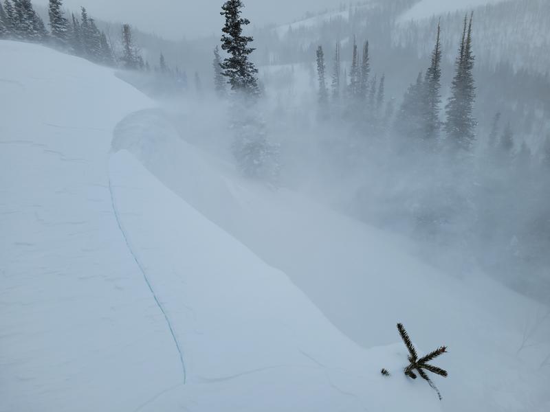
A MODERATE avalanche danger exists on all freshly wind drifted slopes today. You can trigger foot thick slabs of wind drifted snow on many aspects, but they will be most pronounced on mid and upper elevation north through east through south facing slopes. Cornices have become large and unruly: they are calving naturally and triggering new soft slabs on the slope below. Give them a wide berth.
Keep an eye on how the sun and rapid warming affects the new snow. I think we'll be able to skate by today without much wet activity (?), but tomorrow will be a different story.
Low
Moderate
Considerable
High
Extreme
Learn how to read the forecast here
Special Announcements
We are seeking a passionate individual to join us as Executive Director of the nonprofit Utah Avalanche Center.
Weather and Snow
Skies are clear. Winds blew from the west northwest yesterday, averaging 30-40mph with gusts to 50 and knocking limbs from trees. They're now blowing 10-15mph from the west. Mountain temps are in the single digits and low teens.
For today, we can expect mostly sunny skies, light winds from the west, backing to the southwest, and temperature rapidly warming into the mid-20s to low 30s.
The Outlook: Winds from the southwest start to ramp up Thursday night ahead of a powerful storm what will engulf the intermountain west for the weekend. Strong winds howl ahead of a dramatic cold front that crashes through Saturday afternoon. 1-2' of snow can be expected with perhaps the lion's share in the Logan and Ogden mountains. Another storm nips at its heels for Tuesday.

So far so good - Utah precipitation/water numbers are well above "average" so far with more storms on the way.
Recent Avalanches
Strong and erratic winds produced erratic and spotty soft slabs of wind drifted snow across the compass and at many elevations yesterday with some reports of cornices falling and triggering shallow soft slabs below. We also got a second hand report of a skier who was involved in a large cornice fall along the Park City ridgeline, but was uninjured.
The report on Monday's avalanche accident on Little Water Peak in the SLC mountains that caught and carried four people can be found HERE.
Ad
Avalanche Problem #1
Wind Drifted Snow
Type
Location
Likelihood
Size
Description
Strong, erratic, and swirling winds have unevenly deposited soft and occasional hard slabs of wind drifted snow across the compass, but primarily on slopes with an easterly component. Note that drifts may be found well off the ridgelines and cross-loaded into gullies and couloirs. Shooting cracks may or may not be associated with the fresh drifts of wind blown snow.
(Wind transport and cornice fall: Ambler photo)
General Announcements
This information does not apply to developed ski areas or highways where avalanche control is normally done. This forecast is from the U.S.D.A. Forest Service, which is solely responsible for its content. This forecast describes general avalanche conditions and local variations always occur.